
imajbox® 360HD
72MPX Panoramic mobile mapping sytem
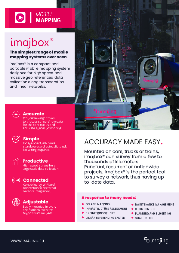
The imajbox® 360, an all-in-one surveying solution, combines advanced GNSS positioning with a high-end IMU for precise mapping. Its quick and cable-free setup, remote control via smartphone, and AI-powered software make it efficient for various applications. Achieve sub-centimeter accuracy with RTK and PPK support. Perfect for mapping, monitoring, and more.

imajing
Labège, FR
Description
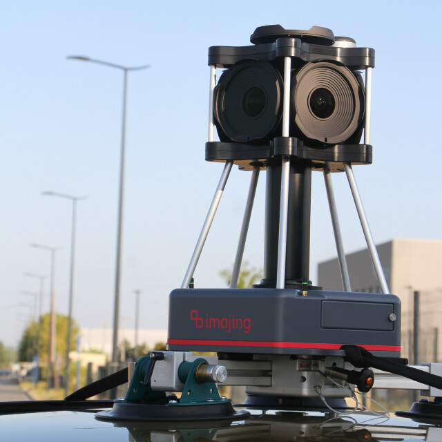
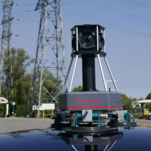
Introducing the imajbox® 360, a game-changing solution for precision surveying and mapping tasks. This cutting-edge device integrates GPS, GLONASS, GALILEO, and BEIDOU multifrequency GNSS receivers, along with a 6-axis high-end IMU (Inertial Measurement Unit). What sets it apart is its utilization of imajing InertialVision fusion algorithms, enabling unmatched accuracy in positioning.
One of its standout features is its support for both Real-Time Kinematic (RTK) and Post-Processing Kinematic (PPK) positioning, guaranteeing sub-centimeter accuracy in your surveying endeavors. Whether you're working on mapping, inventory management, change detection, site preparation, or any other application demanding precision, the imajbox® 360 is your trusted companion.
But what truly makes the imajbox® 360 stand out is its remarkable simplicity. Designed with ease of use in mind, this platform boasts a safe and quick mounting system suitable for any vehicle. Setup is a breeze, taking just minutes, and it requires only one person to operate. Plus, you can control it remotely from your smartphone, ensuring convenience and flexibility in the field.
Productivity is at the core of imajbox® 360's design. It features high-capacity extractible storage, ensuring you can collect extensive data without interruptions. With up to 2 hours of battery life and the option to draw power from a cigarette lighter plug, you can cover large-scale areas without worrying about running out of energy.
The imajing InertialVision fusion algorithms offer full auto-calibration and continuous data collection, facilitating seamless and efficient mapping. Moreover, it comes ready to survey with an extractable 1TB SSD and an internal battery, providing 2 hours of autonomy. The complete docking system, featuring suction pads and safety straps, ensures stability during operation.
To complement this exceptional hardware, imajing offers the imajview®5 photogrammetric software. This powerful tool allows you to explore, extract, geo-reference, and measure within images, all within a GIS environment. Compute slopes, transverse profiles, radii of curvature, and export 3D GIS features, imagery, and trajectories effortlessly. Additionally, imajing's AI services provide automatic analysis, saving you time and effort.
The applications of imajbox® 360 are vast, ranging from mapping and inventory management to change detection, site preparation, immersive virtual visits, smart city initiatives, and pavement management. It's an all-in-one solution that's ready to survey right out of the box, complete with an extractable 1TB SSD, an internal battery, and a comprehensive docking system, including suction pads and safety straps.
Do you have questions about this product?
- Questions about price, availability, and/or retailers
- Questions about technical specifications and usage
- Questions about suitability for your project or application
Specifications
-
Positioning
-
GNSS receiver: Brand and model
septentrio Mosaïc X5
Ground control point integration supported
N
IMU: Brand and model
Thales
IMU update rate [kHz]
1
Number of antennas
1
Number of wheel sensors
0
Tracked GNSS signals
GNSS, GLONASS, GALILEO, BEIDOU, QZSS, SBAS
Update rate of GNSS receiver
20
Documents
Brochure
imajboxrange_2023.pdf
738.01 KB


