
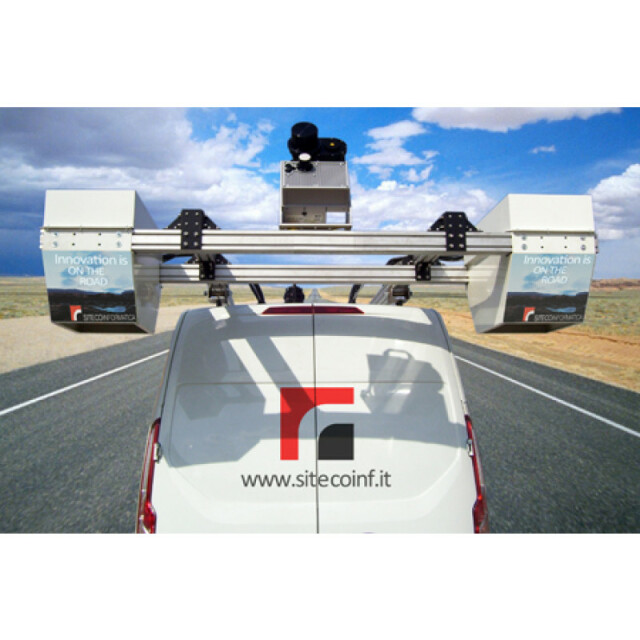
PAVE-Scanner
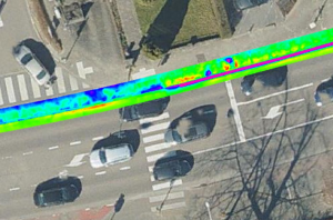
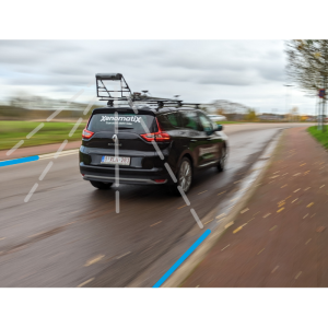
The system collects Asset and Pavement databases in a single survey campaign, providing big advantages for their contextual management. The complete 3D lidar and imagery infrastructure survey, with millimeter resolution pavement inspection provides a thorough analysis of the maintenance conditions.
Siteco Informatica
Bologna, IT
Description
The system collects Asset and Pavement databases in a single survey campaign, providing big advantages for their contextual management.
The complete 3D lidar and imagery infrastructure survey, with millimeter resolution pavement inspection provides a thorough analysis of the maintenance conditions.
Specifications
-
General
-
Year of initial introduction
2016
Year of last update
2016
Application
Outdoor
-
Positioning
-
GNSS receiver: Brand and model
Trimble BD920
Number of antennas
2
Update rate of GNSS receiver
5
IMU: Brand and model
Applanix LV
IMU update rate [kHz]
200
Wheel sensor: Brand and model
BEI
Number of wheel sensors
1
Tracked GNSS signals
All
Ground control point integration supported
Y
-
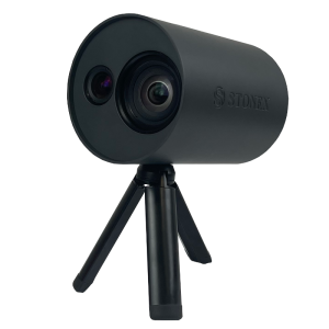
Lidar Sensor
-
Brand
Z+F
Number of laser scanners
1
Laser safety classification
1
Min. Range [m]
1
Max Range [m]
150
Max. vertical field of view [deg]
360
Max. measurement rate [kHz]
1000
Scans per second
200
Export formats
All, LAS, BIN, PTC, PTS, OCTREE
Range precision (1 σ)
1
Absolute accuracy (1 σ):
1
-
Operation
-
Max. speed [km/hr]
200
Main applications
Pavement AnalysisGISPMSMobile MappingRoad/Rail
Distinguishing features
COMPLETE INFRASTRUCTURE DATA SET The new Pave-Scanner collects high speed 2 Mpps laser-scanner point clouds; the Ladybug5 spherical image is combined with 3D high resolution imagery delivered by the LCMS pavement sensors on 4m lane passes.
Training provided
Y
-
Camera System
-
Brand and model
Point Grey LadyBug 5
Number of cameras
6
FoV per camera [deg]
360
Maximum frames/sec. per camera
20
Export formats
All
-
Dimensions & Environment
-
Size with case
900 x 400 x 600
Weight [kg]
70
Min. Operation temp. [°C]
-5°
Max. Operation temp. [°C]
60
-
Included Processing Software
-
Photogrammetry Software
Road-SIT Survey
Laser Point Clouds Software
no
Project Management Software
Road-SIT
-
Control Unit
-
Computer
MicroPC
Processor
Intel I7
Size hard disk [GB]
2000
WiFi
Y
I/O port(s)
8


