
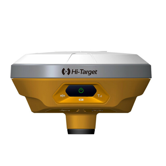
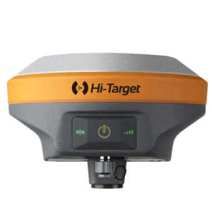
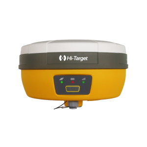
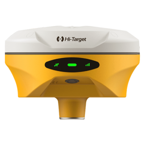
V100 GNSS RTK System
An ultra-compact design, but provides an efficient and reliable surveying solution
V100 is an ultra-compact GNSS RTK receiver with exquisite design and structure. It has multi-frequency full constellation technology, dual-mode Bluetooth and NFC. Provide users with fast, efficient and reliable GNSS RTK surveying solution.

Hi-Target
Guangzhou, CN
Description
Multi-constellation tracking
It supports full constellation satellite signals tracked simultaneously with 220 channels and can obtain stable and reliable location information in various environments.
Convenient communication
Dual-mode Bluetooth and NFC technology provide a convenient way for connection and communication in field operations.
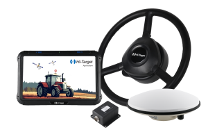
Wide range of application
V100 can be paired with varieties of handhelds and GIS data collectors, and provide an easy-to-use solution for survey and GIS professionals who need to collect highly accurate data in a variety of applications.
For more information, please click HERE to visit our website.
Do you have questions about this product?
- Questions about price, availability, and/or retailers
- Questions about technical specifications and usage
- Questions about suitability for your project or application
Specifications
-
General
-
Year of initial introduction
2015
Height [m]
0.057
Depth [m]
0.1275
Width [m]
0.1275
Total Weight [kg]
0.7
Housing Material
metal
Type
Land
-
Performance
-
Max. simultaneous tracked channels
220
Tracked satellite signals
GPS: L1C/A, L2C, L2E, L5, GLONASS: L1C/A, L1P, L2C/A (GLONASS M only), L2P, SBAS: L1 C/A, L5, Galileo: L1 BOC, E5A, E5B, E5AltBOCi (Reserved), BDS: B1, B2, QZSS: L1 C/A, L1 SAIF, L2C, L5
SBAS differential signals
EGNOS,WAAS,MSAS,GAGAN,QZSS
Type of measurements
full carrier phase
Reacqisition time [s]
8
RTK Network Compatibility
Y
MRS functionality
Y
No. channels
220
-
Environment
-
Operating temperature: min. [°C]
-40
Operating temperature: max. [°C]
65
Humidity resistance
100%
Water sand and dust proof
IP67
Shock and vibration proof
3m(9.84ft)
ROHS compliance
N
WEEE compliance
N
-
Communication: general
-
Communication ports
1 x mini USB port, for data downloading, power supply and firmware upgrading; 1 x 5-pin port, for NMEA output, DC power supply and external devices
Simultaneous links
Y
PPS Out
N
Bluetooth
Y
-
Communication: Protocols
-
RTCM standards for differential data
RTCM 2.1, 2.3, 3.0, 3.1, 3.2
CMR standards for differential data
CMR, CMR+, sCMRx
Other formats for differential data
No
NMEA output format
NMEA-0183
other output formats
No
L-Band Compatible
Yes
Configuration method
PC software
-
Communication: links
-
Radio modems
external
GSM; UMTS phone modems
external
CDMA phone modems
external
Landline modems
external
-
Horizontal uncertainty
-
code: DGNSS/RTC (constant part) [m]
0.025
code: DGNSS/RTC (variable part) [ppm]
1
phase: RTK rapid static (constant part) [m]
0.0025
phase: RTK rapid static (variable part) [ppm]
1
phase: RTK kinematic (constant part) [m]
0.008
phase: RTK kinematic (variable part) [ppm]
1
phase: static post processing (constant part) [m]
0.0025
phase: static post processing (variable part) [ppm]
1
phase: kinematic post processing (constant part) [m]
0.0025
phase: kinematic post processing (variable part) [ppm]
1
Initialization time on the fly [s]
8
RTK network solution methods
VRS, RTCM3
-
Power
-
Operating power: min. [V]
6
Operating power: max. [V]
28
Typical consumption [W]
3.2
Internal power supply
Yes
External power supply
Yes
Operating time with internal power supply [hr]
10
Certifications
CE, FCC, KC, IP67
Rechargeable with (auto)battery
Yes
Direct car connection cable available
No
-
Recording
-
Memory medium
SD card
Data capacity [MB]
8192
Data input
pen; keys; qwerty keyboard
-
More information
-
Distinguishable features
Compact, easy-to-use, network RTK
Documents
Brochure
migrationa0hwpf.pdf
56.27 MB
Videos


