


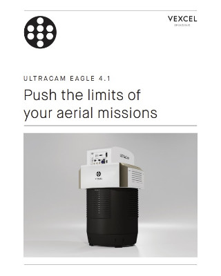
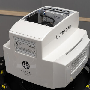
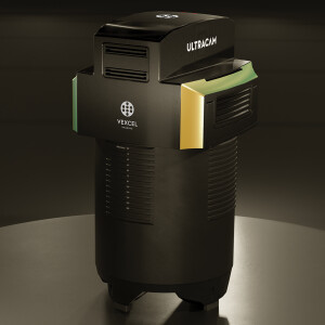
UltraCam Eagle 4.1
Most versatile photogrammetric large-format aerial camera
The UltraCam Eagle 4.1 delivers the efficiency, flexibility and photogrammetric-grade quality you need to succeed in today's rapidly evolving market: Over 28,000 pixels across the flight strip, three exchangeable lens kits, high-resolution PAN sensors, multi-directional Adaptive Motion Compensation (AMC) and True Pixel Processing (TPP) for best imaging performance.

Vexcel Imaging
Graz, AT
Description
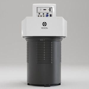
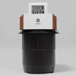
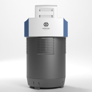
Built on the renowned UltraCam approach and leveraging the latest 4th generation system advancements, the new UltraCam Eagle 4.1 is the pinnacle of nadir photogrammetric aerial camera systems. As a true mapping-grade aerial camera, the UltraCam Eagle 4.1 collects high-resolution panchromatic (PAN), R, G, B and NIR color information at over 500 Megapixels – an impressive footprint that can be exploited at different altitudes, thanks to three user-exchangeable lens kits.
The Eagle 4.1 features CMOS sensors for a finer pixel pitch, industry-leading panchromatic image footprint, and a rapid cycle rate of 1 frame every 0.7 seconds. The new sensors, coupled with new electronics and new lenses developed exclusively for Vexcel, provide UltraCam customers with imagery of unprecedented sharpness, detail and image dynamic. Central to this is also the proprietary Adaptive Motion Compensation (AMC), correcting image motion blur caused by multi-directional camera movement during flight.
“We continue to choose the UltraCam Eagle over other systems on the market because of its large footprint, the user-exchangeable lens system and its state-of-the-art technology. With the Eagle 4.1, we can provide our customers with highest quality imagery and data.”
(Kaoru Orimo, UltraCam Eagle customer)
Vexcel cuts no corners in developing best-in-class UltraCams. The result is once again an aerial camera sensor that provides more than just pretty pictures – imagery taken by the UltraCam Eagle 4.1 is visually stunning but also of photogrammetric-grade quality, higher in acuity and better for analysis and interpretation.
KEY SPECIFICATIONS
28,110 x 18,060 pixels PAN image size
9,370 x 6,020 pixels color image size
CMOS imaging sensors
Adaptive Motion Compensation (AMC)
1 frame per 0.7 seconds
90 mm, 120 mm, or 150 mm user-exchangeable lens systems
Do you have questions about this product?
- Questions about price, availability, and/or retailers
- Questions about technical specifications and usage
- Questions about suitability for your project or application
Specifications
-
Application
-
Training facilities
Yes
Main applications
Ortho Photos, Point Clouds, DSM, DTM, EO, AT for Photogrammetry, 3D City Modeling, Mining, Oil & Gas, Agriculture, Insurance, Environmental Monitoring, Urban planning, Security & Defense, Disaster Management, Telecommunications
Distinguishable features
Collects PAN, RGB and NIR at over 500 Megapixels - User-exchangeable lens system - Adaptive Motion Compensation (AMC) - high collection efficiency
-
Uncertainty
-
Geometric calibration
Yes
Radiometric calibration
Yes
-
Data storage
-
Type of storage
SSD
Storage capacity [GB]
32.000
Storage Replaceable
Y
-
Sensor Characteristics
-
Lenses: focal lengths [mm]
90mm, 120mm, 150mm
Lenses: interchangeable
yes
Pixel size [µm]
3.76
Megapixels
>500
Dynamic range [bits]
14
Number of lenses
8
Max. across-track FOV [deg]
60.8
Type CMOS
Sony
Max. integration time [s]
0.7
-
Operation Characteristics
-
Platform
Max. acquisition duration [h]
unlimited
-
Software
-
On board image storage format(s)
RAW
Type of mission planning software
Topoflight Mission Planner
Type of postprocessing software
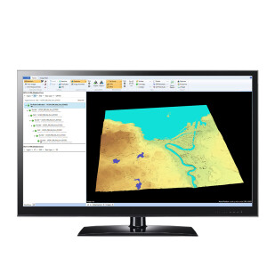
Vexcel UltraMap
-
General
-
Year of introduction
2022
-
Images and data
-
Digital Aerial Nadir Frames
Y
Oblique Images
N
-
Hardware
-
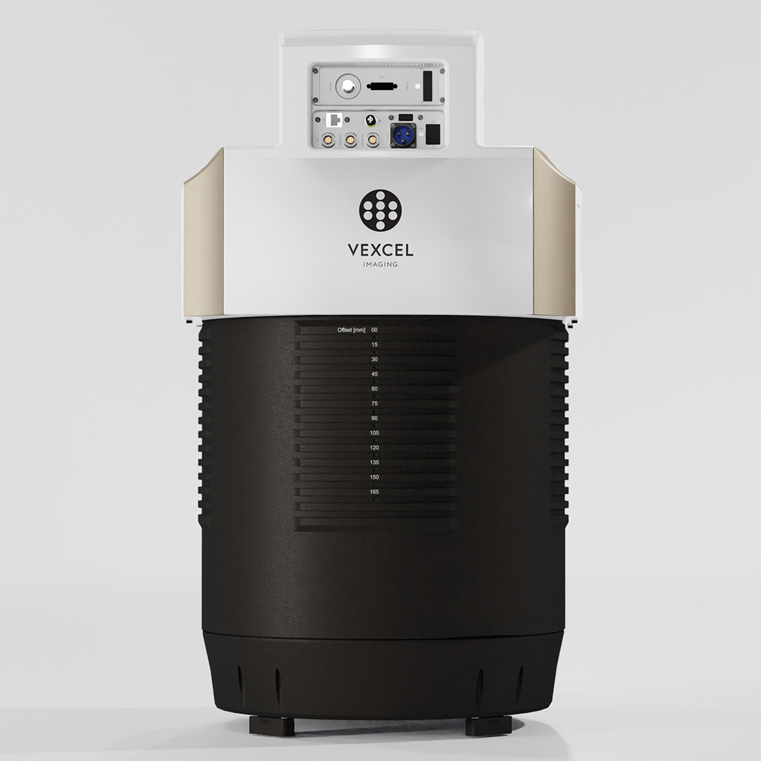
Camera unit Weight [kg]
60
Power requirements
330 W (average) / 350 W (peak)
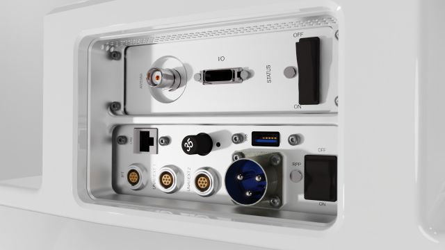
Type of GNSS/ INS positioning system
UltraNav and most current third-party systems
Camera unit Length [m]
0.745
Camera unit Width [m]
0.433
Camera unit Depth [m]
0.433
-
Application areas
-
Select an application area:
Construction and Infrastructure, Cultural Heritage, Land Surveying and Cadastre, Mining, Oil and Gas, Defense and Security, Other
-
Product characteristics
-
Choose characteristics:
Panchromatic Imagery
Documents
Brochure
UC_Eagle_4.1_en.pdf
Videos


