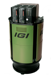
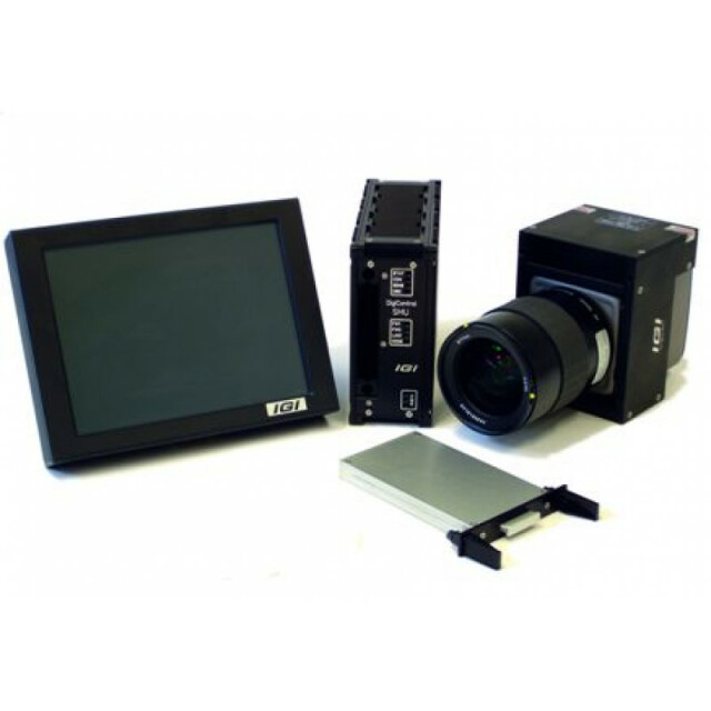
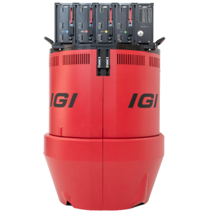
IGI DigiCAM-150
DigiCAM is a result of the IGI’s passion for airborne developments. It is an aerial digital camera system in medium format, providing professional photogrammetry. The DigiCAM combined with CCNS-5 and AEROcontrol provide the complete solution for generating directly georeferenced images on a planned mission.

IGI
Kreuztal, DE
Description
Do you have questions about this product?
- Questions about price, availability, and/or retailers
- Questions about technical specifications and usage
- Questions about suitability for your project or application
Specifications
-
Application
-
Main applications
Corridor Mapping; Topographic Mapping in Medium and Small Projects; Orthophoto Generation; Secondary Sensor for Airborne LiDAR Projects (As Part of the IGI LiteMapper); Capturing of Aerial Oblique Images
Distinguishable features
Versatile Aerial Camera; Exchangable Lenses; Part of IGIs Modular Sensor Systems; Single DigiCAMs can be combined to Multi Camera Systems, High-End GNSS/IMU System
Training facilities
Yes
-
Uncertainty
-
Precision [pixels]
0.25
Geometric calibration
Y
Radiometric calibration
Y
-
Data storage
-
Type of storage
SSD
Storage capacity [GB]
4000
Storage Replaceable
Y
-
Sensor Characteristics
-
Number of lenses
1
Lenses: focal lengths [mm]
40; 50; 70; 90; 110; 150
Lenses: interchangeable
Y
Pixel size [µm]
3.76
Megapixels
150
Dynamic range [bits]
16
CCD RGB
Y
Charged Coupled Device (CCD) IR
Y
CCD simultaneous
N
CCD along track format [pixel x pixel]
14,204 x 10,652
CCD across track format [pixel x pixel]
10,652 x 14,204
Max. shutter speed [s]
0,0004
Data collection rate [megapixel/s]
37.5
CCD along track format [mm x mm]
53.4x40
CCD across track format [mm x mm]
40x53.4
-
Operation Characteristics
-
Helicopter
Y
Fixed-wing
Y
Min. flying height [m]
0
Typical flying height [m]
1000
Max flying height[m]
4000
Max. acquisition duration [h]
8
Warm-up time [s]
60
Forward motion compensation
N
In flight pre-view
Y
Temperature controlled pod
N
-
Software
-
On board image storage format(s)
RAW
Type of mission planning software
IGIplan
Type of postprocessing software
IGI AEROoffice, IGImatch
-
General
-
Year of introduction
2010
Last update
2018
-
Hardware
-
Camera unit Weight [kg]
1.7
Camera unit Length [m]
0.1
Camera unit Width [m]
0.13
Camera unit Depth [m]
0.12
Power requirements
15W
Type of GNSS/ INS positioning system
IGI AEROcontrol 600Hz


