LiteMapper 7800VQ2
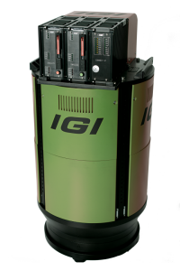
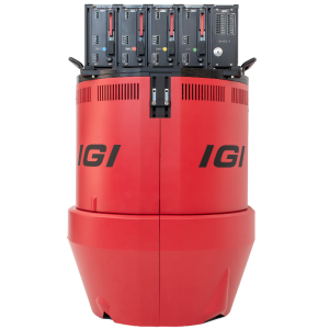
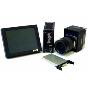
The newest IGI LiteMapper-7800VQ2 with integrated 2MHz RIEGL VQ-780II Lidar is equipped with IGI SMU-2 for data storage and management. Using the IGI SMU-2, installations in helicopters and cramped scenarios can be planned and executed very quickly! Designed as a rugged but compact and lightweight system, the IGI LiteMapper can be used in various aircraft.

IGI
Kreuztal, DE
Description
Designed as a rugged but also compact and lightweight system, the IGI LiteMapper can be used in a variety of aircraft, from large airplanes and helicopters to ultra-light airplanes and gyroplanes or even remote piloted aircraft systems (RPAS). All systems are installed on vibration damped platforms or in stabilized mounts.
Do you have questions about this product?
- Questions about price, availability, and/or retailers
- Questions about technical specifications and usage
- Questions about suitability for your project or application
Specifications
-
General
-
Year of introduction
2020
Year of last update
2020
Total Weight [kg]
27
Power requirements
18-32VDC typ. 220W
Type of GNSS/INS positioning system
IGI AEROcontrol III - 512Hz
Camera
IGI DigiCAM & IGI DigiTHERM (thermal IR)
Data storage facilities
Removeable SSD, hot-plug
Mission planning software
IGIplan
Postprocessing software
IGI AEROoffice & Riegl ALS Software
-
Application
-
Main applications
All typical airborne applications: Corridor Mapping, City Modelling, Topography & Mining, Opencast Pits, Wide Area Mapping, Forestry, Mapping of Lakesides & River Banks, Agriculture & Forestry, Power Lines
-
Measurement Characteristics
-
Scanning method
time-of-flight
Min. pulse frequency [Hz]
150000
Max. pulse frequency [Hz]
2000000
Max. field of view [deg]
60
Max. number of recorded echoes per pulse
practically unlimited
Full-wave form digitization
Y
Pulse sampling frequency [GHz]
1
multiple pulses in air
Y
-
Operation Characteristics
-
Platform
Helicopter, Fixed-wing, Gyroplane
-
Laser Pulse Characteristics
-
Beam divergence [mrad]
0.25
Type/class laser
Class 3B
-
More information
-
Distinguishable features
Full Waveform Processing, Multiple Time Around, Flexible Integration with Modular Optical, Thermal and Hyperspectral Cameras; High-end GNSS/IMU; Certified Helicopter Installations
-
Uncertainty and resolution
-
Pitch and roll pointing precision [deg]
0.006
Heading pointing precision [deg]
0.001
Across-track point spacing at 1km [m]
0.1
-
Application areas
-
Select an application area:


