TcpMDT Images
Adjustment, management and transformation of images integrated in MDT
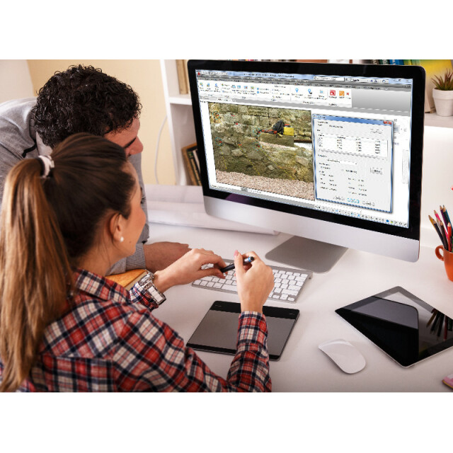
This CAD application allows you to perform all kinds of operations on digital images, georeferenced or not, in a wide variety of formats. It is designed especially for the needs of Surveying, Civil Engineering, Architecture or Archaeology projects, in which it is common to work with aerial photographs, orthoimages and scanned maps in combination with vector drawings.
APLITOP
Málaga, ES
Description
This module is designed for needs of projects involving Land Surveying, Civil Engineering, Architecture, Archaeology etc. in which it is frequent to work with different types of images in combination with vector drawings.
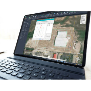
Orthophotos
MDT Images automatically inserts in their real position on the drawing a series of orthophotos in the most usual formats.
Aerial Photos and Scanned Maps
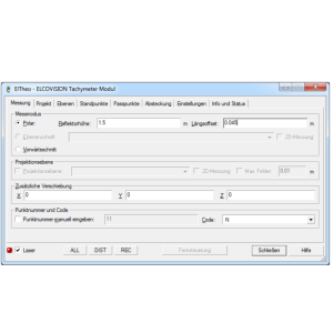
There are several options for georeferencing images, assigning them real terrain coordinates.
The simplest is to draw reference lines connecting known points on the image to points on the drawing. For more complex cases marks can be inserted with a name and subsequently link them to topographic points.
Photos with Position
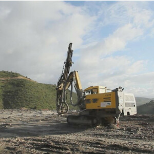
MDT Images also insert photos at its own location if they have been taken by smartphones and cameras with GPS. Each photo is automatically linked to a topographic point and they may be inserted on a given scale in their position, similarly to Google Maps; what's more, for images taken by drones it allows them to be oriented according to the angle of flight and on their real scale in line with the width and height of the sensor and the focal distance. The data associated with the image may be consulted at any time.
Web Map Services
It is possible to capture and insert in their real position on the drawing the compatible WMS (Web Map Services) and WMTS (Web Map Tile Services) provided by any supplier (i.e. regional mapping institutes, cadaster and other public and private entities).
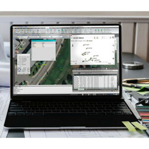
Operations with Images
Without leaving CAD it is possible to carry out on the images inserted in the drawing all kinds of basic transformations such as rotating, flipping, adjusting brightness, contrast, intensity, saturation, color balancing etc. The resolution, size and depth in color may also be changed. Other useful tools are: delimiting image as from a polyline, dividing an image into several images based on a sheet diagram and pasting images.
Images Deformation
By means of the use of reference lines or marks an image may be deformed by two methods: projective transformation or Rubber-Sheeting. The projective transformation will adjust four points at the most irrespective of the number of points used for calculation. The Rubber-Sheeting technique consists of a bilinear transformation of each of the cells of the grid generated from the pairs of points and whereby an adjustment will be obtained to all the points involved in the calculation.
The images obtained will be created, applying the nearest neighbor method, bilinear or bicubic interpolation or the Lagrange method. The calculation shows the mean squared error data, residues etc.
Specifications
-
Data management
-
Security options for access
N
Search on file content
N
Version management
N
Save standardization for drawings/maps
Spatial reference system
Manual georeferencing
-
Geometry types
-
Points
Lines
Surfaces
Multipolygon
-
Other
-
License or freeware
License
Training
Y
Main users
Archeologists, architects, surveyors
Main applications
Management of raster images
Distinguishable features
It run as CAD standard application.Insertion of georeferenced images at their position.Insertion of pictures with EXIF location from smartphones, cameras with GPS or UAV.Insertion of images from WMS services.Change resolution or size of images.Flip and rotate image.Adjust brightness, contrast, hue, saturation of image.Cut and paste images.Georeference images from drawing.Distort image by projective transformation or rubber-sheeting.
Related products
AutoCAD, BricsCAD, GStarCAD, ZWCAD
-
2D Editing
-
Select
Remove
Graphic transformations
Scale, Move, Rotate, Align, Others
Coordinate transformations
Image georeferencing by similarity or affine transformation.Image distorting by projective transformation or rubber-sheeting.
-
2D Construction
-
Positioning by coördinates
Y
Positioning by snapping
Y
Positioning on virtual raster
N
Positioning in relation to other element
Positioning by Dimensions
N
-
Storage
-
Type of data storage
File
Native storage format
dwg
Input formats
Dwg, Dxf, GeoTiff, ECW, SID, Jpg, Others
Export formats
GeoTiff, Jpg, Others
GML version
None
Compression
N
-
Visualisation
-
Types
Change view
-
Data analysis
-
Merge
Map layers
Clip
Y
Measurement
Tools to detect errors
Root-mean-square deviation error and residuals in image georeference and distortion
Topology
-
Interoperability
-
Web standards
WMS, WMTS, WFS, WCS
Spatial database management systems
Messaging protocols
Extensions
-
General
-
Year of introduction
2010
Year of last update
2021
Supported hardware
Aerial, professional and smartphone cameras. 2D scanners
Supported operation system
Windows


