
VisionCivil Pro
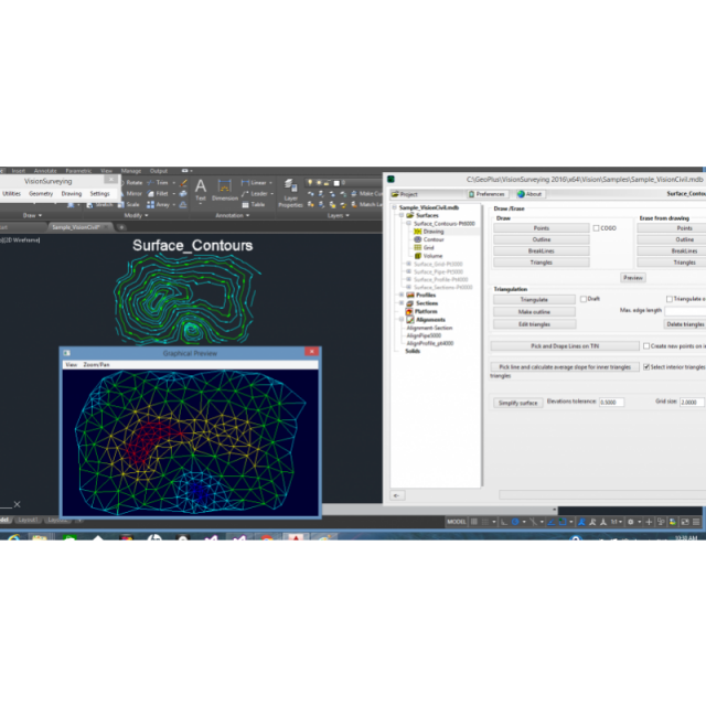
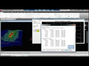
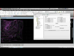
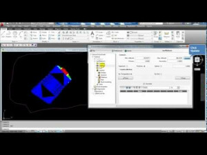
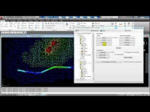
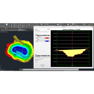
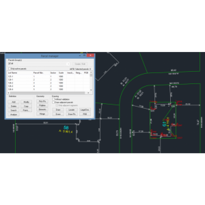
VisionCivil Pro is designed for land and infrastructure professionals. It integrates into AutoCAD, MicroStation, BricsCad, PowerDraft, Civil 3D. VisionCivil Pro use an external database to facilitate data sharing. Edit surfaces by adding breaklines and holes, work with 2D and 3D profile alignments, as well as handling Lidar Point Clouds.

Geo-Plus
Laval, CA
Description
VisionCivil Pro integrates into your favorite CAD tool (BricsCad®, AutoCAD®, Microstation®, PowerDraft®) to improve its functionality and usability. VisionCivil Pro can also be the bridge between them. VisionCivil Pro uses an external CAD database. This way, the drawing is lighter for the workstation to handle. Sharing your data becomes easier! It offers features like triangulating a surface created from graphics selections or point groups, editing your surfaces easily by adding breaklines and holes, uses powerful COGO features, works with 2D and 3D profile alignments, customizes your profiles and sections, easily and precisely calculates the volume between two surfaces, sections or complex volumes (overhangs), applies a combined scale factor to all objects, easily handles LiDAR point clouds and many others. It creates drawings according to your own standards or those of your customers or subcontractors. Improve project delivery time with time saving land survey and civil engineering features and respond faster to your customer’s needs.
For more information about the product or to download an LTD version please visit the VisionCivil Pro web page.
Do you have questions about this product?
- Questions about price, availability, and/or retailers
- Questions about technical specifications and usage
- Questions about suitability for your project or application
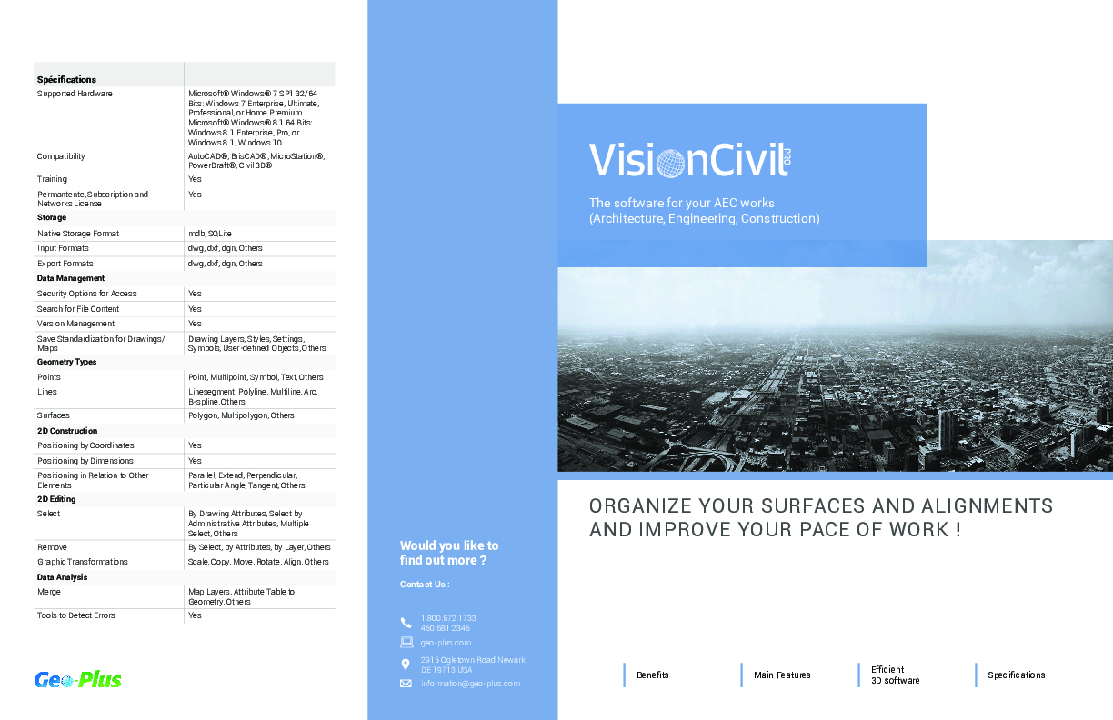
Specifications
-
Data management
-
Security options for access
Y
Search on file content
Y
Version management
Y
Save standardization for drawings/maps
Spatial reference system
-
Geometry types
-
Points
Lines
Surfaces
-
Other
-
License or freeware
License
Training
Y
Distinguishable features
CAD tool, easiness of use
Related products
VisionCivil Lt. VisionPlus
-
2D Editing
-
Select
Remove
Graphic transformations
Coordinate transformations
Least Mean Square
-
2D Construction
-
Positioning by coördinates
Y
Positioning by snapping
Y
Positioning on virtual raster
Y
Positioning in relation to other element
Positioning by Dimensions
Y
-
Storage
-
Type of data storage
Database
Native storage format
mdb, SQLite
Input formats
Export formats
Compression
Y
-
Visualisation
-
Types
Change view
-
Data analysis
-
Merge
Clip
Y
Measurement
Topology
Tools to detect errors
Y
-
Interoperability
-
Web standards
Spatial database management systems
Messaging protocols
Extensions
-
General
-
Year of last update
2022
Supported hardware
Windows 10 64-bit
Supported operation system
Windows
Documents
Brochure
migrationpyjpwp.pdf
951.39 KB


