


Pythagoras CAD
CAD Software
Pythagoras strives to deliver a CAD & GIS solutions for all your mapping projects. Together with our clients and partners we create software that solves problems in different areas. Surveyors, indoor mapping, dredging and mining companies and UAV, Lidar and machine control users benefit from the intelligent algorithms that convert your data into CAD deliverables. Data sets coming from total stations, GPS instruments, laser scanners, mobile mappers, UAV and drones, single and Multibeam systems and other CAD and GIS software packages can be handled and processed with ease.

Pythagoras
Turnhout, BE
Description
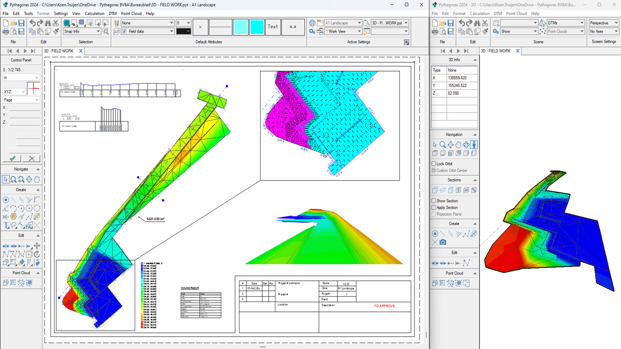
Pythagoras CAD is an all-in-one, user-friendly, standalone CAD software suite. Our software is compatible with all surveying instruments and data formats. Our user-friendly tools, coupled with excellent end-user support, will save you valuable time.
We offer comprehensive solutions across various sectors, making us truly “360° Compatible.”
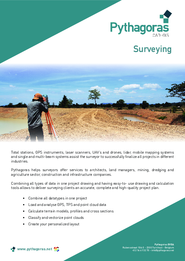
Surveying: Pythagoras empowers surveyors to provide services to a wide range of industries, including architects, land managers, and companies in mining, dredging, agriculture, construction, and infrastructure.
Indoor Mapping: For indoor mapping companies, Pythagoras streamlines the process of filtering floor plans and sections from extensive data sets. We use advanced vectorization and classification algorithms to automate this task.
Machine Control: We help analyze diverse data types to create precise, risk-free designs that can be seamlessly integrated into your machine control system.
UAV & Lidar: With Pythagoras, importing processed orthophotos and classified lidar data is effortless. Our intuitive visualization and cleaning tools enable thorough analysis of images in 2D and point clouds in 3D.
Mining: Pythagoras simplifies the handling of various data sets, swiftly converting them into detailed 3D models, excavation reports, contour lines, profiles, and cross sections.
Dredging: Consider Pythagoras your daily assistant for managing all your hydrographical survey and design needs.
Monitoring: Our tools make it easy to compare different project phases, aiding in job-site inspection, deformation analysis, and dredging surveys. These powerful functions enhance project oversight and analysis.

Feel free to contact us, and we would be happy to demonstrate how Pythagoras can benefit your specific use case.
Do you have questions about this product?
- Questions about price, availability, and/or retailers
- Questions about technical specifications and usage
- Questions about suitability for your project or application

