CHCNAV Rugged Android Tablets and Smartphones Bring Precision and Efficiency to Field Data Collection
WHICH CHCNAV ANDROID DEVICES ARE BEST FOR FIELD DATA COLLECTION AND MANAGEMENT?
CHC Navigation offers a wide range of rugged and durable GNSS field data controllers, tablets, and smartphones designed to meet the specific needs of professionals in surveying, engineering, geodesy, construction, urban planning, forestry, agriculture, and other specialized fields. These devices enable efficient and accurate data collection, management, and analysis in challenging field conditions.
WHY CHOOSE A PROFESSIONAL GNSS OR HIGH-ACCURACY GNSS RTK ANDROID DEVICE FOR FIELD DATA COLLECTION AND MANAGEMENT?
Achieving superior accuracy and durability in field data collection is a crucial benefit of using professional-grade GNSS and high-accuracy GNSS RTK smartphones and tablets. CHCNAV's professional GNSS data collectors offer two levels of accuracy: centimeter-level accuracy with Real-Time Kinematic (RTK) technology and meter-to-sub-meter-level accuracy without RTK corrections.
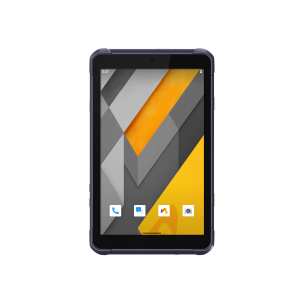
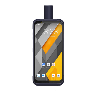
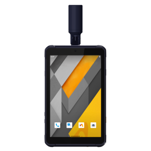
Both the latest generation GNSS tablets (LT800H, LT800) and smartphones (LT60H) share common features, including Google Mobile Service (GMS), Android Enterprise Recommended (AER) certifications, ensuring seamless compatibility with popular data collection applications available on the Google Play Store. These handheld devices feature large, sunlight-readable displays and a rugged IP67-rated industrial design, making them ideal for outdoor use in harsh environments. All of this makes CHCNAV smartphones and tablets the preferred choice for professionals from various industries with demanding needs.

WHAT ARE THE TOP 5 APPLICATIONS FOR PROFESSIONAL HIGH-ACCURACY GNSS RTK ANDROID TABLETS AND SMARTPHONES?
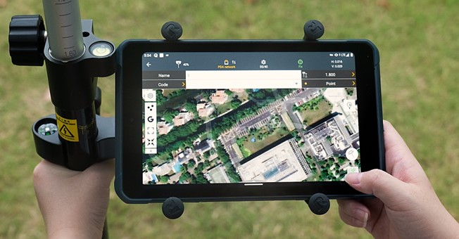
CHCNAV's LT60H GNSS RTK Smartphone and LT800H GNSS RTK Tablet demonstrate versatility and excellence in a variety of domains, including
Surveying: Facilitates precise positioning and data collection in producing topographic maps, land surveys, and construction layouts. Surveyors can accurately capture the coordinates of specific points, lines, and areas.
GIS data collection: Captures accurate location information for GIS databases that support urban planning, natural resource management, and asset inventory applications. This data can be seamlessly integrated into GIS software to create detailed maps, analyze spatial patterns, and support decision-making.
Utilities & Infrastructure Management: Accurately locates and maps underground utilities, pipelines, and infrastructure assets. Facilitates precise identification and documentation of surface and underground infrastructure locations, ensuring accurate placement of infrastructure components.
Construction: Enables precision surveying, structural monitoring, asset management, and construction planning. Construction professionals can accurately measure and map construction sites, monitor progress, and ensure structures are built according to design specifications.
Agriculture: Empowers field mapping, yield monitoring, and input optimization in precision agriculture. Provides precise location information for soil sampling, crop scouting, irrigation, fertilization, and planting; helps farmers maximize yields, optimize input use, and monitor field conditions and crop health. CHCNAV Android mobile devices support a wide range of precision agriculture software solutions from multiple vendors, enhancing their value for the farming community.

FOR WHAT APPLICATIONS SHOULD USERS CHOOSE SUB-METER TO METER ACCURACY TABLETS AND SMARTPHONES?
GNSS tablets and controllers without RTK capability, such as the LT800 GNSS tablet, are well suited for applications where durability and reliability are more important than very high accuracy. Typical applications may include boundary surveying, topographic mapping, construction layout, asset mapping, environmental monitoring, and agriculture.
While these units may offer a lower level of accuracy than their GNSS RTK-enabled counterparts, they excel at meeting the demands of applications that require robust and uninterrupted performance in various outdoor field conditions.
WHAT MAKES CHCNAV ANDROID SMARTPHONES AND TABLETS STAND OUT?
Whether you represent a small surveying firm, a large construction company, or a government agency, CHCNAV provides rugged and reliable GNSS solutions tailored to diverse field data collection and management needs. These devices enable professionals across various industries to achieve maximum accuracy and efficiency in field data collection. Whether the task requires centimeter-level accuracy with GNSS RTK or sufficient sub-meter-to-meter GNSS accuracy, CHCNAV excels at providing robust solutions that address each organization's unique needs.
About CHC Navigation
CHC Navigation (CHCNAV) creates innovative mapping, navigation, and positioning solutions to make customers' work more efficient. CHCNAV products and solutions cover multiple industries such as geospatial, construction, agriculture, and marine. With a presence across the globe, distributors in more than 120 countries, and more than 1,700 employees, today, CHC Navigation is recognized as one of the fastest-growing companies in geomatics technologies.
Do you have questions about this case study?
Get in touch with CHC Navigation | CHCNAV, and they would be happy to answer any questions you have about pricing, suitability, availability, specs, etc.


![3月21日-封面[1].jpg](https://cdn.geo-matching.com/voeE1ywo.jpg?w=320&s=6b3b1a0215d770f8797653e9202a8f52)


