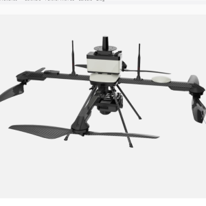
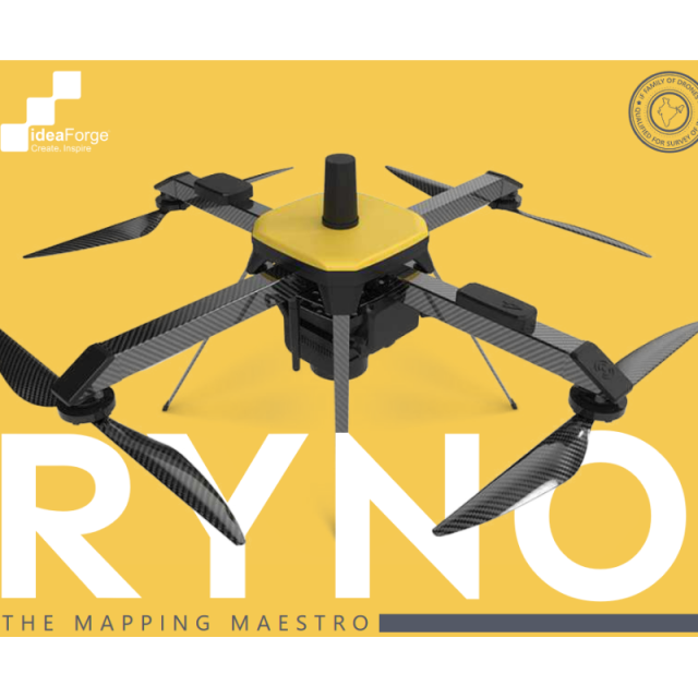
RYNO UAV
The Mapping Maestro
Get ready to map like never before RYNO UAV is our micro category survey-grade drone equipped with an advanced mapping payload and state-of-the-art PPK Module. With our extensive experience in building MIL SPEC drones, we have ensured that RYNO UAV offers category-defying performance even in the most demanding conditions.
ideaForge
India
Description
Payload
The combination of the mapping payload with PPK module is a powerhouse in itself. It delivers accuracy that has never been seen before in this class.
Ground Control Station
- Our state-of-the-art GCS enables fully autonomous flight and provides a host of
- safety and security features.
- Terrain Avoidance to keep your RYNO safe
- Easy Takeoff/Landing ensures you concentrate on outcomes
- Flight Planning for predictable and repeatable mapping operations
- Geotagging software for accurate post-processing
- Live Display of Flight Parameters to keep you updated every step of the way
- Encrypted Communication for the highest privacy
- Fail Safe Features for Comm Loss, Low Battery, High Winds, Temperature range violation
Features:
SOI Quality
iF Family of Survey Grade Mapping Drones are Qualified by Survey of India for Swamitva Yojna
Best-in-Class Area Coverage
Fly longer and farther for quicker ROI
Superior Accuracy
<5 cm in X & Y - axis and <10 cm in Z - axis Typical accuracy with survey grade PPK Module.
Robust Build Quality
RYNO airframe is built for over 2000 mapping operations.
Best-in-Class Area Coverage
Fly longer and farther for quicker ROI
Terrain Avoidance
Safely conduct surveying operations in tough weather and terrain conditions
Man-portable
75% Lighter than Drones with Similar Performance
Quadcopter Configuration with VTOL
Conduct operations with increased flexibility, even from smaller areas
Waypoint Based Navigation
Tell Ryno where to go and let it take care of the rest
Less than 10 minutes Deployment Time
User-friendly assembly to conduct mapping operations faster
Minimal Training Requirements
No UAOP, Security Clearance or DGCA Training
NPNT Ready
Designed for NPNT standard
Applications
With its industry-leading hardware and micro category weight, RYNO UAV delivers unbeatable area coverage with centimetre-level accuracy, no matter your experience level.
Industry Use Cases
With RYNO UAV, you can get unbeatable area coverage and centimetre-level accuracies in real-world conditions, even in the most demanding conditions. The UAV is geared to build operational excellence across various use cases in multiple industries.
Specifications
-
Imaging/scanning devices
-
Onboard imaging/scanning devices
-
Included software and automatically generated
-
Type of software included
Automatically Generated Products
Related products


