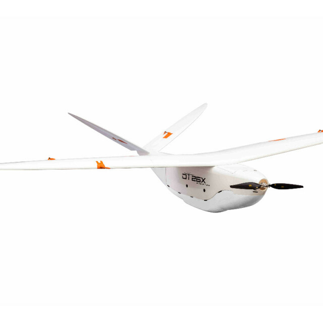
DT26X LIDAR
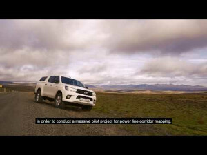
The only professional LiDAR UAV capable of accurately surveying infrastructures (eg. poles, powerlines) or ground under vegetation at an altitude of 120 m and a speed of 17 m/s.
Delair
Labège, FR
Description
The only professional LiDAR UAV capable of accurately surveying infrastructures (eg. poles, powerlines) or ground under vegetation at an altitude of 120 m and a speed of 17 m/s.
Specifications
-
Environment
-
Min. operation temperature [°C]
-10
Max. operation temperature [°C]
55
Max. wind speed [m/sec]
20
Max. humidity [%]
100
-
Imaging/scanning devices
-
Onboard imaging/scanning devices
Lidar
Type of Lidar
RIEGL miniVUX-1DL
Build-in Stablilsation
Y
Exchangeable
Y
Sensor tilting to allow oblique views
N
-
Platform
-
Brand
Delair
Max. payload [kg]
2
Max. stay in the air [min]
150
Max. speed [km/h]
110
Max. height above sea level [m]
4000
Propulsion
Electric, brushless motors (lithium-polymer)
Platform
Aircraft
-
Operation Characteristics and Safety
-
Min. ø of launch/landing site [m]
15
Launching method
Hand or catapult
Automatic launch and landing
Y
Training provided
Y
Collision avoidance systems (CAS)
Y
Autonomous emergency landing
Y
-
Dimensions
-
ø / wingspan [cm]
330
Height [cm]
160
Weight [kg]
14
Weight of battery [kg]
0.5
Weight of filled fuel tank [kg]
0
Number of rotors
1
Transport on human back
Y
-
Base Station
-
Ground computer included
N
Type of Ground computer
Laptop
Sensor control
Y
-
Navigation Sensors
-
Type of GNSS receiver and captured signals
Dual-band GNSS (L1/L2).
Type of IMU
All-axis
Other sensors and additional information
GPS-less, vision based navigation
-
General
-
Year of last update
2015
Typical applications
Survey, Mapping, Agriculture, GIS
-
Included software and automatically generated
-
Flight planning software
Solapp
Type of software included
Flight planning, Point cloud processing software
Automatically Generated Products
3D Landscape Models, DEMs
Videos


