


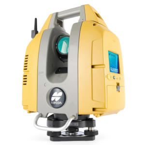
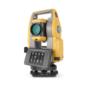
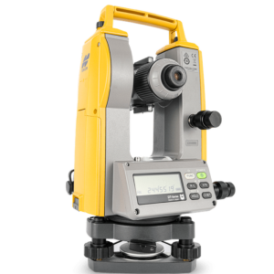
GTL-1200
Scanning Robotic Total Station
Work more productively and efficiently by combining the best of a fully featured robotic total station and a high-speed scanner.
Topcon
Capelle aan den IJssel, NL
Description
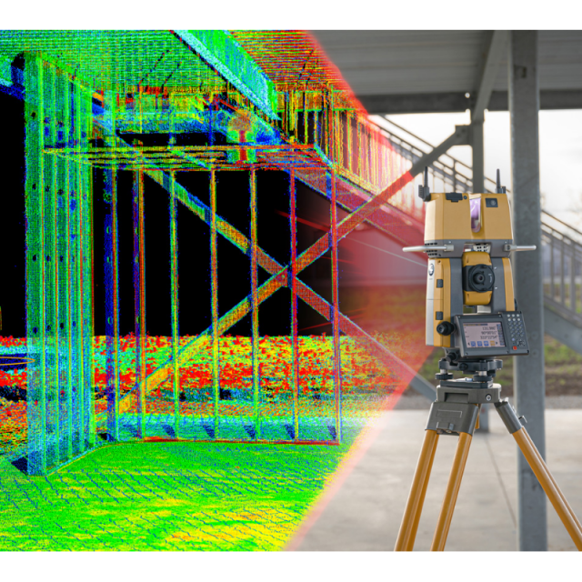
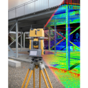
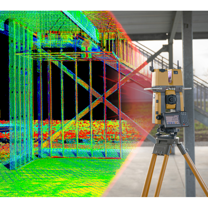
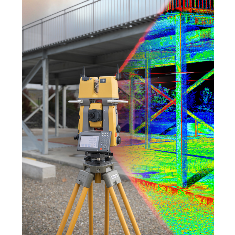
Efficient layout and scanning with a single instrument
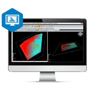
The GTL-1200 combines the power of a robotic total station with a best-in-class laser scanner to perform digital layout and capture high-res 3D scans in a single setup. Simplify the scanning process and dramatically reduce the need for post-processing by capturing scan data on survey control. The workflow seamlessly integrates with ClearEdge3D software for advanced construction QA workflows and as-builts.
- Fast layout and scanning using a single instrument
- Instant point cloud registration
- Full dome scan and images in seconds
- Tailored scan density to minimize software processing time
- Point clouds accurately matched to BIM model coordinates
Do you have questions about this product?
- Questions about price, availability, and/or retailers
- Questions about technical specifications and usage
- Questions about suitability for your project or application
Specifications
-
General
-
Height [m]
0.428
Width [m]
0.282
Depth [m]
0.1807
Weight [kg]
7.07
Year of introduction
2022
Display Panel
4.3 inch Transmissive TFT VWGA color LCD
-
User Interface
-
Operating System
Windows Embedded Compact 7
Color display
Y
Screen size: length of diagonal ["]
4.3
Screen type
LCD
Touchscreen
Y
On-board survey software
MAGNET Collage
-
Distance Measurement with Prism
-
Standard deviation: constant part [mm]
1.2
Maximum range with 1 standard prism [m]
1
-
Integrated camera
-
Integrated camera available [Y/N]
Y
Resolution [px rows x columns]
5MP
Field of View Horizontal [deg]
130
Field of View Vertical [deg]
180
-
Data Storage & Connectivity
-
Internal memory [GB]
1
SD Card [Y/N]
Y
USB [Y/N]
Y
Compact Flash [Y/N]
N
Bluetooth {Y/N}
Y
WiFi {Y/N}
Y
-
Miscellaneous
-
Guiding light
Y
-
Automatic Tracking and Locking
-
Maximum Range [m]
1,000
Maximum angular speed [deg/s]
180
Tracking and recovery of moving prism
Y
-
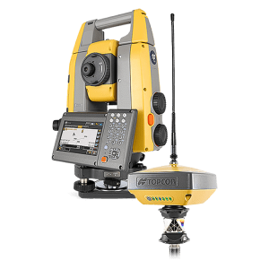
Robotic operation
-
Maximum range of robotic operation[m]
1,000
Compatible with GNSS for detail survey
Y
Recommended controller
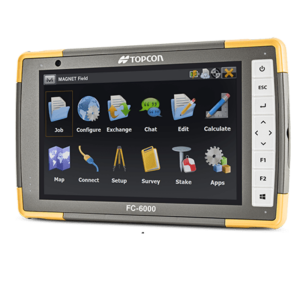
FC-600
Controller IP rating
IP-68
Controller display type and size
7.1
Graphical field note storage on controller
Y
Camera in controller
Y
-
Integrated Laser Scanning
-
Integrated laser scanning available [Y/N]
Y
Scan speed [points / second]
200,000
-
Operation
-
Minimum working temperature [degC]
-10
Maximum working temperature [degC]
50
IP dust/water protection class [IPxx]
IP54 (IEC 60529: 2001)
-
Distance Measurement without Prism
-
Standard deviation: constant part [mm]
2
Maximum range on Kodak white [m]
1
-
Power Supply
-
Battery
Rechargeable Li-ion battery BDC72
Capacity
5,986mAh
Max. operation time on one battery [hr]
1.3
Batteries hot-swappable
N
-
Angle Measurement
-
Vertical Coverage
Elevation angle 51°, Depression angle 37°
Horizontal Rotation
360° (full transit)
Guide Light
LED red 626 nm/green 524 nm
-
Connectivity
-
Bluetooth
Y
USB
Yes
RS232
Yes

