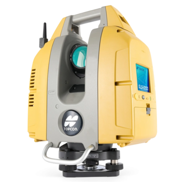
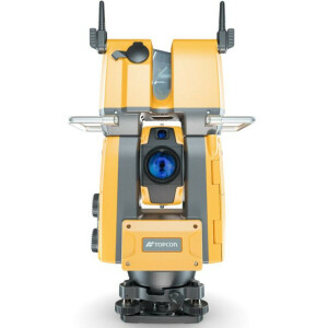
GLS-2200
Scanning With Confidence Versatile Setup Options and Reduced Post-processing Time
Get any job done quickly with the latest scanning and workflow technology. The GLS-2200 offers a unique survey-style setup and easy-to-use processing software that transforms lengthy scanning processes into quick and easy workflows

Topcon
Capelle aan den IJssel, NL
Description
A high-performance and easy-to-use scanning solution
- Unique scan mode to capture dense wet concrete data and larger areas
- Get more accurate data with a precision of 1 mm Plane Fit through MAGNET Collage
- HDR imaging feature improves 3D model rendering results
- Survey-style setup synchronises the scanner with the same coordinate system as the design file, saving post-processing time
- Unmatched 200m setup target range reduces the number of facilities
- API that allows third-party software to connect directly to the scanner for one-time line-of-business applications
Do you have questions about this product?
- Questions about price, availability, and/or retailers
- Questions about technical specifications and usage
- Questions about suitability for your project or application

