
TerraExplorer - 3D Geospatial Viewer & Dissemination Tool
Cutting-edge 3D GIS desktop viewer and creator
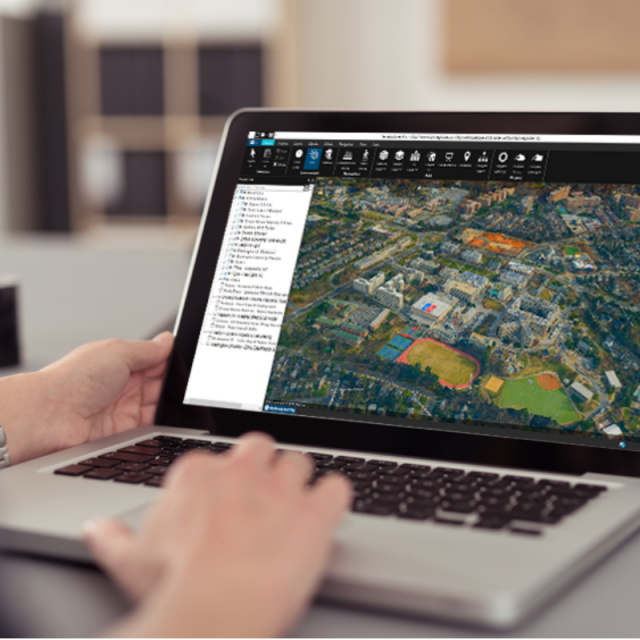
TerraExplorer provides powerful tools and a high-resolution 3D environment in which to view, query, analyze and present geospatial data. With TerraExplorer's robust and extensive capabilities and interoperability, stunningly realistic 3D visualizations can be created by overlaying the terrain with unlimited data layers, 3D models, virtual objects and more.
Skyline Software Systems
Herndon, US
Description
TerraExplorer is a cutting-edge 3D GIS desktop viewer and creator that provides powerful tools and a high-resolution 3D environment in which to view, query, analyze and present geospatial data. With TerraExplorer's robust and extensive capabilities, realistic 3D visualizations can be created by overlaying the terrain with unlimited data layers, 3D models, virtual objects and more. Analysis In addition to basic measurement and analysis tools for distance, slope, and volume measurements, TerraExplorer features advanced capabilities, including 3D plane area measurement, imagery comparison, and dynamic 3D viewshed. Display Imagery and elevation layers of unlimited size and resolution in a wide range of formats can be overlaid on the terrain and seamlessly integrated with feature layers and multi-resolution, stream-optimized 3D mesh model layers for easy visualization, access, and analysis of 3D geospatial data. If a new layer is based on a source that uses a different coordinate system, the layer can be reprojected to the project's coordinate system. Point, line and polygon features can be displayed and used to display advanced layer information based on their attribute data. TerraExplorer also includes an extensive set of objects: 2D and 3D, dynamic, buildings, models, point cloud models and video, that can be displayed on the terrain, as well as advanced terrain objects that allow terrain modification within TerraExplorer Pro. A flexible clipboard mechanism and sophisticated duplication tools make it easy to copy, paste, and position objects on the terrain. Realism is enhanced with environment settings that include lighting effects, horizon distance, fog color, sky texture, cloud display, and shadow color. Spatial Queries TerraExplorer provides advanced capabilities for manipulating feature and 3DML data and analyzing spatial relationships. Various spatial operations can be performed on a layer’s features, including merging features into a single feature, clipping one polygon from another, exploding a multi-part feature into its individual component features, and exporting selected features to a new file. Complex spatial and attribute queries are supported. Features can be filtered based on attribute value or based on their spatial relationship with a specified polygon, line point or object. A buffer zone can be defined to include features within a certain radius of the selection. Publishing Data SkylineGlobe Server streamlines the TerraExplorer workflow, enabling complete projects and layers to be optimized and published directly from TerraExplorer Pro to the cloud server. Through a single publishing operation, the data is made available to all TerraExplorer clients: Desktop, Mobile, and TE for Web, as well as standard geospatial clients such as WFS/WFS-T/WMS/WMTS/3D Tiles (Cesium). 1 Creating and Sharing 3D Presentations TerraExplorer’s presentation tools enable you to create a presentation, in which you communicate a specific view of the 3D World, by combining a customized flight route with a particular display of the project. Your presentation consists of one or more steps, in each of which you control the display of the 3D World, including current camera position, layer and object visibility, system time, and popup messages and captions. Presentations can be easily converted to standard video files. Optimization Advanced tools allow conversion of model files and of point cloud data from various formats to a stream- optimized Skyline-proprietary format for improved display performance as well as download rate. The Extract Terrain tool extracts and creates a subset of a local or remote terrain database for easy distribution.
Specifications
-
Data management
-
Spatial reference system
From data source
Security options for access
Y
Search on file content
Y
Version management
Y
-
Geometry types
-
Lines
Line segment
Points
Point
Surfaces
Polygon
Raster
Reference
-
Other
-
License or freeware
Open source
Training
Y
Main applications
TerraExplorer Pro, Photomesh, TerraBuilder
Related products
SkylineGlobe Server
Distinguishable features
supports many formats, publishable to offline kit - completely offline disconnected projects can be made
Extensions
Extensive API allows tools to be added easily.
-
2D Editing
-
Select
By drawing attributes
Remove
By select
Graphic transformations
Scale
Coordinate transformations
Yes
Mosaicing
Yes
Generalization
No
-
2D Construction
-
Positioning in relation to other element
Parallel
Positioning by coördinates
Y
Positioning by snapping
N
-
Storage
-
Type of data storage
File
Input formats
Dwg
Export formats
Dwg
Native storage format
File
Compression
Y
-
Visualisation
-
Types
Color
Change view
None
Thematic mapping
Choropleth
Temporal
Yes
-
Interoperability
-
Web standards
None
Spatial database management systems
None
Messaging protocols
None
Extensions
none
Metadata
None
Publish standards
KML
Available API’s
Yes
-
General
-
Year of last update
2019
Supported operation system
Windows
Main GIS category
Enterprise GIS
Year of introduction
1996
Supported hardware
Multi-Core, 4 or 8 cores recommended; 4GB RAM Recommended: 1GB Video RAM recommended with Pixel and vertex shader 3.0
-
Data analysis
-
Merge
Map layers
Buffer
Point buffer
Overlay operations
Intersection
Clip
Y


