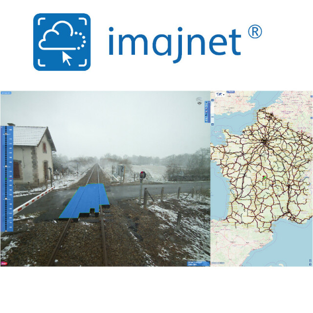
imajnet
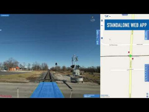
3D enabled field imagery web service
imajnet® is a safe and powerful web service giving access to nationwide surveys for any entity within an organization. imajnet® is provided with plug-ins and SDKs to be integrated into any third party GIS web or desktop application.

imajing
Labège, FR
Description
imajnet is designed to support transportation organization workflow with up-to-date geo-referenced images to support asset management, maintenance and monitoring.
imajnet® is provided with plug-ins and SDKs to be integrated into any third party GIS web or desktop application.
Do you have questions about this product?
- Questions about price, availability, and/or retailers
- Questions about technical specifications and usage
- Questions about suitability for your project or application
Specifications
-
Data management
-
Security options for access
Y
Search on file content
Y
Version management
Y
Spatial reference system
From data source, Fixed
-
Geometry types
-
Lines
Line segment, Polyline
Points
Point
Surfaces
Polygon
Raster
-
Other
-
License or freeware
License
Training
Y
Main users
SNCF Reseau, Infrabel, MEL, CD34, etc
Main applications
Survey sharing, on-line localize in the field, virtual visit, feature collection in surveys
Related products
imajbox, imajview
Distinguishable features
handles millions of km of surveys
-
2D Editing
-
Select
Remove
Graphic transformations
-
2D Construction
-
Positioning by coördinates
Y
Positioning in relation to other element
Others
-
Storage
-
Type of data storage
Database, Public cloud, Private cloud
Native storage format
Native survey format used
Input formats
Shape, KML, Jpg, Others
Export formats
KML
-
Visualisation
-
Types
Color
Change view
Zoomfactor, Target point, Twist angle
Temporal
navigation in time as well as in space
Thematic mapping
-
Interoperability
-
Web standards
WMS, WFS
Spatial database management systems
PostGIS
Messaging protocols
REST
Publish standards
KML
Extensions
Available API’s
SDK and low level API (Rest)
Metadata
Creation
-
General
-
Year of introduction
2015
Year of last update
2019
Supported hardware
Physical or virtual server
Supported operation system
Linux
Main GIS category
Enterprise GIS, Internet GIS, Mobile GIS
-
Data analysis
-
Merge
Buffer
Overlay operations
Videos


