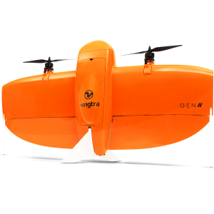
SAMA VTOL PPK UAV
Professional VTOL UAV for Mapping
TareqhUAV
Tehran, IR
Description
Aerial mapping SAMA VTOL UAV is a safe and efficient drone for photogrammetry and remote sensing applications in vast areas. In this UAV by good Camera , low distortion lens and PPK system(Post Processing Kinematic) surveying absolute accuracy of 3 cm In the X/Y and 4 cm in Z is accessible without GCPs.
Sama UAV package contains UAV ground station(Flight management software) Comes with a variety of sensor options and special transport box. Sama UAV with 1-hour flight endurance can be imaging in the remote areas of reach and up to a height of 600 metres from the ground and under wind conditions up to 40 kilometers per hour.
Specifications
-
Environment
-
Min. operation temperature [°C]
-10
Max. operation temperature [°C]
40
Max. wind speed [m/sec]
12.5
Max. humidity [%]
100
-
Battery and Power
-
Battery type
Lipo
-
Imaging/scanning devices
-
Onboard imaging/scanning devices
RGB Camera, Additional sensors, NIR Camera
Type of Camera
Fujifilm x-A3 , SONY RX1 RIII , Thermal Flir Due pro , Micasense Rededge-MX
Build-in Stablilsation
Y
Exchangeable
Y
Sensor tilting to allow oblique views
N
Additional Sensors and additional information
Multispectral- Thermal
-
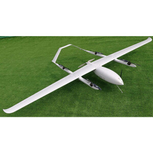
Platform
-
Platform
Aircraft
Max. payload [kg]
0.5
Max. stay in the air [min]
60
Max. speed [km/h]
100
Max. height above sea level [m]
5000
Propulsion
Electric
Material
Fibeglass composite
Brand
TareqhUAV
-
Accessories
-
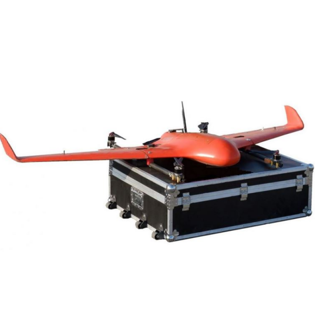
Transportation accessories
Aluminium hard case
Included batteries and charger
2 battery and charger
More included products and spare parts
2 propeller
-
Operation Characteristics and Safety
-
Min. ø of launch/landing site [m]
3
Launching method
Automatic Vertical take off and landing
Training provided
Y
Automatic launch and landing
Y
Autonomous emergency landing
Y
Collision avoidance systems (CAS)
Y
-
Dimensions
-
ø / wingspan [cm]
212
Height [cm]
40
Weight [kg]
7
Number of rotors
5
Transport on human back
N
-
Base Station
-
Ground computer included
Y
Type of Ground computer
Tablet
Real time image and video download link
Y
-
Navigation Sensors
-
Type of GNSS receiver and captured signals
GNSS L1 PPK
Correction services [PPK, RTK]
PPK
Other sensors and additional information
Airspeed sensor , dual gps , jyro ,accels ,compass
-
General
-
Year of last update
2019
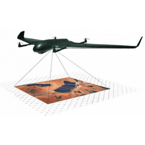
Typical applications
Mapping, Surveying, Mining, Environmental, Agriculture
Product Name
Sama VTOL UAV
-
Included software and automatically generated
-
Type of software included
Flight planning, Photogrammetric software
Automatically Generated Products
3D City Models, Point Clouds, 3D Landscape Models, DEMs, DTMs, Orthomosaics, NDVI maps
Flight planning software
Sama Planner [QgroundControl based]
Photogrammetric software
Agisoft metashape , Pix4d , ContextCapture , UAS master
Point cloud processing software
Agisoft metashape , Pix4d , ContextCapture , UAS master


