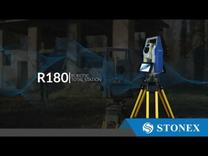

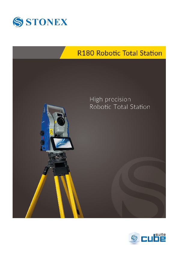
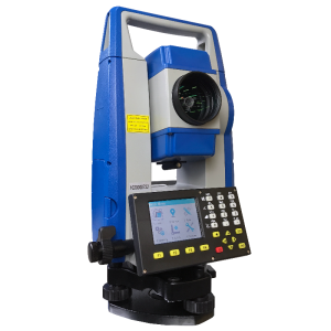
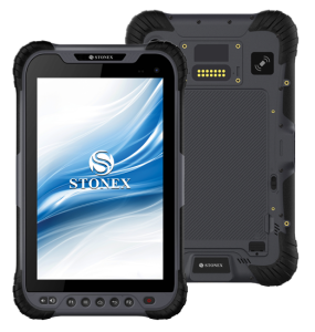
R180 Robotic Total Station
Robotic Total Station with Android
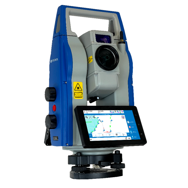
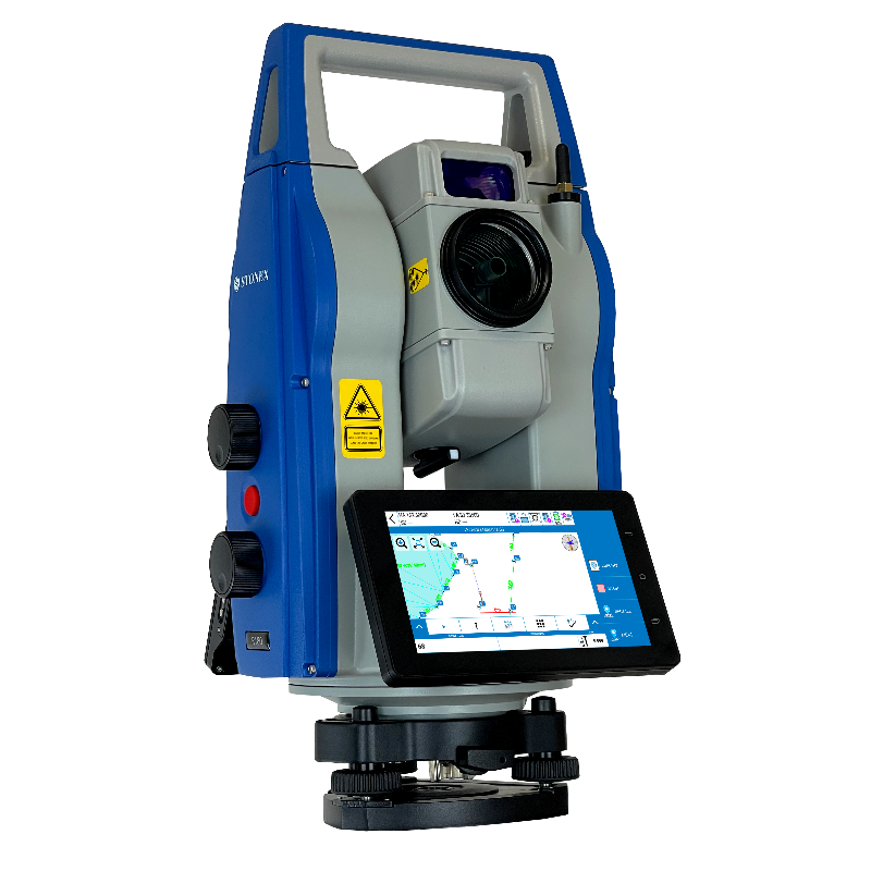
The R180 is a highly accurate and fast Android robotic station. It features a rotation speed of 180°/sec and an EDM accuracy of 1 mm + 1 ppm, with a range of up to 1000 m without a prism. The R180 is available in two versions, 0.5″ and 1″ second. For both models, the quietness and smoothness in prism searches and rotations are among the most observed and appreciated features.

Stonex
Paderno Dugnano (MI), IT
Description
Equipped with the Android operating system, the R180 has Cube-a as onboard software. This enables users to navigate online and interact with the touch screen in an easy and familiar way.
The Cube-a onboard software includes all the classic functions of the program, as well as the integration of jobs done with GNSS and surveys done with the total station. This allows operators to achieve complex and professional work in a short time and with high accuracy. Additionally, the R180 has a camera and a light guide to further facilitate field work.
TDRIVE MOTOR, FAST AND SILENT
The R180 Robotic total station boasts a rotation speed of 180°/sec, making it one of the fastest in its product category. Not only is it speedy, but it is also impressively quiet, with noise levels among the lowest in its class. Additionally, the Tdrive technology, with a very high speed motor, allows for high-speed pursuit, even with a prism installed on moving vehicles. Not using gear technology ensures frictionless movement, greater durability, and less maintenance.
HIGH ACCURACY AND PROFESSIONAL RESULTS
This instrument is top-of-the-line. Its detailed engineering allows for exceptional performance, achieving an accuracy of 1 mm + 1 ppm with a prism, at a measurement speed of significantly less than one second.
LONG DISTANCE REFLECTORLESS
R180 guarantees high accuracy long range measurements: up to 1000 m in reflectorless mode and up to 6000 m using a single prism, with millimeter accuracy.
BUILT-IN CAMERA
The R180 is further enhanced by the addition of a built-in camera, which can be utilized thanks to the presence of two 6-inch screens. This camera allows you to view the points operator have surveyed on the large screens, or to use the image to help with collimation.
ANDROID AND CUBE-A ON BOARD
R180 is equipped with an Android operating system and has Cube-a installed on board. The 6-inch touch screens allow you to have complete control of the station.
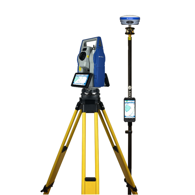
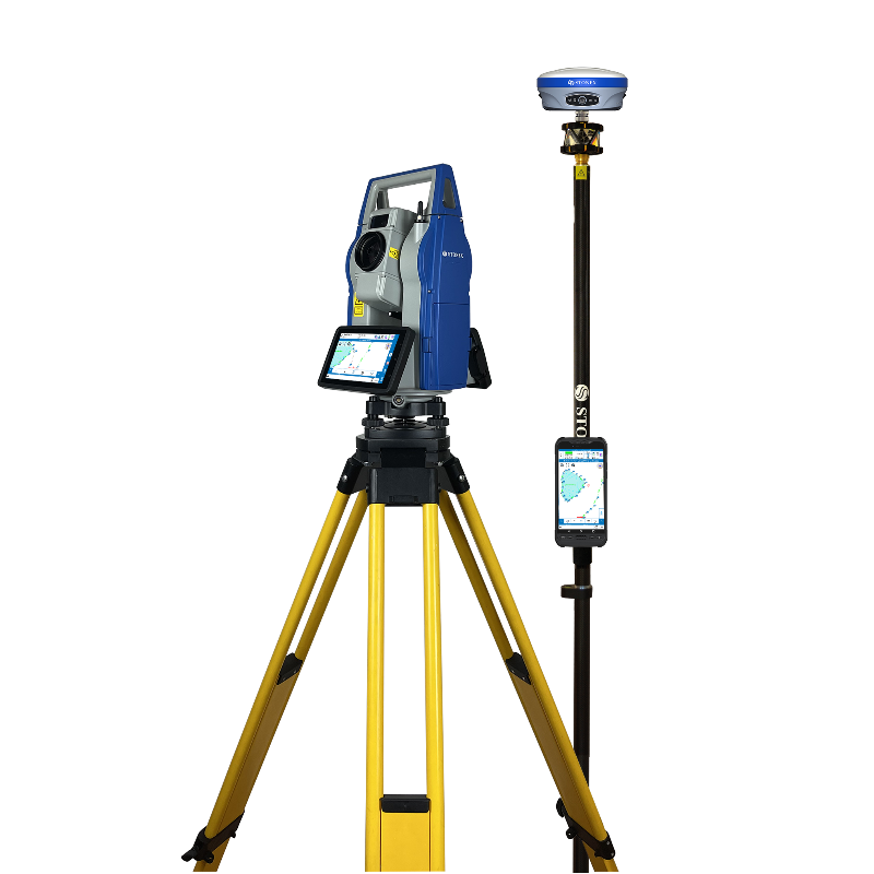
OnePole Solution
The OnePole Solution is a surveying system that combines the high accuracy of prism measurements with the ability to measure points that are not visible from the Total Station (TS) using GNSS technology.
While a TS requires reference points that must be visible from the station, an RTK GNSS receiver can quickly determine its position with centimeter-level accuracy using data from satellites.
The OnePole Solution allows for the simultaneous use of TS and GNSS, and can easily switch between the two with a simple tap on a button. Additionally, the system reduces prism search times through auto-aiming to the current GNSS position.
Do you have questions about this product?
- Questions about price, availability, and/or retailers
- Questions about technical specifications and usage
- Questions about suitability for your project or application
Specifications
-
General
-
Year of introduction
2023
Height [m]
0.43
Width [m]
0.255
Depth [m]
0.235
Weight [kg]
9.3
Display Panel
two 6" color touch screens
Area of Application
survey, construction, monitoring
-
User Interface
-
Operating System
Android
On-board survey software
Cube-a
No. faces
2
Resolution [px rows x columns]
720x1280
Color display
Y
Screen type
color LCD
Touchscreen
Y
-
Distance Measurement with Prism
-
Standard deviation: constant part [mm]
1
Standard deviation: variable part [ppm}
1
Maximum range with 1 standard prism [m]
6000
Measuring Time [s]
0.3 / 0.7
-
Integrated camera
-
Integrated camera available [Y/N]
Y
-
Data Storage & Connectivity
-
Internal memory [GB]
32
USB [Y/N]
Y
RS-232 /422 Serial [Y/N]
Y
Bluetooth {Y/N}
Y
WiFi {Y/N}
Y
-
Miscellaneous
-
Guiding light
Y
Integration with GNSS receiver possible [Y/N]
Y
-
Automatic Tracking and Locking
-
Maximum Range [m]
1000
Maximum angular speed [deg/s]
180
Tracking and recovery of moving prism
Y
-
Robotic operation
-
Compatible with GNSS for detail survey
Y
Recommended controller
Android controller
Graphical field note storage on controller
Y
Camera in controller
Y
-
Operation
-
Minimum working temperature [degC]
-20
Maximum working temperature [degC]
50
IP dust/water protection class [IPxx]
IP54
-
Distance Measurement without Prism
-
Standard deviation: constant part [mm]
2
Standard deviation: variable part [ppm]
2
Non-Prism Range [m]
1000
-
Power Supply
-
Battery
Li-ion
Capacity
6400 mAh
Max. operation time on one battery [hr]
5
-
Support
-
Reach of global support network
Y
-
Angle Measurement
-
Standard deviation [arcsec]
0.5 and 1
Compensation
± 3.0' / 1"
Guide Light
Y
-
Connectivity
-
Bluetooth
Y
USB
Yes
RS232
Yes
Other connectors or connector specifications
4G built-in
-
Hardware
-
Laser Plummet
Y
Documents
Brochure
stonex-r180-total-station.pdf
2.7 MB


