
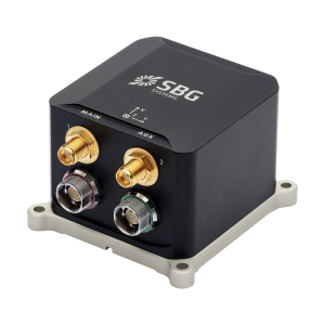
Quanta Plus
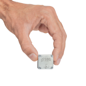
Optimized Size for Direct Georeferencing
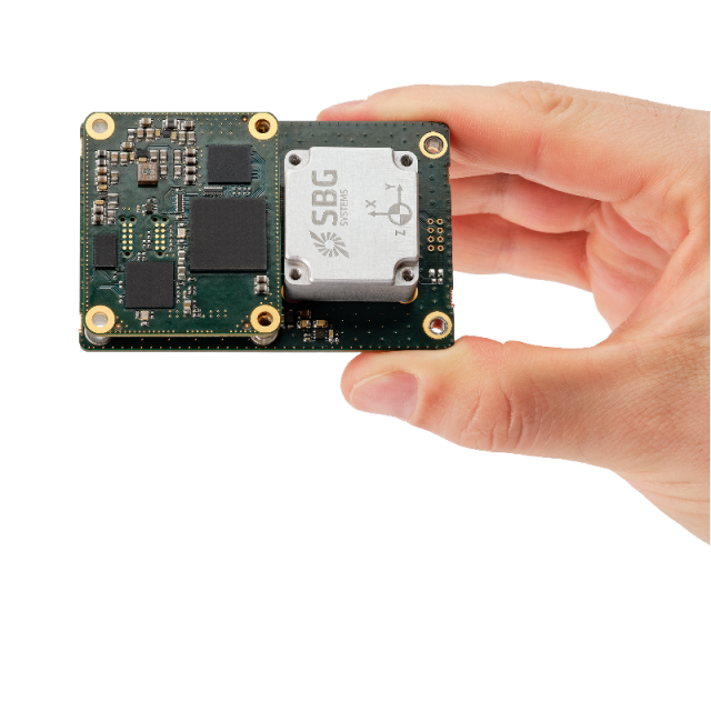
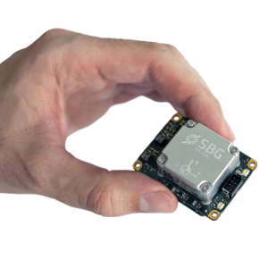
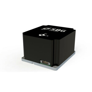
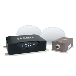
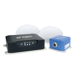
Quanta Plus is a small, lightweight, and high-performance OEM GNSS-aided INS that can be easily integrated into survey systems with LiDAR or other third-party sensors.

SBG Systems
Carrières-sur-Seine, FR
Description
Quanta Plus combines a tactical MEMS IMU with a high-performance GNSS receiver to get reliable position and attitude, even in harshest GNSS environments.
Its miniature OEM form factor and stellar performances makes it ideal for mapping applications such as UAV dedicated to surveying or mobile mapping.
Quanta Plus also benefits from easy integration within our post-processing software: Qinertia.
Do you have questions about this product?
- Questions about price, availability, and/or retailers
- Questions about technical specifications and usage
- Questions about suitability for your project or application
Specifications
-
Other specifications
-
Export restrictions
NO restriction
Graphical user interface
Y
Typical application
LiDAR & Photogrammetry, UAV-based Surveying, Mobile Mapping, Indoor Mapping
Distinguishable features
Best SWaP-C for stellar performance
-
Environmental
-
Non-operating shock tolerance [g]
40
Operating shock tolerance [g]
8
Min. operating temperature [°C]
-40
Max. operating temperature [°C]
85
Max. rotation speed [deg/s]
490
-
Software
-
Filtering
Y
Adaptable filter strength
Y
Max. number of position input signals
2
Uncertainty indicators given in output
SD
-
GNSS aided uncertainty
-
Heading [deg]
0.015
Pitch [deg]
0.04
Roll [deg]
0.04
-
General
-
Type of application
Air, Land
Year of initial development
2023
Height [m]
0.022
Width [m]
0.051
Length [m]
0.078
Weight [kg]
0.275
Min. Voltage (DC)
4.75
Max. Voltage (DC)
5.25
Power consumption [W]
3.5
Splashproof casting
N
Water resistant casting
N
Mean time between failures [hr]
150000
Type of accelerometer
MEMS
Type of gyro
MEMS
Moving parts
N
Height [mm]
22.6
Width [mm]
78.75
Length [mm]
51.5
Removable from base plate
N
-
GNSS Positioning Sensor
-
Number of integrated GNSS receivers and antenna ports
2
No. channels p receiver
445
Tracked satellite signals
GPS: L1 C/A, L2, L2C, L5 GLONASS: L1 C/A, L2 C/A, L2P, L3 GALILEO: E1, E5a, E5b BEIDOU: B1I, B1C, B2a, B2I, B3I QZSS: L1 C/A, L2C, L5 SBAS
SBAS differential signals
Y
RTK Network Compatibility
Y
Update rate [ Hz ]
5
Cold start [ seconds ]
45
-
Data formats
-
NMEA formats
All standard NMEA frames
RTCM
Y
Other
sbgEcom
-
Inertial Measurement Unit
-
Accelerometer bias [µ-g]
10
gyro bias [deg/hr]
0.8
Calibration procedure
https://www.sbg-systems.com/production-testing-calibration/
-
GNSS positional accuracy
-
Horizontal Position Accuracy (RTK) [ RMS in cm ]
1
Documents
Brochure
Quanta-Plus-Leaflet.pdf
Videos


