Planet Basemaps
Comprehensive, high-frequency mosaics for analysis
Power your applications and analytics with seamless basemaps built from the most recent satellite imagery from around the world.
Planet
San Francisco, US
Description
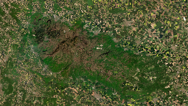
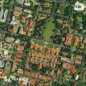
Planet Basemaps leverage cutting-edge software together with daily global satellite imagery to create visually consistent and scientifically accurate mosaics. Gain insights over broad areas and diverse geographies, and empower time series analysis and data analytics with Planet’s Global and Select Basemaps.
Select Basemaps
With Planet Select Basemaps, customers have access to accurate, up-to-date, and seamless geospatial data captured by the world's largest fleet of satellites.
Planet Select Basemaps comprises two offerings—Visual Basemaps and Surface Reflectance Basemaps—that are generated in line with customer needs to provide fresh, actionable insights over broad areas. Unlike other image mosaics, Planet Select Basemaps let the customer determine the AOI, frequency of updates, and the delivery.
Visual Basemaps
Spatially accurate, color-corrected, high-resolution basemaps that minimize the effects of cloud, haze, and other image variables.
Surface Reflectance Basemaps
With minimized atmospheric effects and enhanced pixel accuracy, this basemap provides consistent data for deeper analysis with four or eight spectral bands.
Global Basemaps
1.5+ million scenes incorporated daily to create a smooth contextual layer, updated annually, and ready for your workflow.
Planet's range of basemap solutions ensure that your application needs are met. Planet Select Basemaps are customizable with options for visual or multispectral content and frequency of delivery. Planet’s Global Basemap spans the Earth’s entire landmass and is generated once each year from data collected daily.
Planet Basemaps and GIS: Flexible Delivery, Efficient Integration
Use Planet Basemaps within your preferred GIS environment. Access Basemaps efficiently online in a variety of formats.
Ready to use with popular GIS applications, including ArcGIS and QGIS
Web streaming via XYZ and WMTS services
Get the new add-in for easy, rapid integration into Esri ArcGIS Pro - Download now.
Documents
Brochure
Planet-Datasheet-Basemaps-Letter.pdf
3.76 MB

