


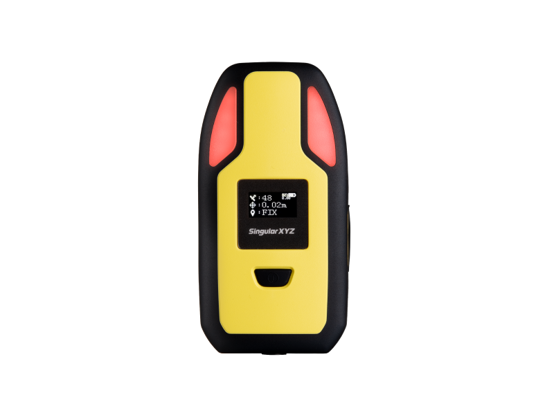

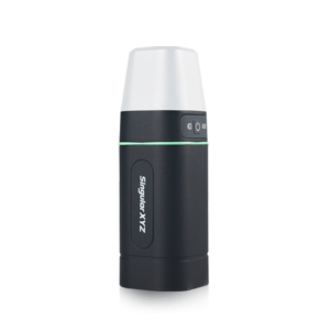
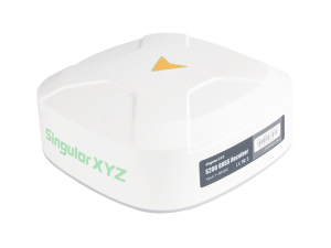
P2 GNSS Receiver
Accurate, Alert, Wearable: For Your Safety, GIS & Surveying
Triple-alert function, flexible wearable design and full-constellation satellite tracking, P2 is an ideal choice for your safety, GIS, surveying and various applications.

SingularXYZ Intelligent Technology Ltd.
Shanghai, CN
Description
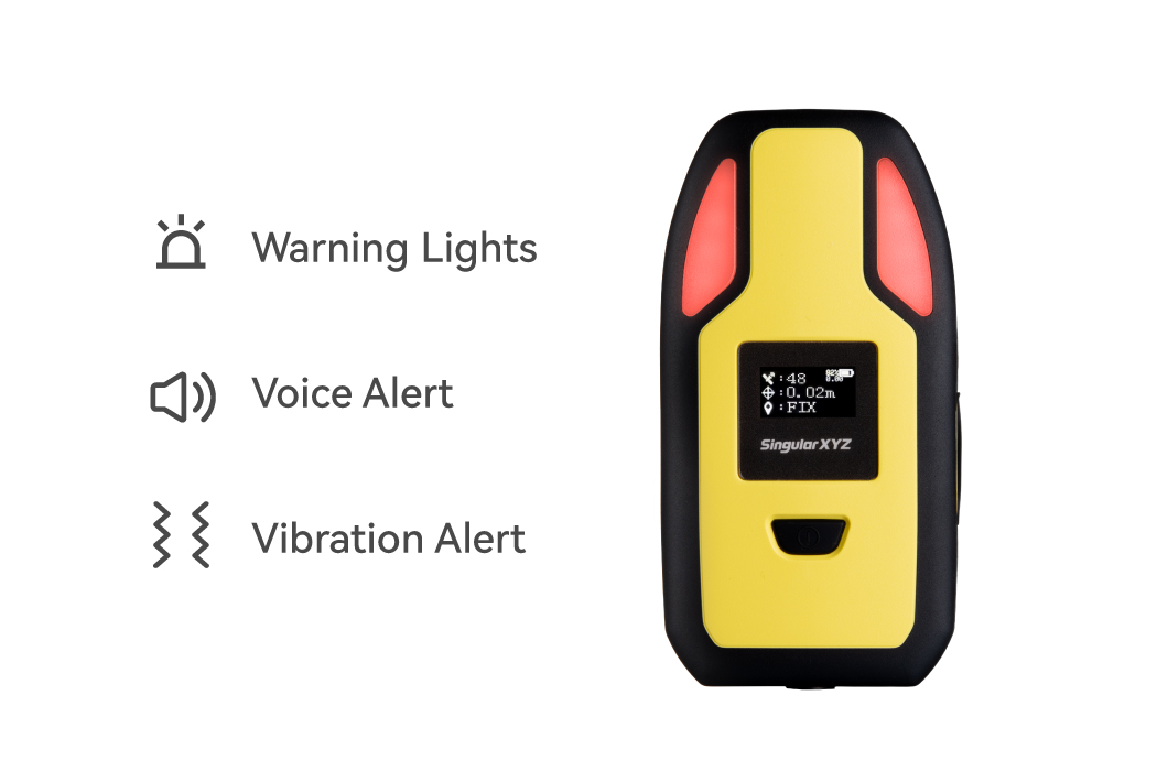
ADVANCED SAFETY ALERTS
Prioritizing construction site safety, the P2 GNSS receiver comes with a range of warning features including warning lights, voice alerts, and vibration alerts, notifying users when they entering dangerous areas, enhancing safety during construction operations.
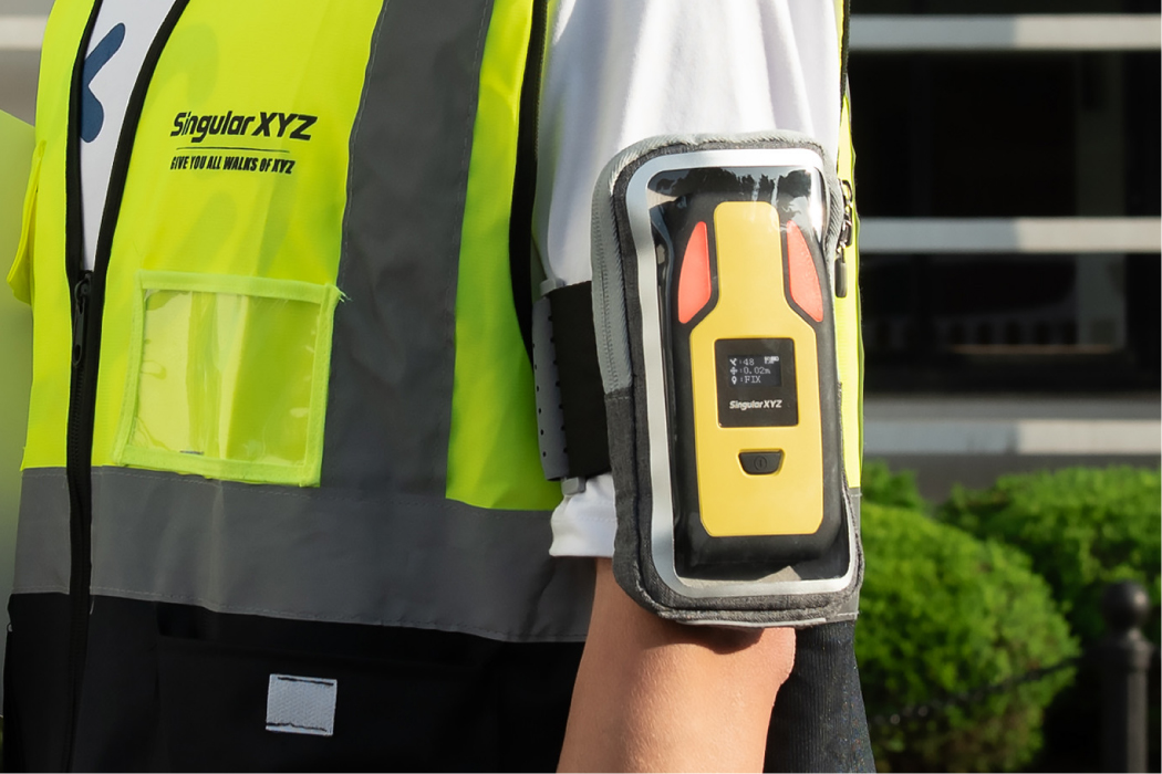
WEARABLE DESIGN
Designed with user comfort in mind, the P2 features a flexible and wearable design that can be easily worn on the arm, around the neck, or attached to a helmet. This ensures enhanced personnel safety without adding unnecessary burden to construction workers.
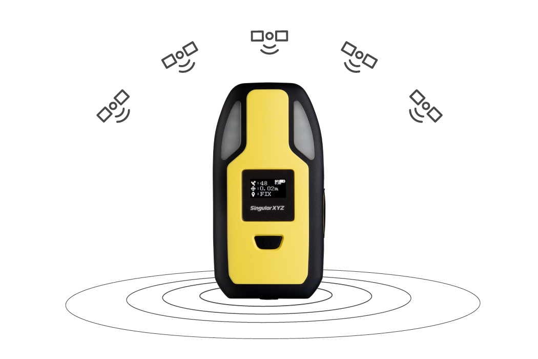
CENTIMETER-LEVEL TRACKING
Considering obstacles in the construction site, P2 GNSS receiver is upgraded with 1408-channel GNSS engine, tracking GPS, BDS, GLONASS, Galileo and QZSS synchronously, providing enhancing consistent and reliable centimeter-level positioning.
EFFICIENT COMMUNICATION
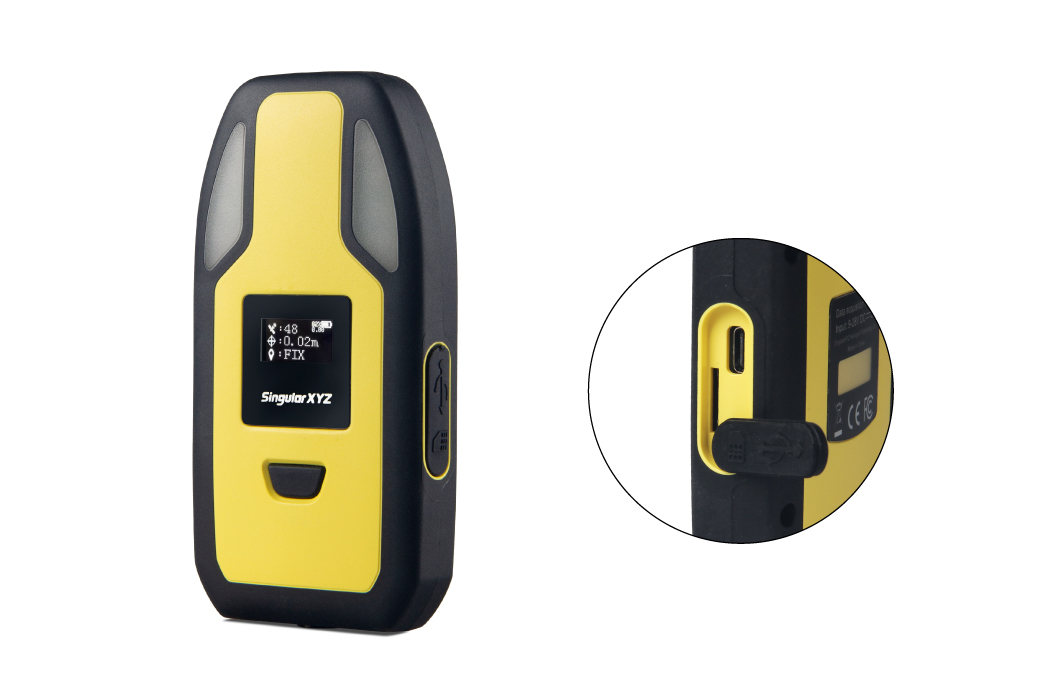
Featuring a built-in 4G modem for real-time RTK correction data reception and positioning data returning, the P2 also offers Bluetooth connectivity for convenient configuration and a Type-C interface for charging and upgrades.
GUARANTEE YOUR SAFETY
Integrated with geofencing platforms, the P2 can alert operators when they are nearing hazardous or restricted areas. Additionally, the always-on warning light serves as a visual warning during night operations, further enhancing safety on the construction site.
TAILORED INTEGRATION SUPPORT
To facilitate seamless integration into various platforms and systems, SingularXYZ offers comprehensive SDK documentation and R&D support for customized functions such as geo-fencing integration, trajectory recording, real-time position tracking, operation area statistics, etc.
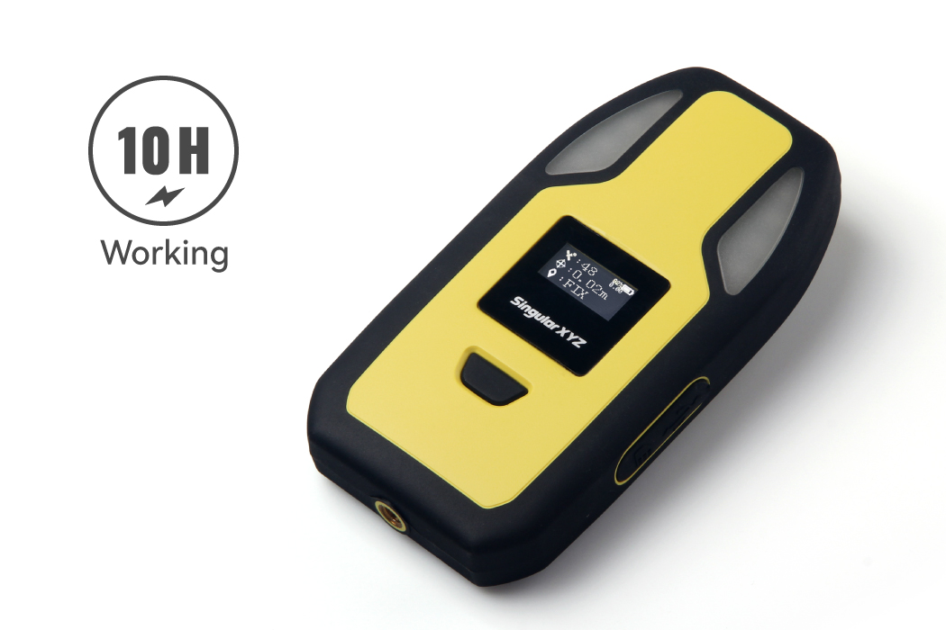
LONG TIME BATTERY
Powered by a 4000mAh internal battery and optimized for low power consumption, the P2 can operate continuously for up to 10 hours, ensuring uninterrupted safety throughout the workday.
IP67 PROTECTION
Built to withstand harsh working conditions, the P2 is housed in a rugged IP67 enclosure with sealed plugs, providing protection against accidental drops, shocks, inclement weather, and other potential damages.
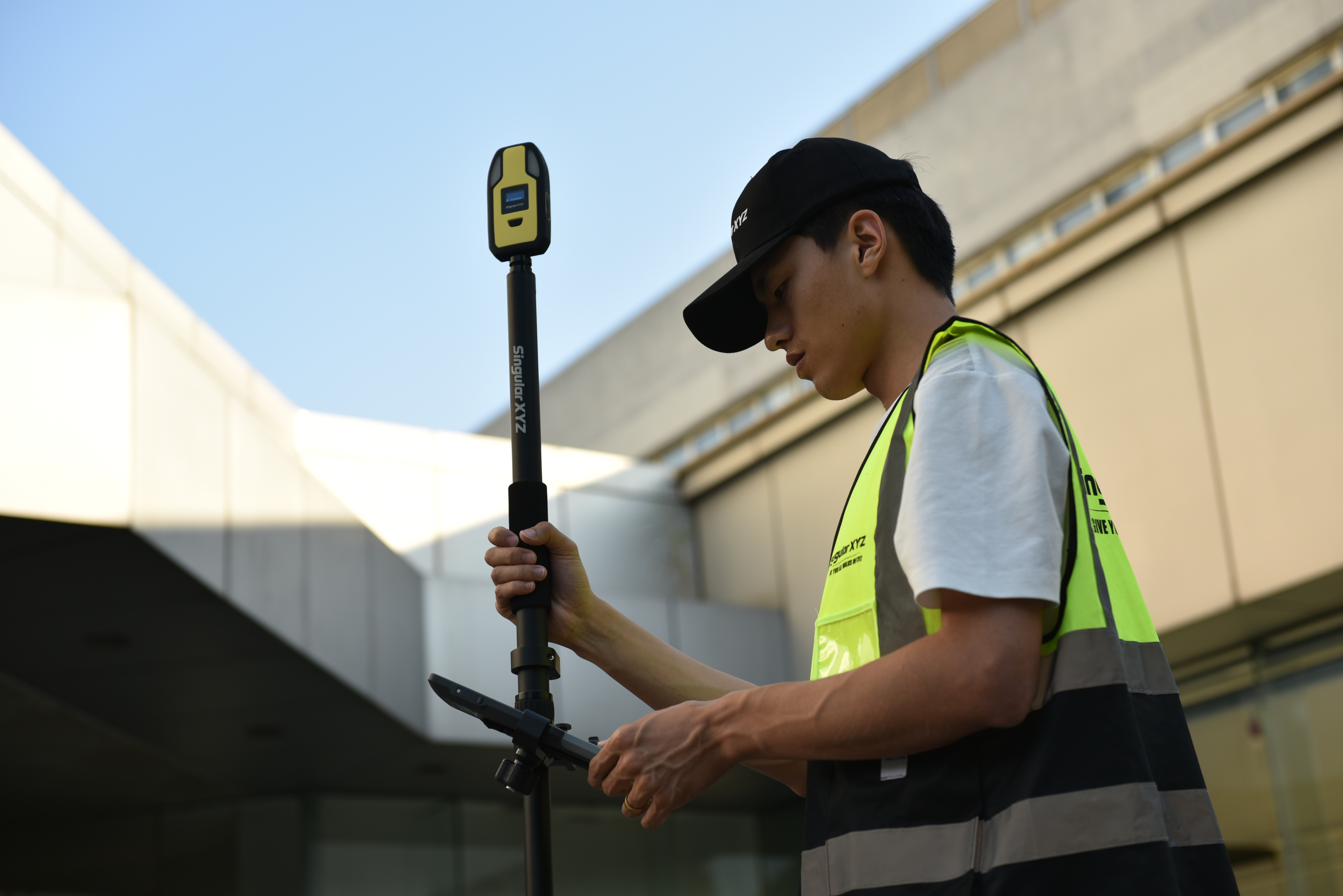
HANDHELD FOR GIS
Weighing less than 300 grams, the P2 GNSS receiver is an ultra-lightweight, perfect handheld device for all your GIS tasks and various positioning related applications
Do you have questions about this product?
- Questions about price, availability, and/or retailers
- Questions about technical specifications and usage
- Questions about suitability for your project or application
Specifications
-
General
-
Depth [m]
0.022
Height [m]
0.135
Housing Material
Plastic
Total Weight [kg]
>0.3
Width [m]
0.07
Year of initial introduction
2024
Type
Land, Marine, Aerial
-
Performance
-
Max. simultaneous tracked channels
1408
MRS functionality
Y
No. channels
1408
Reacqisition time [s]
1
RTK Network Compatibility
Y
SBAS differential signals
WAAS, EGNOS, MSAS, GAGAN, SDCM
Tracked satellite signals
BDS: B1I, B2I, B3I, B1C, B2a, B2b* GPS: L1 C/A, L1C*, L2P, L2C, L5 GLONASS: L1, L2, L3* Galileo: E1, E5a, E5b, E6* QZSS: L1, L2, L5
Type of measurements
RTK
-
Environment
-
Humidity resistance
100% non-condensing
Operating temperature: min. [°C]
-40
Operating temperature: max. [°C]
85
Shock and vibration proof
Designed to survive a 1.5 m drop onto concrete
Water sand and dust proof
IP67
-
Communication: general
-
Communication ports
Type-C, Bluetooth, 4G
Simultaneous links
Y
PPS Out
N
Bluetooth
Y
-
Communication: Protocols
-
Configuration method
Android field software
L-Band Compatible
Y
NMEA output format
NMEA-0183
Other formats for differential data
N
other output formats
NMEA-0183
RTCM standards for differential data
RTCM3.X
-
Communication: links
-
CDMA phone modems
Y
GSM; UMTS phone modems
Y
Radio modems
N
-
Horizontal uncertainty
-
code: DGNSS/RTC (constant part) [m]
0.4
phase: RTK kinematic (variable part) [ppm]
1
phase: RTK kinematic (constant part) [m]
0.008
RTK network solution methods
VRS
-
Power
-
Internal power supply
5V, 2A
Operating power: max. [V]
5
Operating power: min. [V]
5
Operating time with internal power supply [hr]
10
Rechargeable with (auto)battery
Y
Connectors
Type-C
-
Recording
-
Data capacity [MB]
N
Data input
N
Memory medium
N
Type of data (on board recording)
N
-
More information
-
Distinguishable features
Triple-alert function
Documents
Brochure
74792e4c2993d9d9.pdf


