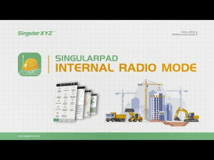
SingularPad Field Surveying Software
Professional Assistant For Your Projects
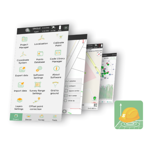
SingularPad is fully functional as a field surveying software, equipped with complete work modes and necessary functions for surveyors, which supports both GNSS receivers and total stations. In order to provide professional users with better working experience, SingularPad is designed with more advanced features, such as more import formats, more calculation tools, stake out accuracy analysis, auto-sketching by codes, CAD layer editing and etc.

SingularXYZ Intelligent Technology Ltd.
Shanghai, CN
Description
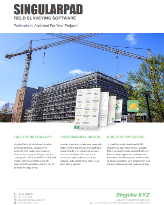
FULLY FUNCTIONALITY
SingularPad is fully functional as a field surveying software, equipped with complete work modes and necessary functions for surveyors. Projection/datum configuration, GSM/radio/PDA CORS work modes, point survey/stake out/CAD sketch/COGO calculation and etc. can all be found in SingularPad.
PROFESSIONAL DESIGN
In order to provide professional users with a better working experience, SingularPad is designed with more advanced features, such as more import formats, more calculation toolsstake-outut accuracy analysis, auto-sketching by codes, CAD layer editing and etc.
NON-STOP IMPROVING
To meet the rapidly developed GNSS industry and user requirements, SingularPad is constantly being upgraded with new features. Any suggestions and demands from users are welcome and will be added as soon as possible. With SingularPad, you will enjoy software services never out of date.
FEATURED FUNCTIONS
- Auto-Sketching: Automatically generate different polyline layers independently by selecting different codes and then measuring.
- CAD Sketching: Detailed CAD sketching function, including line, polygon, spline, circle and etc. Each layer is editable.
- Custom Surveying Interface: Users can customize the information display content and measurement function menu according to their working scenarios to meet their own usage habits and needs.
- Convenient Point Stakeout: Multiple guidance and prompting methods for your easy point stakeouts, such as guideline or compass guidance, forward direction or reference point reference. Moreover, SingularPad also provides a stakeout accuracy analysis function for your precise stakeout.
- Multiple Stakeout Modes: SingularPad supports multiple stakeout work modes, including point stakeout, line stakeout, DSM stakeout, CAD stakeout and road stakeout. For each stakeout mode, SingularPad also supports abundant file formats for your import.
- AB Line Surveying: Specially designed for precision agriculture systems, this feature allows users to easily measure AB guidance lines with mobile RTK devices. Farmers do not need to drive tractors across the large farms to generate guidance lines, which largely saves resources and energy.
Do you have questions about this product?
- Questions about price, availability, and/or retailers
- Questions about technical specifications and usage
- Questions about suitability for your project or application
Specifications
-
GNSS data and processing
-
GNSS static / RTK data collection
Y
GNSS setting out
Y
Input data formats supported
*.csv, *.dat, *.txt, *.raw, *.rw5, *.kml, *.kmz, *.ncn, *.pxy, *.crd, *.sl, *.crd, *.cot, *.loc, *.cdb, *.rob, *.RP, *.LE, *.RE, *.REC, *.ip, *.dy, *.rod, *.road, *.xy, *.PHI, *.SEC, *.sjw, *.xml, *.tnb, *.dxf, *.dwg and user-defined
Static baseline post-processing
N
Base and rover RTK
Y
Network RTK
VRS
-
CAD functions
-
CAD functions for Internal measured building surveys
Y
CAD functions for Rail applications
Y
Output formats supported
*.dxf, *.dwg
-
General
-
Mobile (real time connected to instrument)
Y
-
Integrated environment for
-
GNSS data
Y
Point cloud data
N
Transformation between map projections
Y
Documents
Brochure
c19a709b99f4905e.pdf
Videos


