


Navsight Marine - Ekinox Grade INS
Cost-effective INS/GNSS
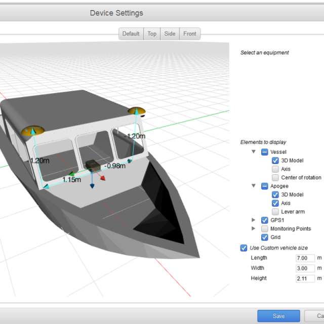
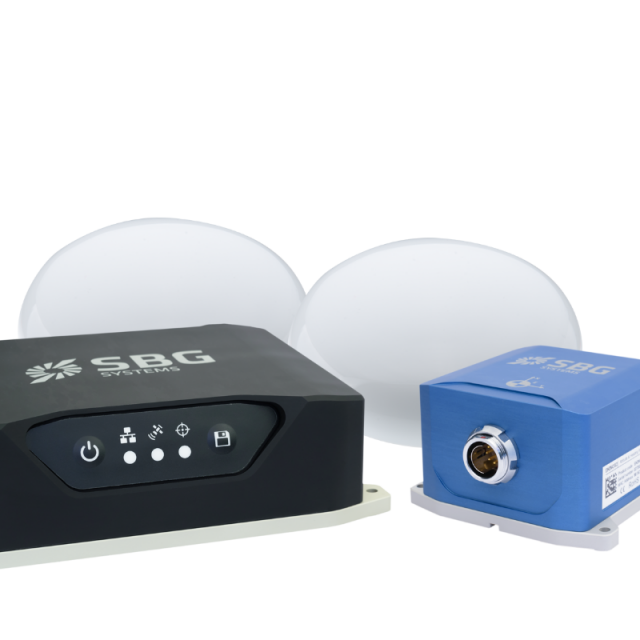
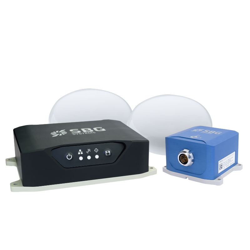
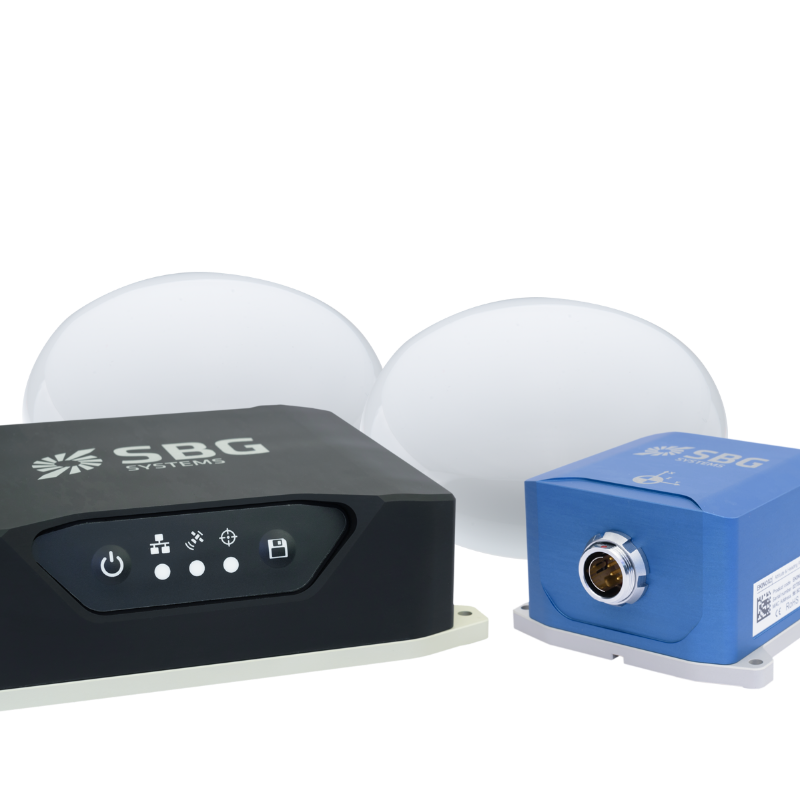
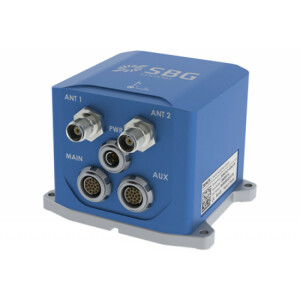
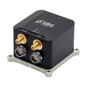
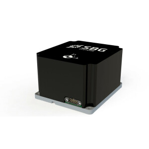
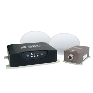
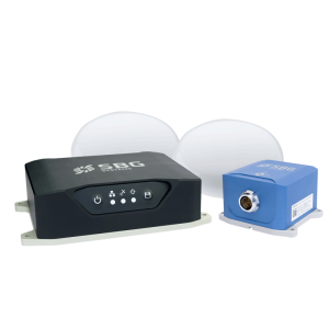
Navsight Marine Solution, Ekinox Grade consists of an Inertial Measurement Unit connected to Navsight, a rugged processing unit embedding the fusion intelligence. The configuration is made easy throughout our intuitive embedded web interface where all parameters can be quickly displayed and adjusted. The new 3D View helps you to check your mechanical installation, especially your sensor position, your alignments, and lever arms.

SBG Systems
Carrières-sur-Seine, FR
Description
Navsight Marine Solution - Ekinox Grade consists in an Inertial Measurement Unit connected to Navsight, a rugged processing unit embedding the fusion intelligence.
State-of-the-art Solution for Hydrographers:
- Latest Gyroscopes and Accelerometers and GNSS receiver
- Fast Initialization with GNSS-based Dual-Antenna heading
- Accurate Data in Rough Sea with Delayed Heave
- Configuration Made Easy thanks to the Web Interface
- Ideal for Challenging Shallow to Deep Water Applications
Designed to Ease Hydrographers' Tasks
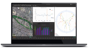
- Web Interface with 3D View
Configuration is made easy throughout our intuitive embedded web interface where all parameters can be quickly displayed and adjusted. The new 3D View helps you to check your mechanical installation, especially your sensor position, your alignments, and lever arms.
- Automatic Lever Arm Estimation
Navsight allows quick installation and initialization thanks to new mechanical calibration module. The embedded filtering controls and validates lever arms and antenna alignment during the calibration procedure.
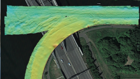
- Extensive Heave Calculation
The Navsight Marine Solution provides a real-time heave accurate to 5 cm, automatically adjusted to the wave frequency.
The embedded Delayed Heave feature allows a more extensive calculation, resulting in a heave accurate to 2.5 cm computed in real-time with a little delay.
Do you have questions about this product?
- Questions about price, availability, and/or retailers
- Questions about technical specifications and usage
- Questions about suitability for your project or application
Specifications
-
Other specifications
-
Graphical user interface
Y
Typical application
Shallow Water Survey
Distinguishable features
Cost-effective, Compact, Easy-to-use
Export restrictions
No
-
Environmental
-
Min. operating temperature [°C]
-40
Max. operating temperature [°C]
75
Non-operating shock tolerance [g]
500
Operating shock tolerance [g]
3
Max. rotation speed [deg/s]
300
-
Software
-
Filtering
Y
Adaptable filter strength
Yes
-
GNSS aided uncertainty
-
Heading [deg]
0.02
Pitch [deg]
0.015
Roll [deg]
0.015
Heave: constant part [m]
0.05
Heave: variable part [%]
5
-
General
-
Year of initial development
2018
Height [m]
0.112
Width [m]
0.094
Length [m]
0.094
Weight [kg]
0.425
Min. Voltage (AC)
9
Max. Voltage (AC)
36
Power consumption [W]
7
Splashproof casting
Y
Water resistant casting
Y
Type of application
Marine
Water resistance [m]
200
Type of accelerometer
MEMS
Type of gyro
MEMS
Mean time between failures [hr]
50000
Height [mm]
58
Width [mm]
100
Length [mm]
86
-
GNSS Positioning Sensor
-
Number of integrated GNSS receivers and antenna ports
2
RTK Network Compatibility
Yes
Update rate [ Hz ]
200
Cold start [ seconds ]
45
Hot start [ seconds ]
20
-
Data formats
-
RTCM
Y
-
Inertial Measurement Unit
-
Accelerometer bias [µ-g]
2
gyro bias [deg/hr]
0.5
-
GNSS positional accuracy
-
Horizontal Position Accuracy [ RMS in cm ]
120
Horizontal Position Accuracy (RTK) [ RMS in cm ]
1
Documents
Brochure
Navsight_Marine_Leaflet.pdf
Videos

