MAGNET Enterprise
Connect Field and Office in the Cloud Real-Time Data for Surveyors, Layout Crews and Office-Project Teams
Create a secure cloud environment that connects your office and field teams to improve your communication and collaboration.

Topcon
Capelle aan den IJssel, NL
Description
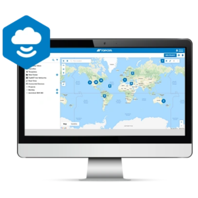
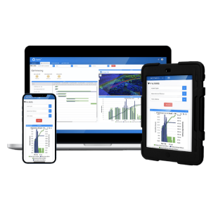
Connect your field and office teams with real-time access to your project data
Create a secure cloud environment that connects your office and field teams to improve your communication and collaboration. You can utilise any web browser to view your data on a map, redline models, and measure areas and distances. Save time and money with the ability to review and convert data on the fly and better organise projects.
- View connected Topcon devices and transfer real-time data
- See a visual map of projects and geo-referenced datasets
- Convert file types with an easy right click
- Annotate and share redlined models with field users
- Directly connect to Topcon’s MAGNET Field and Office products
- Export data to Topcon Sitelink3D, Bentley ProjectWise and Autodesk®️ BIM 360
Enterprise is included with any MAGNET software subscription license. MAGNET Enterprise is also included for the first year when purchasing a MAGNET Field or Office permanent license.
Do you have questions about this product?
- Questions about price, availability, and/or retailers
- Questions about technical specifications and usage
- Questions about suitability for your project or application
Documents
Brochure
topcon-magnet-digitalbooklet-corporatedocument-4.pdf
5.53 MB


