


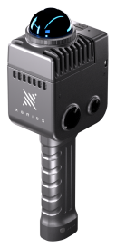

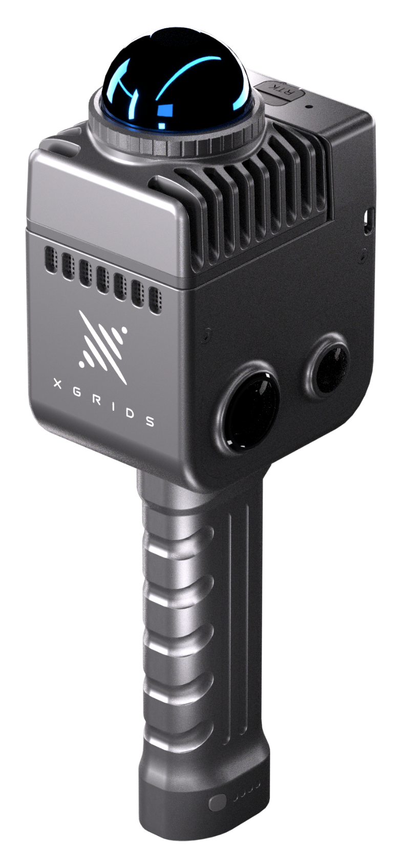

LixelKity K1 Compact Handheld LiDAR Scanner
1kg compact 3d laser scanner
The Lixel K1, XGRIDS' compact handheld scanner, incorporates 36MP panorama cameras and 360° LiDAR within its body. It produces colored models at the centimeter level, catering to professionals and 3D hobbyists by providing a convenient scanning and reconstruction experience.
Description
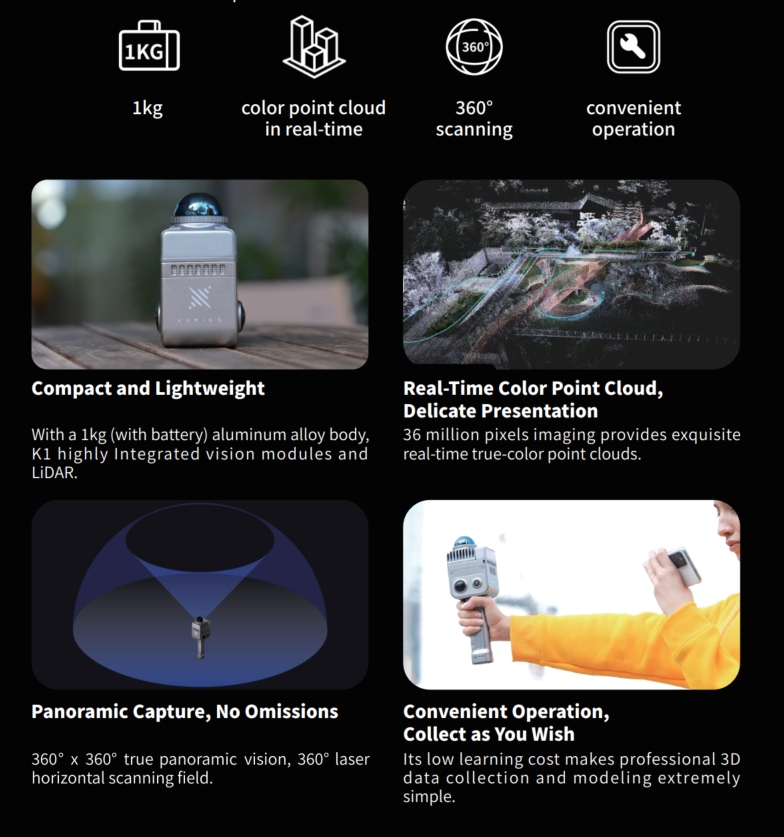
LixelK1 is a compact handheld scanning and modeling device newly introduced by XGRIDS. With a lightweight <1kg body, it integrates 56 MP panoramic vision modules and a 360° LiDAR, capable of real-time generation of centimeter-level colored 3D models. Tailored for professionals, small to medium-sized businesses, and 3D enthusiasts, it offers a convenient solution for 3D capture and modeling.


Multi-sensor data fusion, including laser, vision, and GNSS data, ensures stable scanning with enhanced scene adaptability.
Do you have questions about this product?
- Questions about price, availability, and/or retailers
- Questions about technical specifications and usage
- Questions about suitability for your project or application
Specifications
-
General
-
Total Weight [kg]
1
Year of introduction
2023
-
Application
-
Main applications
Construction, floor plan, scan to bim, cad drawing, filming and gaming, 3d modeling
Main users
Surveyers and 3d designers
-
Scanning Characteristics
-
3D measurement accuracy [mm]
Relative Accuracy: ±1.2cm Absolute Accuracy: ≤3cm Repeat Accuracy: ≤2cm Horizontal Accuracy: ≤0.015°
Data aquisition speed (points p/second)
200,000
Laser Class
Class1
Max. horizontal field of view [deg]
360
Max. vertical field of view [deg]
59
Scanning Speed
1000 ㎡ scanned in 2 min
-
Operation Characteristics
-
Operating temperature: max. [°C]
50
Operating temperature: min. [°C]
-20
-
Power
-
Battery type
Fast-lock Battery
Scan time per battery [h]
1.5
-
More information
-
Distinguishable features
5G remote transmission, color point in real-time, mesh model generation
-
Functionality
-
Mesh as output
Y
Real time visualization during scanning
Y
Software name
LixelStudio
-
Connectivity and Sensors
-
Bluetooth
Y
INS
Y
USB Port
Y
WiFi
Y
Documents
Brochure
Lixel L2-A5 (2).pdf
14.08 MB
Videos


