
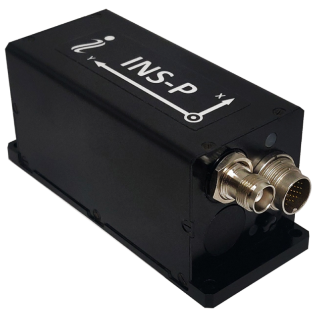
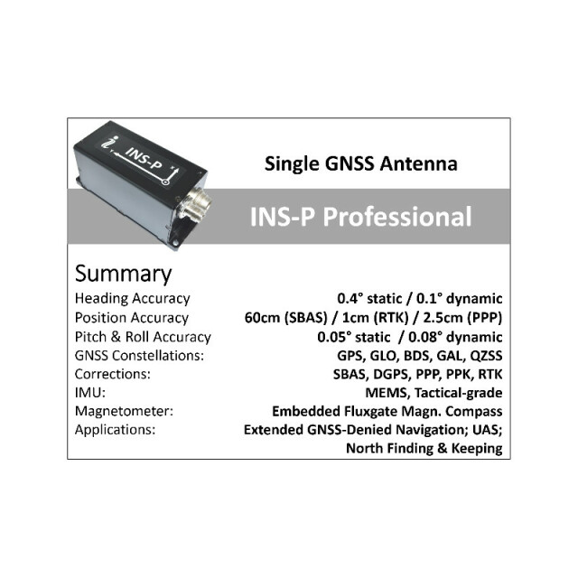


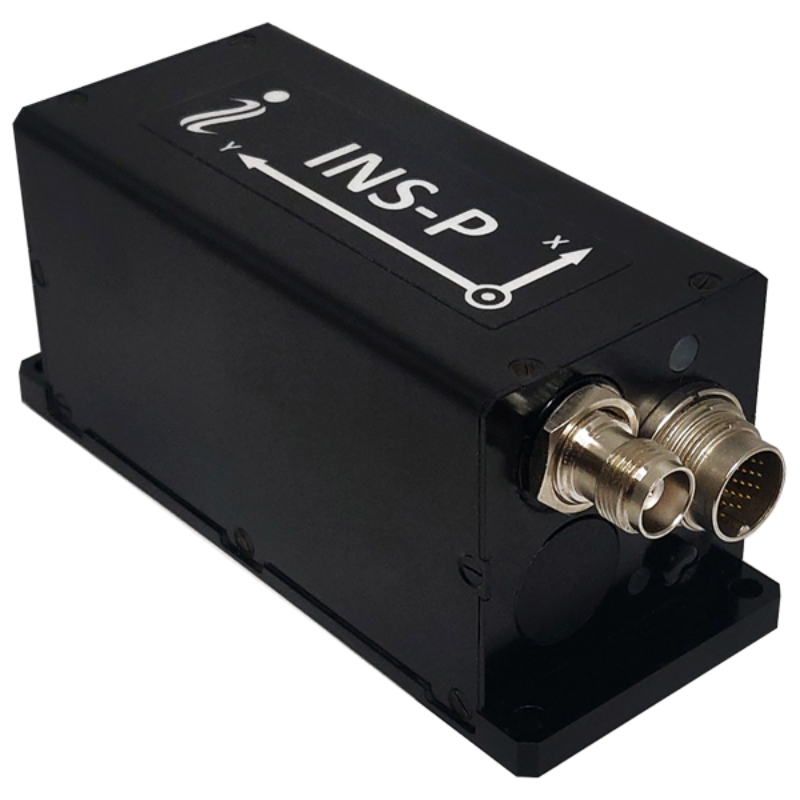
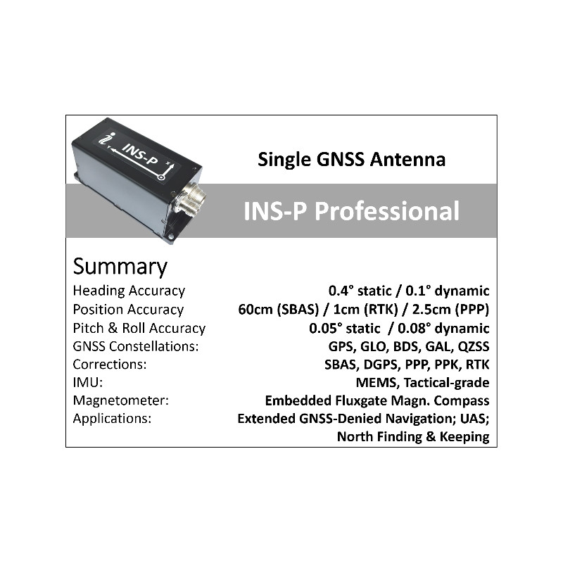


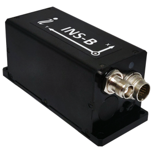
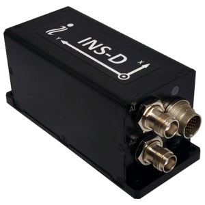
INS-P – Professional Single Antenna GPS-Aided Inertial Navigation System
The best compact and cost effective GPS-Aided Inertial Navigation System (INS-P) for GPS-enable and GPS-denied environments
The Inertial Labs, Professional version of Single Antenna GPS-Aided Inertial Navigation System "INS-P" is the new generation of fully-integrated, combined Tactical-grade IMU, Fluxgate compass and high precision GNSS receiver, supporting GPS, Glonass, Galileo, QZSS, Beidou and L-Band navigation. INS-P is high-performance strapdown system, that determines position, velocity and absolute orientation (Heading, Pitch and Roll) for any device on which it is mounted.

Inertial Labs, Inc.
Paeonian Springs, US
Description
- MIL-STD-810G/DO-160E compliance
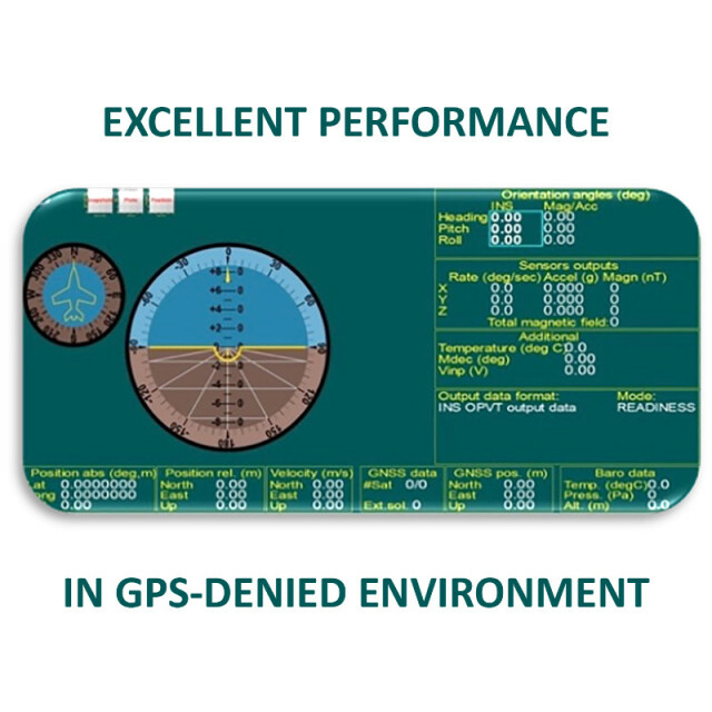
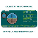
- Excellent accuracy in GPS-Denied environments (Tactical-grade IMU + Aiding data)
- GPS, GLONASS, GALILEO, BEIDOU, SBAS, DGPS, RTK supported signals
- Tactical-grade IMU (1 deg/hr gyroscopes and 5 micro accelerometers Bias in-run stability)
- High precision single antenna GNSS receivers
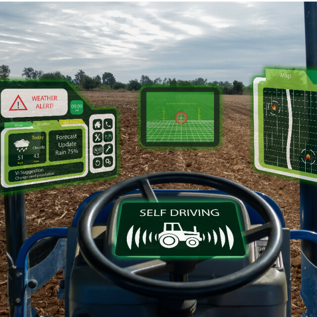
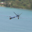
- The best on a market solution for UAV/UAS flight control in GPS-denied environments
- Embedded gyro-compensated Fluxgate compass
- Odometer, Wheel sensor, Airspeed sensor, Wind sensor, Doppler shift from locator aiding data
- 1 cm + 1 ppm RTK Horizontal Position Accuracy
- 2.5 cm TerraStar-C PRO Horizontal Position Accuracy
- 0.1 deg GNSS Heading accuracy
- Advanced, extendable, embedded Kalman Filter based sensor fusion algorithms
- State-of-the-art algorithms for different dynamic motions of Vessels, Ships, Helicopters, UAV, UUV, UGV, AGV, ROV, Gimbals and Land Vehicles
- Implemented ZUPT, GNSS tracking angle features
- Full temperature calibration of all sensing elements
- Environmentally sealed (IP67), compact design, MIL-STD-810G/DO-160E
Do you have questions about this product?
- Questions about price, availability, and/or retailers
- Questions about technical specifications and usage
- Questions about suitability for your project or application
Specifications
-
Other specifications
-
Export restrictions
No
Graphical user interface
Y
Typical application
UAV/UAS flight control systems
Distinguishable features
Aiding data; Tactical-grade IMU; High precision GNSS receiver; gyro-compensated Fluxgate Compass
-
Environmental
-
Non-operating shock tolerance [g]
3000
Operating shock tolerance [g]
1500
Min. operating temperature [°C]
-40
Max. operating temperature [°C]
75
Max. rotation speed [deg/s]
950
-
Software
-
Name
GUI Software
Filtering
Y
Adaptable filter strength
Kalman
Adaptable input signals
Y
Integrity monitoring of position input
Y
Integrity monitoring of log input
Y
Max. number of position input signals
10
Max. number of log input signals
10
Maximum latency of log input [ms]
3
Maximum latency of position input [ms]
3
Uncertainty indicators given in output
Yes
Uncertainty of time stamp for output [ms]
0.02
-
Doppler log aided uncertainty
-
Heading [deg]
0.1
Pitch [deg]
0.08
Roll [deg]
0.08
Heave [m]
0.05
Surge/sway [m]
0.1
Decrease in position accuracy [m/hr]
100
-
GNSS aided uncertainty
-
Heading [deg]
0.1
Pitch [deg]
0.08
Roll [deg]
0.08
Heave: constant part [m]
0.05
Heave: variable part [%]
5
Surge/sway [m]
0.1
Increase in position uncertainty w.r.t. stand-alone GPS [m]
1
-
General
-
Type of application
Air, Land, Marine
Year of initial development
2014
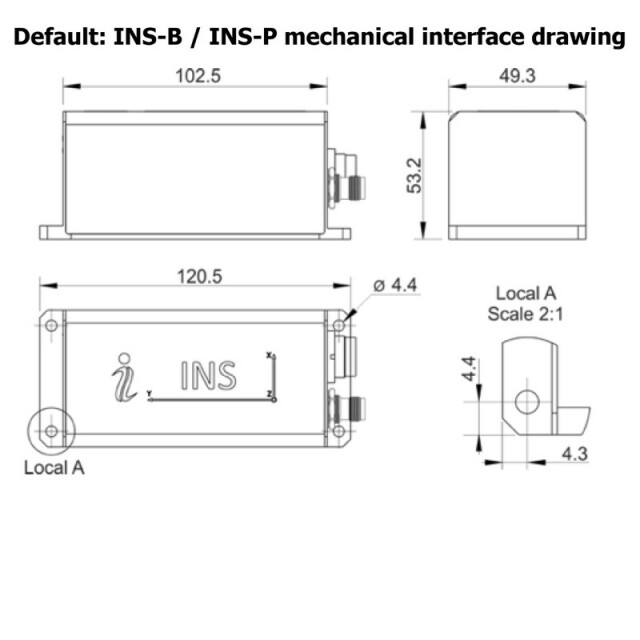
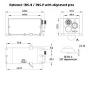
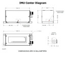
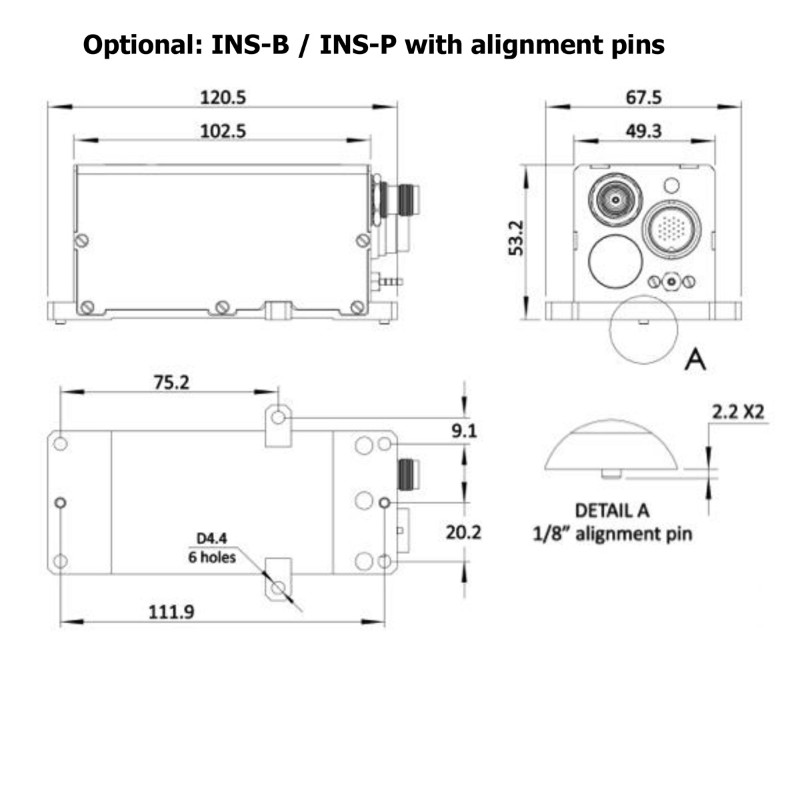
Height [m]
0.053
Width [m]
0.05
Length [m]
0.12
Weight [kg]
0.28
Min. Voltage (AC)
9
Max. Voltage (AC)
36
Min. Voltage (DC)
9
Max. Voltage (DC)
36
Power consumption [W]
1.4
Splashproof casting
Y
Water resistant casting
Y
Water resistance [m]
0.5
Mean time between failures [hr]
100000
Type of accelerometer
MEMS
Type of gyro
MEMS
Removable from base plate
N
Moving parts
N
Height [mm]
53.2
Width [mm]
49.3
Length [mm]
120.5
-
EM log aided uncertainty
-
Heading [deg]
0.1
Pitch [deg]
0.08
Roll [deg]
0.08
Heave [m]
0.05
Surge/sway [m]
0.1
Decrease in position accuracy [m/hr]
100
-
GNSS Positioning Sensor
-
Number of integrated GNSS receivers and antenna ports
1
No. channels p receiver
555
Tracked satellite signals
GPS L1/L2/L5; GLONASS L1/L2; BeiDou B1/B2/B3, QZSS L1/L2/L5; GALILEO E1/E5
SBAS differential signals
Yes
RTK Network Compatibility
Yes
Update rate [ Hz ]
200
Cold start [ seconds ]
50
Hot start [ seconds ]
30
-
Unaided uncertainty
-
Heading [deg]
0.1
Pitch [deg]
0.08
Roll [deg]
0.08
Heave [m]
0.05
Decrease in position accuracy [m/hr]
100
Surge/sway [m]
0.1
-
Data formats
-
NMEA formats
NMEA 0183
RTCM
Y
Other
Binary, ASCII
-
Inertial Measurement Unit
-
Accelerometer bias [µ-g]
5
gyro bias [deg/hr]
1
Calibration procedure
Embedded magnetic calibration of the gyro-compensated Fluxgate compass
-
GNSS positional accuracy
-
Horizontal Position Accuracy [ RMS in cm ]
100
Horizontal Position Accuracy (SBAS) [ RMS in cm ]
60
Horizontal Position Accuracy (RTK) [ RMS in cm ]
1
Documents
Brochure
ins-datasheet-rev6-6-september-2021-1.pdf
1.26 MB
Other documents
-
Inertial Labs GPS-Aided INS for Remote Sensing (2)765.54 KB
-
Embention Partners with Inertial Labs to Supply Complete Autopilot Payload Solution1.11 MB
-
Compact and cost-effective GPS-Aided INS for Satcom connectivity during Beyond Line-Of-Sight (BLOS) UAV flights578.12 KB


![YRBKMWXn[1].png](https://cdn.geo-matching.com/En53gY1o.png?w=300&h=300&crop=1&s=024b01a5456af84a24979824702460d7)


