![knipsel-1.png](https://cdn.geo-matching.com/MpV5VYne.png?w=480&s=c91590495d3c7a4c90078d46752f55e4)
Product videos
Showing 1-12 of 101 results
![knipsel-1.png](https://cdn.geo-matching.com/MpV5VYne.png?w=480&s=c91590495d3c7a4c90078d46752f55e4)
![trimble-marine-contruction-video-thumbnail-newsletter.png](https://cdn.geo-matching.com/yodPMaoe.png?w=480&s=5f024903ed1a7d52540df67aa11e9c49)
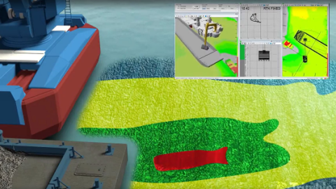
Trimble Marine Construction Software - Backhoe Excavator Dredging
![teledyne-marine-thumbnail-backscatter.png](https://cdn.geo-matching.com/7o2zveo5.png?w=480&s=0951f585bc278ac8eeb25c49bc5904a3)
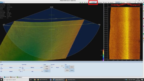
Normalized Backscatter: Good bathymetry and good backscatter
![impact-subsea-thumbnail-2-1.png](https://cdn.geo-matching.com/Pnjrd9na.png?w=480&s=68f8a6bd16dac28dbd59767b2224b6d0)
AUV / ROV AHRS - Can I swap out my existing heading sensor with this?
![impact-subsea-thumbnail-2-0.png](https://cdn.geo-matching.com/EnkL0ep5.png?w=480&s=5169cc94010dba82f1484aaee2ba8d18)
ISD4000 Depth and temperature sensor - How do I get comms quickly?
![impact-subsea-thumbnail-2.png](https://cdn.geo-matching.com/DR38Z9nK.png?w=480&s=e6dc7424ed90d00e50d8082247eb7c4a)
AUV / ROV sensors - Can I run multiple sensors together up one single twisted pair?
![scanfish-vessel-aided-follow-terrain-mode-screenshot.png](https://cdn.geo-matching.com/qoDEANR7.png?w=480&s=435ebbfb0cdcfa6846e1f267f77c263a)
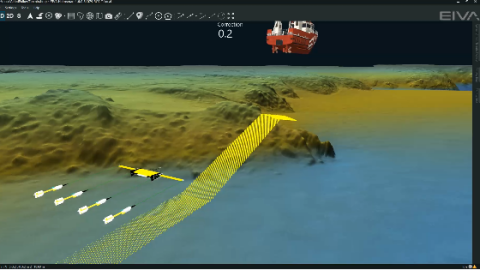
New ScanFish ROTV automated steering mode ā avoid obstacles more smoothly than ever
![sea-kit-usv-maxlimer-at-sea-2-0.jpg](https://cdn.geo-matching.com/yod2Xxne.jpg?w=480&s=74f15859efafbdd8242bd33741319560)
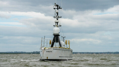
SEA-KIT USVs for remote surveillance
![sea-kit-usv-benefits-infographic.jpg](https://cdn.geo-matching.com/Vo1kxKn1.jpg?w=480&s=be807e330da481ace5b79131acdb9555)
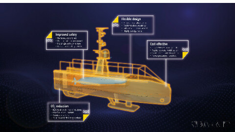
SEA-KIT USVs for fuel efficiency & low emissions
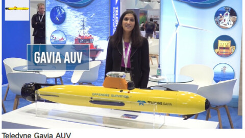
![gavia-auv-0.jpg](https://cdn.geo-matching.com/1o4yyARG.jpg?w=480&s=71b330e961d559cf3c34a42f25aaf4b1)
Teledyne Gavia AUV
![windfarm.jpg](https://cdn.geo-matching.com/OomEE9ow.jpg?w=480&s=c4c2143fe08a8dda9616aa8366bdc378)
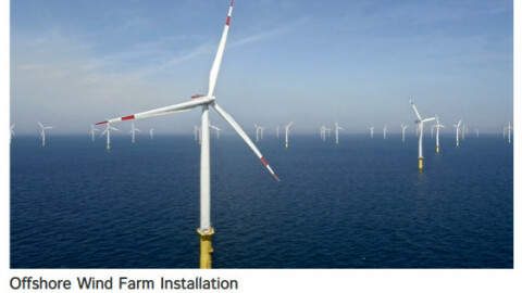
Offshore Wind Farm Installation
![dji-enterprise-talks-mapping-101-how-to-use-a-drone-for-mapping-header.png](https://cdn.geo-matching.com/Vo1kd5n1.png?w=480&s=28f4c3e5d54475e27eec274e7475c502)