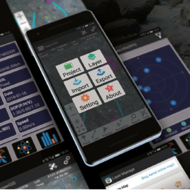
HyperGIS
A RTK GIS App for Android Systems
HyperGIS is designed as a powerful application for GPS data collection and processing. The application can be used in various scenarios such as power grid inspection, forestry survey, land law enforcement, pipeline inspection, urban management, etc.
HowayGIS
Shanghai, CN
Description
- Flexible coordinate system, such as coordinates conversion, many kinds of ellipsoids, and various ways of projection.
- Providing easy-to-use use layers editor, not only can edit multiple layers but also the optimized algorithm supports customizable layer templates to speed up the work.
- Data import and export function, supports file types such as CSV, DXF and SHP.
- Share data between devices.
- Built-in renovation NTRIP engine for decoding raw data be more accurate, increasing the reliability and accuracy of the results when data collection
- Easy to process the features of points, lines, and surfaces
- Report real-time position to the data centre, or cloud.
Specifications
-
Data management
-
Security options for access
N
Search on file content
N
Version management
Y
Spatial reference system
Selectable, Manual georeferencing
-
Geometry types
-
Lines
Polyline
Points
Multipoint
Surfaces
Polygon
Raster
None
-
Other
-
License or freeware
License
-
2D Editing
-
Select
Spatial selection
Remove
By select, By layer
Graphic transformations
Stretch
-
2D Construction
-
Positioning by coördinates
Y
Positioning in relation to other element
Others
Positioning by snapping
N
-
Storage
-
Type of data storage
Database
Native storage format
Database, TXT,JPG
Input formats
Shape
Export formats
Dxf, Shape, KML, Others
GML version
None
Compression
N
-
Visualisation
-
Types
Change view
Thematic mapping
-
Interoperability
-
Web standards
Spatial database management systems
SQLite
Messaging protocols
Extensions
Metadata
-
General
-
Year of introduction
3
Year of last update
2022
Supported hardware
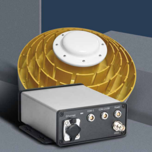
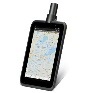
T38P, P78P, handheld products, Android phone and tablet.
Supported operation system
Other
Main GIS category
Mobile GIS
-
Data analysis
-
Merge
Map layers
Clip
N
Buffer
Overlay operations


