
GeoPuls
GeoPuls
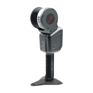
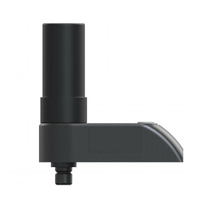
GeoPuls is a brand-new RTK instrument with laser function. Its appearance is bold and innovative, and its performance is excellent. Based on the experience of the previous generation of laser equipment, we have made more improvements, including no more frequent calibration, and the use of green laser to solve the problem of difficult to aim in bright light. In a real sense, it realizes measure where you aim, and replacing the pole in the traditional measurement method. However, we are also compatible with the pole mode, which allows the laser measurement to be used even when the pole is used.GeoPuls is a product that surveyors really need.

Alpha GEO (α-GEO)
Guangdong, CN
Description
Military-level technology
Military-level processing technology, complete electromagnetic compatibility and shielding technology, minimize system electromagnetic interference, and ensure high-quality observation data and results.
Multi constellation
GeoPuls with its 1408 channels new generation full GNSS chipset ability to support multiple satellite constellation including GPS, GLONASS, BEIDOU, GALILEO, OZSS,SBAS and IRNSS provides precise and accurate spatial data for all users around the world.
IMU Tilt Sensor
GeoPuls is equipped with a fast initialization,calibration free and immune to magnetic interference inertial Measurement Unit (IMU). All users can use this technology to collect or stakeout topo points
up to 120°.
Laser Surveying
The world's exclusive patented laser coordinate measurement quick calibration technology can easily achieve centimeter-level measurement accuracy, making measurement more accurate and user-friendly. Besides the green laser module used in the equipment overcomes the difficulty of aiming under sunlight, making field measurement operations faster and more efficient.
Dual-mode Bluetooth
It supports Basic Rate and Enhanced Data Rate operation of traditional Bluetooth, and also supports the latest low-power standard, dual-mode industrial-grade high-speed SPP3.0+ble5.0, suitable for Android/ISO/PC.
GSM
A fast internet connection is guaranteed with a built in 4G module that accelerate receiving correction data using all telecommunication signals and bands.
IP67
Strictly measured IP67 waterproof and dustproof grade, sturdy and durable, completely suitable for harsh outdoor environments.
Do you have questions about this product?
- Questions about price, availability, and/or retailers
- Questions about technical specifications and usage
- Questions about suitability for your project or application
Specifications
-
More information
-
Distinguishable features
RTK instrument with laser function
Documents
Brochure
GeoPuls brochure(2).pdf
5.21 MB
Other documents
-
产品参数.jpg2.2 MB
