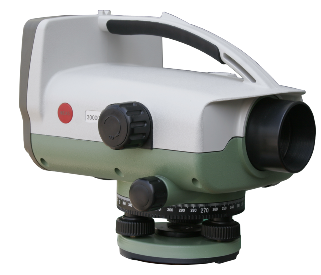
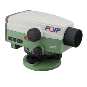
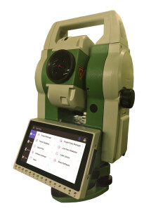
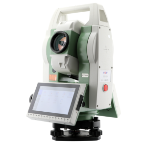
EL03/EL300 Digital Level
EL03 electronic level adopts the international mainstream software design, optimizes the line measurement, and strictly follows the grade measurement specification process, so that the level measurement work is simple and efficient, and is suitable for all national level measurements of the first class and below. Its digital measurement method not only has excellent performance and easy operation, but also can greatly improve the measurement efficiency. In leveling, all you need to do is point at the target staff and focus, press the measurement button, and the elevation and distance values will be displayed in digital form, so that you no longer feel that the measurement work is hard, but that the work is so easy and fast.

FOIF
Suzhou, CN
Description
◎The round-trip horizontal observation accuracy per kilometer is 0.3mm, and the minimum reading is 0.01mm;
◎Large graphical LCD screen, easy to operate and easy to learn, can quickly obtain high-precision elevation information;
◎Add numeric keys and function keys (24 keys) to quickly input valid information;
◎Advanced photosensitive reading system, visible white light can be measured;
◎Comfortable hand-held handle design, easy to carry in the field;
◎Large-range automatic compensation, high leveling accuracy;
◎The digital reading system effectively reduces errors and repetitive operations, automatically records measurements, completely eliminates the interpretation errors of manual readings, and can easily generate reports and improve work efficiency;
◎Diversified data export methods, can be quickly exported through USB cable or SD card, exporting data is more convenient;
◎Equipped with measurement shortcut key, after aiming at the staff, you can quickly start the measurement;
◎Support single-point measurement, multiple line measurements, positive/inverted staff mode switching, intermediate point measurement, stakeout, continuous measurement line adjustment function, and the horizontal network adjustment function can be realized in the post-processing software;
Places of use:
※ Leveling net measurement
※ Deformation monitoring and land subsidence monitoring
※ Industrial measurement
※ Tunnel and mine surveys
※ Topographic survey, leveling line survey, area leveling survey, leveling net survey, contour line survey
※ Road and railway construction stakeout, longitudinal section measurement, cross-section measurement, elevation stakeout
Do you have questions about this product?
- Questions about price, availability, and/or retailers
- Questions about technical specifications and usage
- Questions about suitability for your project or application
Specifications
-
General
-
Operating temperature: min. [°C]
-20
Operating temperature: max. [°C]
50
Water sand and dust proof
IP54
Weight [kg]
3
Year of introduction
2013
-
Telescope
-
Angular field of view
1°30′
Autofocus
N
Objective aperture [mm]
45
Telescope magnification
30
-
Compensator
-
Type of compensator
Air damping
Accuracy of compensator or bubble
Setting accuracy: ±0.3" for EL03, ±0.5" for EL302A
Automatic compensator
Y
-
Data Storage & Connectivity
-
External memory
4GB
Interfaces
RS232C
Internal Memory [data points]
3000
Internal Memory [MB]
4096
-
Operation Characteristics
-
Min. measuring range [m]:
2
Max. measuring range [m]
110
Measuring time [s]
2
Automatic height measurement
Y
Automatic distance measurement
Y
Automatic angle measurement
N
Resolution/interval distance measurement
<±10mm
Visible guiding light
N
Type of screen
LCD
-
Power
-
Battery
Y
Max. operation time on one battery [hr]
12
Documents
Brochure
EL03EL300 brochure_En.pdf
2.5 MB
