
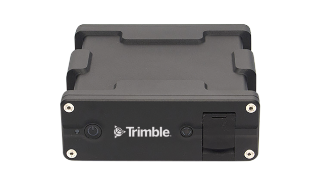
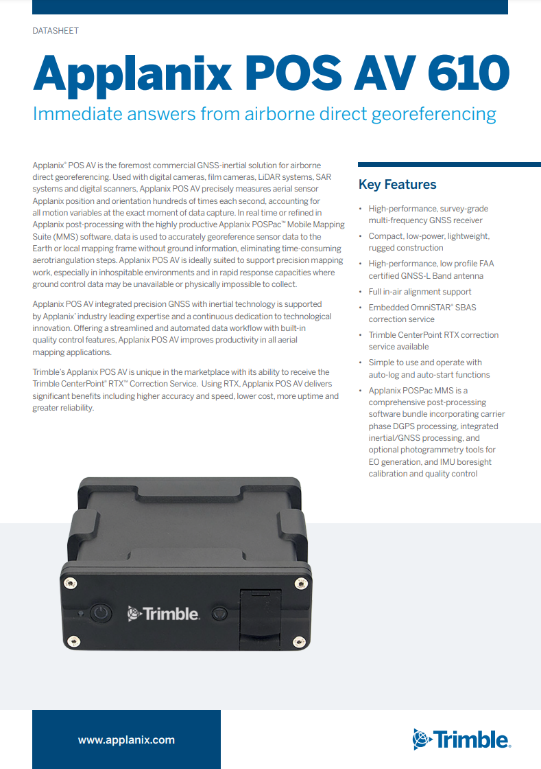
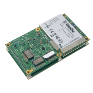
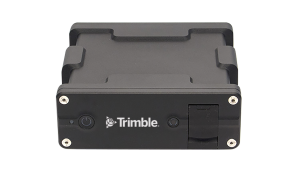
Applanix POS AV 610
Anywhere in the air, trust your position
Immediate Answers From Airborne Direct Georeferencing

Trimble Applanix
Richmond Hill, CA
Description
POS AV is the foremost commercial GNSS-Inertial solution for airborne direct georeferencing. Used with digital cameras, film cameras, LIDAR systems, SAR systems and digital scanners, POS AV precisely measures aerial sensor position and orientation hundreds of times each second, accounting for all motion variables at the exact moment of data capture. In real-time or refined in post-processing with the highly productive POSPac Mobile Mapping Suite (MMS) software, data is used to accurately georeference sensor data to the Earth or local mapping frame without ground information, eliminating time-consuming aero triangulation steps. POS AV is ideally suited to support precision mapping work, especially in inhospitable environments and in rapid response capacities where ground control data may be unavailable or physically impossible to collect. POS AV integrated precision GNSS with inertial technology is supported by Applanix’s industry-leading expertise and continuous dedication to technological innovation. Offering a streamlined and automated data workflow with built-in quality control features, POS AV improves productivity in all aerial mapping applications. As Applanix is a Trimble Company (NASDAQ: TRMB), POS AV is unique in the marketplace with its ability to receive the Trimble CenterPoint RTX Correction Service. Using RTX, POS AV delivers significant benefits including higher accuracy and speed, lower cost, more uptime and greater reliability.
Key Features
- High-performance, survey-gradmulti-frequencycy GNSS receiver
- Compact, low-power, lightweight, rugged construction
- High-performance, low profile FAA certified GNSS-L Band antenna
- Full in-air alignment support
- Embedded Omnistar SBAS correction service
- Trimble CenterPoint™ RTX™ correction service available
- Simple to use and operate with auto-log and auto-start functions
- POSPac MMS post-processing software bundle includes Carrier Phase DGPS processing, Integrated Inertial/GNSS processing, and optional photogrammetry tools for EO generation, IMU boresight calibration and quality control
Do you have questions about this product?
- Questions about price, availability, and/or retailers
- Questions about technical specifications and usage
- Questions about suitability for your project or application
Specifications
-
Other specifications
-
Graphical user interface
Y
Typical application
Direct georeferencing of airborne sensor data.Topographic MappingDigital Terrain Model generationOrthophoto productionReconnaissance, surveillance
Distinguishable features
POS AV is a hardware and software system specifically designed for direct georeferencing of airborne sensors. Support for Trimble CenterPoint RTX service.
Export restrictions
The POS AV is export friendly. Most IMUs are exportable worldwide - consult Applanix for specifics.
-
Environmental
-
Min. operating temperature [°C]
-20
Max. operating temperature [°C]
55
-
Software
-
Name
POSPac MMS
Filtering
Y
Adaptable filter strength
Y
Adaptable input signals
Y
Integrity monitoring of position input
Y
Max. number of position input signals
5
Max. number of log input signals
200
Uncertainty indicators given in output
standard deviation of all position and orientation
-
GNSS aided uncertainty
-
Heading [deg]
0.005
Pitch [deg]
0.0025
Roll [deg]
0.0025
-
General
-
Year of initial development
1992
Height [m]
0.068
Width [m]
0.186
Length [m]
0.169
Weight [kg]
2.4
Min. Voltage (DC)
18
Max. Voltage (DC)
34
Power consumption [W]
59
Splashproof casting
Y
Type of accelerometer
Silicon
Type of gyro
FOG
Type of application
Air
-
Data formats
-
NMEA formats
NIMEA Standard ASCII
Other
Applanix Binary Format
-
Inertial Measurement Unit
-
Calibration procedure
Applanix SmartCal
Documents
Brochure
POS_AV_610.pdf
Other documents
-
Case Study Eagle Forestry Service (EFS)272.76 KB
-
Applanix IN-Fusion Technology Explained46.99 KB
-
The Applanix SmartBaseTM Software for Improved950.43 KB
Videos


