
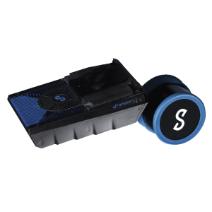
Hovermap HF1
SLAM-based Lidar Mapping and Autonomy Payload
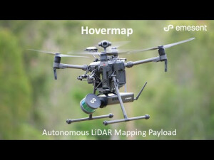
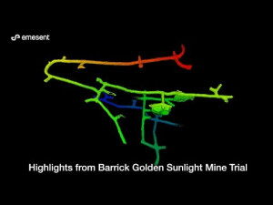
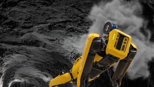
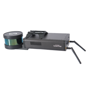
Hovermap is a plug-and-play payload that is easily integrated into a range of drones to provide them with advanced mapping and autonomy capabilities. This includes collision avoidance and GPS-denied flight, allowing drones to be flown safely underground, indoors or up close to structures to inspect and map them. Hovermap is a SLAM-based system, allowing accurate mobile LiDAR mapping even when GPS is not available. It can also be used as a walking or backpack mapping system.

Emesent
Milton, AU
Description
Hovermap is a plug-and-play payload which is easily integrated into a range of drones to provide them with advanced mapping and autonomy capabilities. This includes Omni-directional LiDAR-based collision avoidance and GPS-denied flight, allowing drones to be flown safely underground, indoors or up close to structures to inspect and map them. Hovermap is a SLAM-based system, that allows accurate mobile LiDAR mapping even when GPS is not available. Hovermap can also be used as a walking, vehicle-mounted or backpack-mounted SLAM-based mapping system.
Do you have questions about this product?
- Questions about price, availability, and/or retailers
- Questions about technical specifications and usage
- Questions about suitability for your project or application
Specifications
-
Measurement Characteristics
-
multiple pulses in air
N
Max. field of view [degrees]
360
Max. number of recorded echoes per pulse
2
-
Physical Properties
-
Weight [kg]
1.8
-
Laser Pulse Characteristics
-
Laser Class
1
Wavelength [nm]
905
-
Power Supply
-
Power requirements
12-54V
-
Operation Characteristics
-
Camera included
-
General
-
Year of last update
2019
Year of introduction
2019
Documents
Brochure
emesent-hovermap-flyer-asset-inspection-lr-0.pdf
780.83 KB
Other documents
-
Hovermap HF1 Spec Sheet664.29 KB


