


About PIX4D
Pix4D provides 14 software and hardware solutions that empower professionals to measure, analyze, and model from images captured by drone, hand, or plane. The ecosystem of products encompasses everything from data collection to creating CAD-ready outputs. They serve a variety of industries, including surveying, public safety, agriculture, construction, and telecommunications. Specific products are designed with specialized applications, such as PIX4Dscan and PIX4Dinspect being tailor-made with AI for telecom, whilst others can be used across industries.
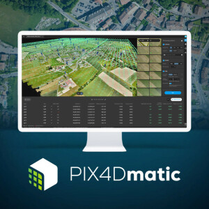
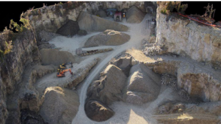
The solutions powered by Pix4D are used by tens of thousands of professionals worldwide. The original Pix4D software, PIX4Dmapper, is nicknamed the “Swiss-army knife” of photogrammetry, packed with many features that generate both 2D and 3D outputs. The new products also offer great excitement, including PIX4Dmatic - capable of 10,000 images datasets as well as merging terrestrial and aerial imagery - and PIX4Dsurvey, which automates vectorizing (eg manhole detection) and prepares data for CAD. PIX4Dfields is the go-to photogrammetry solution for agriculture, generating multi-spectral maps for year-round crop management. PIX4Dcloud Advanced is helping construction professionals to manage and document their site progress over time, whilst PIX4Dengine provides Pix4D processing algorithms to integrate into external platforms.
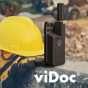
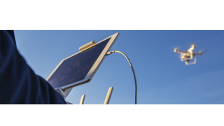
The handheld solutions by Pix4D bring even more opportunities. The PIX4Dcatch app takes advantage of LiDAR sensors in modern phones and tablets, and when paired with the viDoc RTK rover (giving geo-locational accuracy to within 5 cm), the two empower single-point measurement and RTK-accurate 3D models from images collected with everyday mobile devices. The entire suite of Pix4D products is intuitive and user-friendly designed to move seamlessly from data collection to client-ready presentation.
Featured products


Recent articles

Main office
-
Route de Renens 24
1008 Prilly
Switzerland -
+41 21 552 05 90
- https://www.pix4d.com/?utm_source=geo-matching&utm_med


