![hqdefault (817).jpg](https://cdn.geo-matching.com/4p7wy2py.jpg?w=300&s=3f9fe50cd2fc03a37900e61780b501f3)
![img6101587becb92.png](https://cdn.geo-matching.com/Pox0jeoD.png)
Showing 1-9 of 9 results
![hqdefault (817).jpg](https://cdn.geo-matching.com/4p7wy2py.jpg?w=300&s=3f9fe50cd2fc03a37900e61780b501f3)
![hqdefault (30).jpg](https://cdn.geo-matching.com/9pNxLLRZ.jpg?w=300&s=ee66796907828588d2674ea7643dd72c)
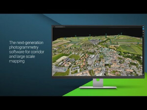
Pix4D - Introducing Pix4Dmatic
Discover Pix4Dfields
![hqdefault (583).jpg](https://cdn.geo-matching.com/9p65xdnb.jpg?w=300&s=f5100a5c0efe1801547c64b72350c032)
Pix4D - Discover Pix4Dmapper (2020)
Outdoor and Indoor 3D Survey of St. Elizabeth Tower, Germany
Pix4Dmapper - Professional photogrammetry software
![hqdefault (584).jpg](https://cdn.geo-matching.com/1pAP21nP.jpg?w=300&s=fdde2bf6ccaa4053d7395f3d8935509b)
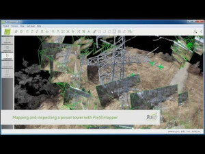
Pix4D - Mapping and Inspecting a power tower // 2014
![hqdefault (585).jpg](https://cdn.geo-matching.com/voaWk0nK.jpg?w=300&s=4e644ac30472b79456c254a373efc0de)
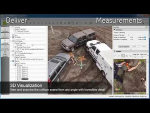
Draganflyer UAV mapping for collision and crime scene investigation
![hqdefault (586).jpg](https://cdn.geo-matching.com/4p7wbdpy.jpg?w=300&s=9ca3faa961a4206c3b8804586a7d6d00)