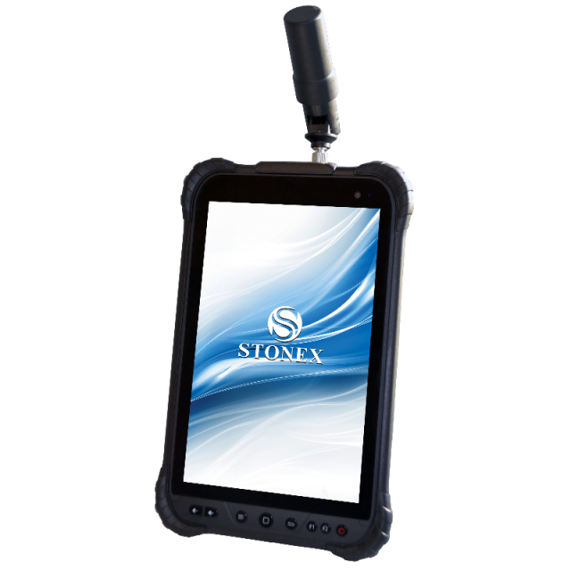
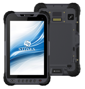
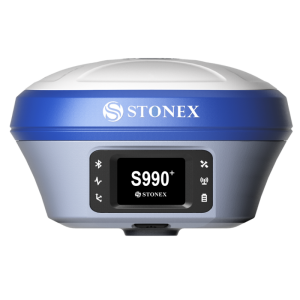
S70G
Handheld GNSS RTK
The S70G is a 4-constellation dual-frequency GNSS system for GIS and survey applications in a compact and portable form. The S70G allows for the collection of data and photos in the field, in an easy and fast way.

Stonex
Paderno Dugnano (MI), IT
Description
S70G is supplied with an antenna connected directly to the tablet, guaranteeing 2cm accuracy. Still, if required, connecting an external antenna it gains even more precise data.S70G is equipped with the Android 9 operating system and has a highly detailed WUXGA resolution (1920x1200) display for greater detail quality. The 8000mAh battery allows the instrument to work for over 8 hours, and the IP67 protection makes the device suitable for any environment. S70G can work in real-time by receiving RTK corrections transmitted by a network of GNSS Permanent Stations. Besides working in real-time, it can also record raw data from satellites for post-processing in the office. This allows the operator to achieve greater precision, enabling work even in areas without good coverage of the GSM signal.
Do you have questions about this product?
- Questions about price, availability, and/or retailers
- Questions about technical specifications and usage
- Questions about suitability for your project or application
Specifications
-
General
-
Year of introduction
2020
Main design elements
hardware and software
Total Weight [kg]
0,598
Width [m]
0.146
Height [m]
0.235
Depth [m]
0.013
Resolution: horizontal pixels
1920
Resolution: vertical pixels
1200
Touchscreen
Y
Display Panel
8" TFT color - 500 Nits
-
More information
-
Main applications
Survey - GIS
-
Software
-
Name of GIS package
Cube-a
Zooming
Y
Panning
Y
Map rotation
Y
Editing of points
Y
Editing of lines
Y
Editing of polygons
Y
Editing of attributes
Y
Query
Y
Sketching of notes on map
Y
Display of external data and photos
Y
Measurements: length
Y
Measurements: area
Y
Import/Export Formats
ASCII - DXF - ESRI SHAPE - KML
Name of survey data collection software
Cube-a
-
Connectivity
-
Wireless Data Transfer
Y
Bluetooth
Y
Ports
USB Type-C OTG - connector for external antenna
WiFi
Y
Supply Voltage [V]
3.8
-
GNSS Receiver
-
GNSS Systems Supported
GPS, Glonass, BeiDou, Galileo
Number of Channels
184
Update Rate [Hz]
20
Time to first fix after cold start [s]
1
Compatible external GNSS receivers
Y
Stand alone positional accuracy [m]
0.02
Compatible GNSS correction signals
RTK
-
Computer
-
Processor
SDM632
RAM [MB]
4000
Hard Disk [MB]
64000
Types of Replaceable Memory
SDHC - Micro SD
Audio: speaker
Y
Operating System
Android 9
Built-in Camera: megapixels
13
Hard Disk
Flash
Audio: microphone
Y
-
Horizontal uncertainty
-
phase: RTK kinematic (constant part) [m]
0,005
phase: RTK kinematic (variable part) [ppm]
1
-
Operation Characteristics
-
Integrated sensors
Compass, IMU, NFC
Operating temperature: min. [°C]
-20
Operating temperature: max. [°C]
60
Water and dust proof [IP]
IP67
Humidity resistance
Y
Shock proof
Y
Operation time per battery [hr]
8
Battery Field Replaceable
Y
Pole mount available
Y


