


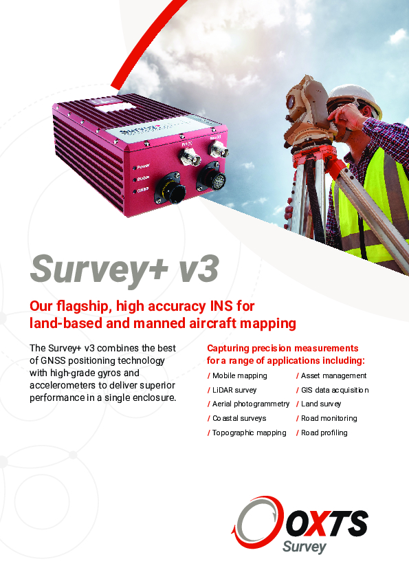
Survey+ V3
GNSS/INS for land and airborne survey applications
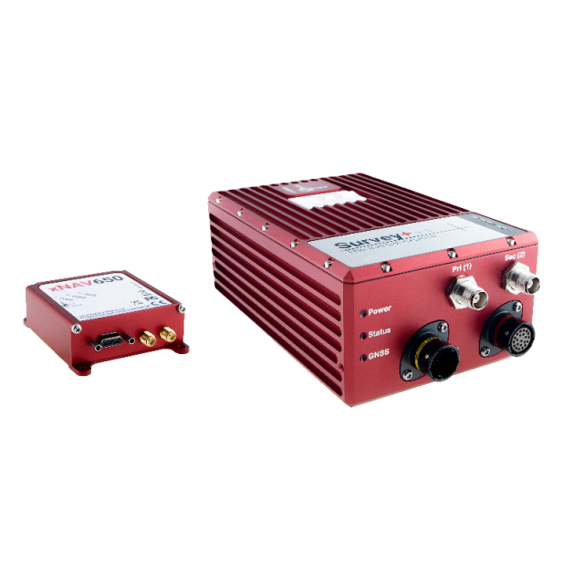
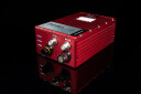
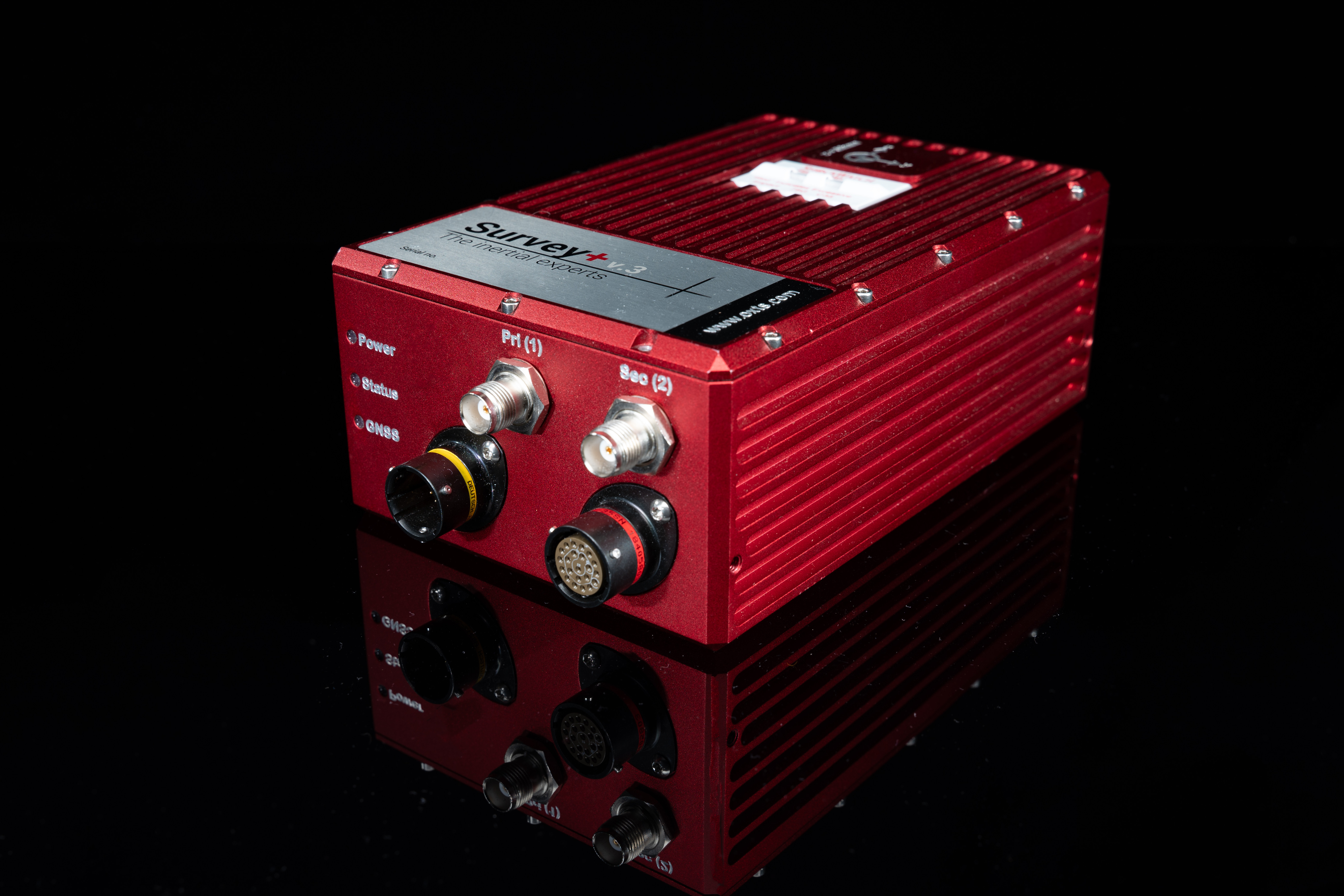
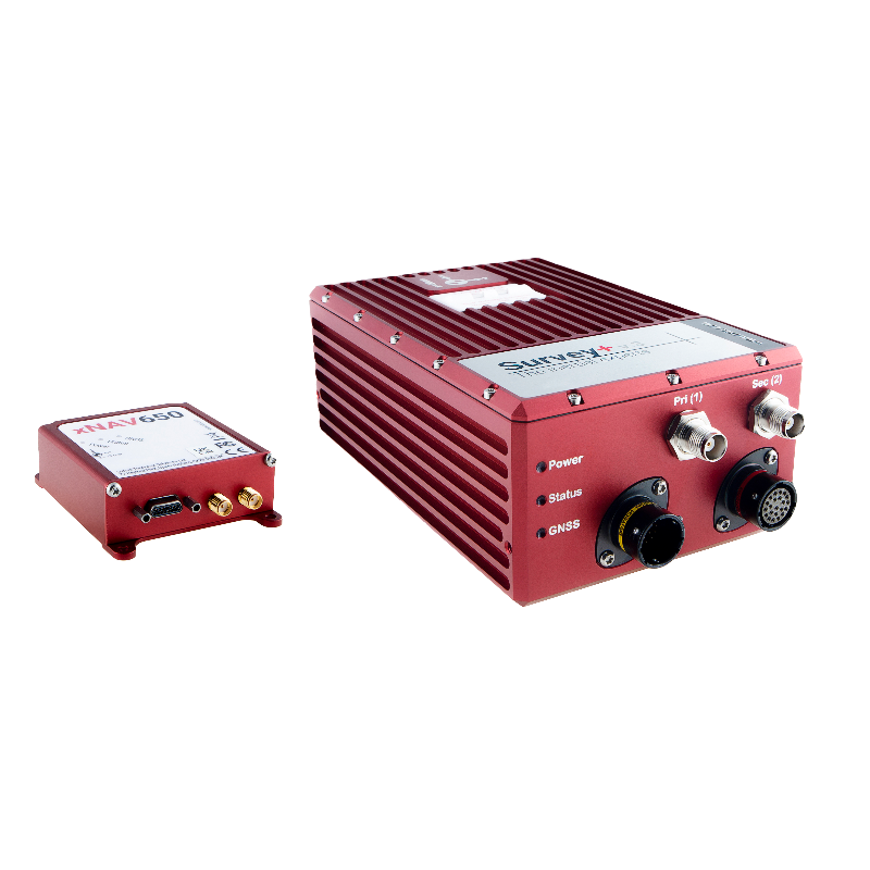
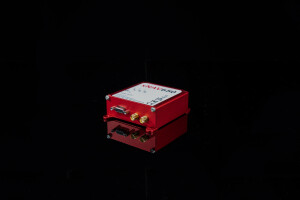
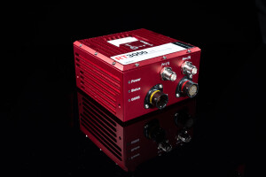
Survey+ inertial navigation systems from Oxford Technical Solutions combine the best of GNSS positioning technology with high-grade gyros and accelerometers to deliver superior performance in a single enclosure. The OxTS flagship, high accuracy INS for land-based and manned aircraft mapping.

Oxford Technical Solutions - OxTS
Bicester, GB
Description
Survey+ inertial navigation systems from Oxford Technical Solutions combine the best of GNSS positioning technology with high-grade gyros and accelerometers to deliver superior performance in a single enclosure.
Key Features
- 1 cm positioning
- 0.03° roll and pitch
- Low cost, high accuracy
- Tightly coupled GNSS/INS
- gx/ix™ technology
- Real-time outputs
- 100 or 250 Hz versions
- Dual antenna versions
- GLONASS enabled versions
- Smooth, stable outputs
- Odometer input
- ITAR free
- Software suite included
- Cables and antennas included
Further reading:
OxTS Lidar Surveying Brochure
Download the OxTS LiDAR Surveying brochure and learn more about LiDAR Surveying using an OxTS INS. The brochure introduces the benefits of integrating the inertial data provided by an OxTS INS with raw LiDAR data. The brochure also details the currently supported LiDAR sensors
OxTS Boresight Calibration Brochure
Accurately measuring the angles between your navigation and survey devices can be difficult to get right. However, using a data-driven approach to calibrating these angles can dramatically reduce survey set-up time, increase survey repeatability and improve the final output. Read how this can be achieved with our Boresight Calibration brochure.
Do you have questions about this product?
- Questions about price, availability, and/or retailers
- Questions about technical specifications and usage
- Questions about suitability for your project or application
Specifications
-
Other specifications
-
Graphical user interface
Y
Typical application
Mobile Mapping, Pavement Inspection, Rail Corridor Inspection, Aerial LiDAR
Distinguishable features
gx/ix tight-coupling technology, Free software suite including post-processing, 1 cm RTK position, high-grade low drift IMU, great urban performance, range of model variation to suit any budget
Export restrictions
Commercially Exportable, ITAR free
-
Environmental
-
Operating shock tolerance [g]
100
Max. rotation speed [deg/s]
100
Min. operating temperature [°C]
-10
Max. operating temperature [°C]
50
-
Software
-
Name
NAVsuite
Filtering
Y
Adaptable input signals
Y
Integrity monitoring of position input
Y
Integrity monitoring of log input
Y
Uncertainty indicators given in output
Y
-
GNSS aided uncertainty
-
Heading [deg]
0.05
Pitch [deg]
0.03
Roll [deg]
0.03
Heave: constant part [m]
0.1
Heave: variable part [%]
10
-
General
-
Year of initial development
2013
Height [m]
0.071
Width [m]
0.12
Length [m]
0.184
Weight [kg]
1.5
Min. Voltage (DC)
10
Max. Voltage (DC)
48
Power consumption [W]
14
Splashproof casting
Y
Water resistant casting
N
Type of accelerometer
MEMS
Type of gyro
MEMS
Type of application
Air, Land
-
GNSS Positioning Sensor
-
Number of integrated GNSS receivers and antenna ports
2
Tracked satellite signals
GPS L1, GPS L2, GLONASS L1, GLONASS L2, Option: Beidou L1, L2
SBAS differential signals
Y, Optional
RTK Network Compatibility
Y, Optional
-
Unaided uncertainty
-
Heading [deg]
0.1
Pitch [deg]
0.03
Roll [deg]
0.03
-
Data formats
-
NMEA formats
NMEA Standard ASCII
RTCM
Y
Other
NCOM, MCOM, TSS1, TSSHHRP, EM3000, EM1000
-
Inertial Measurement Unit
-
Accelerometer bias [µ-g]
2
gyro bias [deg/hr]
2
Calibration procedure
ISO17025, SuperCAL
-
GNSS positional accuracy
-
Horizontal Position Accuracy [ RMS in cm ]
180
Horizontal Position Accuracy (SBAS) [ RMS in cm ]
60
Horizontal Position Accuracy (RTK) [ RMS in cm ]
1
Documents
Brochure
survey-v3-non-wifi-web-0.pdf
2.16 MB
