
OpenCities Planner
OpenCities Planner helps you connect the data, people, workflows, and ideas necessary to support your city’s planning and project processes.
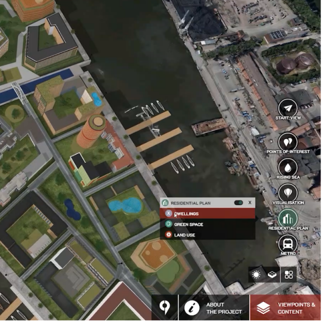
OpenCitiesPlanner is a cloud-based environment to visualize and communicate projects and plans at site, campus, or city scale providing context to planning, complex projects, and city operations.
Bentley Systems
Exton, US
Description
OpenCities Planner is a cloud-based service that enables visualization of 2D, 3D, and GIS data in a 3D world. You can design, visualize, and communicate projects from large-scale city developments to detailed architectural designs. Powered by Microsoft Azure, OpenCities Planner is scaled to support users globally and offers robust performance and multilayered security thanks to the extensive network of Microsoft's datacenters. All you need is a web browser as OpenCities Planner is completely web based and plug-in free.
OpenCities Planner capabilities combined with Bentley’s reality modeling offerings make city-scale digital twins broadly accessible. Synchronizing reality and ‘virtuality,’ OpenCities Planner offers the perfect web solution to enable every city government in going digital.
Scalable for all organization types from individual planners, architects, GIS engineers to city governments, and larger organizations.
Why OpenCities Planner?
- Designed specifically for project communication and collaboration
- Powerful yet easy to use and easy to deploy with only a short training
- Powerful data management functionality to enable inclusion of existing data
- Inbuilt engagement and consultation creation tools
- Agnostic to planning and GIS system and data types
Import CAD, GIS, and web services
-
Import detailed 3D models and place them in the 3D world by adding images, vector data, and documents to communicate your project, as well as connect with WMS to add GIS layers to the presentation.
Share projects and crowdsource ideas
- Invite team members or publish a direct link for public access with just a few clicks by controlling content access based on user roles.
Sketch, analyze, and export from 3D cities
-
Create, visualize, and analyze planning options using 3D modeling and shadow analysis by dragging an object to the map from the 3D library and exporting in 3D to continue detailed design in a third-party BIM or CAD application.
Visualize everything
-
Visualize large-scale projects spanning entire cities down to street level when streaming reality meshes, terrain models, and semantic 3D city models, such as CityGML.
Specifications
-
Data management
-
Spatial reference system
-
Geometry types
-
Lines
Points
Surfaces
Raster
-
Other
-
License or freeware
-
2D Editing
-
Select
Remove
Graphic transformations
-
2D Construction
-
Positioning in relation to other element
-
Storage
-
Type of data storage
Input formats
Export formats
-
Visualisation
-
Types
Change view
Thematic mapping
-
Interoperability
-
Web standards
Spatial database management systems
Messaging protocols
Extensions
Metadata
-
General
-
Supported operation system
Main GIS category
-
Data analysis
-
Merge
Buffer
Overlay operations


