
UAV Photogrammetry Used in City Planning
City planning project in Guilin, China. Surveying and mapping are important foundations for the development of a national economy. An accurate understanding of the spatial configuration of territory and information about its attributes is important for decision making. The development of drone photogrammetry technology has brought tremendous change to the surveying and mapping industry. Surveyors no longer need to spend a lot of time and energy on fieldwork, as accurate information can be obtained by drone, and the results are even superior to the traditional way of operating.
From a financial point of view, the use of the drone has significantly improved the return on investment. Drone photogrammetry has gradually become a common measurement method due to its convenience, high accuracy, and lower cost.
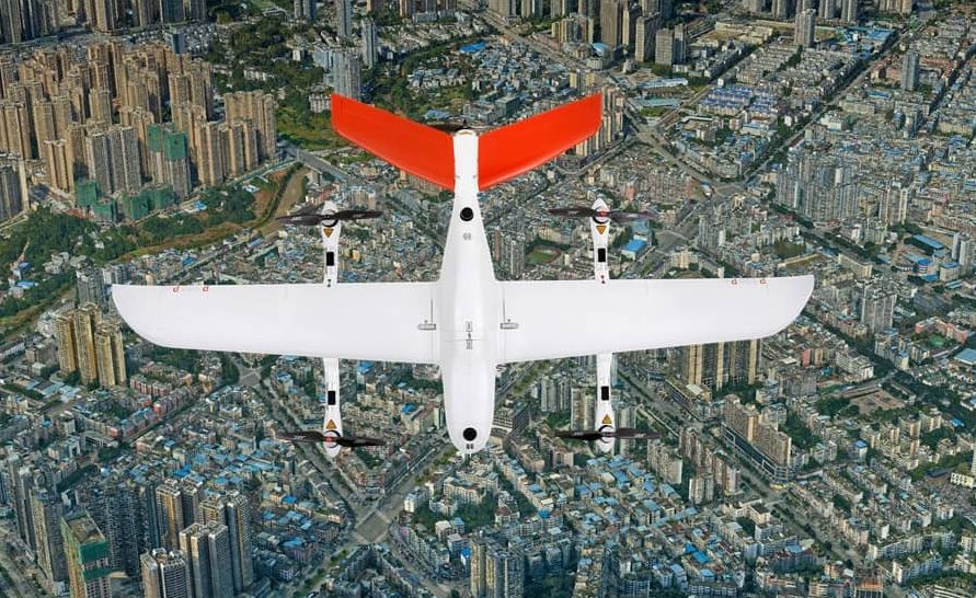
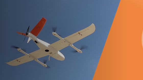
Figure 1. A top-down view of the P330 PRO VTOL drone.
Working Towards Sustainable Urban Development
Guilin, in China's Guangxi province, is an important tourist city in southern China. Tourism has become an important part of the city's planning. In order to have up-to-date data on the evolution of local topography, landforms, houses, roads, and other attribute information, the local government has to conduct a comprehensive survey of the entire area every six months. The Guangxi Guilin Survey and Design Institute Co, Ltd. undertook the project implementation lead.
Digital Mapping and Technological Barriers
Since tourism has become an important part of economic growth, regular collection of land information is necessary for urban planning. Currently, most land information is collected by manned surveys with GNSS, GIS collectors, and satellite images.
The challenges faced by surveying and mapping departments can be listed as follows:
- Significant manpower expenditure: Because the project covers a large area, many surveyors are required to carry out the data collection.
- Long completion time: Surveys conducted by field crews are very time-consuming in terms of data collection in the field and post-processing to obtain useable results.
- Advanced qualification requirement: In order to achieve accurate mapping surveys, all team members must have a solid knowledge of GNSS and GIS technologies.
- Image updates are not always available when needed: Satellite images are not updated in real-time. The actual site may differ significantly from the reference images obtained earlier for the project.
- Some areas are hard to reach: rivers, mountains, construction zones, and difficult to map by on-the-ground teams.
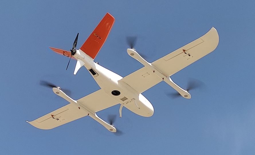
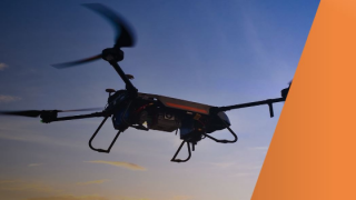
Figure 2. P330 PRO VTOL drone in the sky.
Benefits of Using the P330 Pro for Aerial Orthophoto Applications
With the constant development of drone technology, UAVs are now widely used for construction, civil engineering, monitoring and emergency rescue. Combined with aerial photography technology, unmanned aerial vehicles become an extremely cost-effective alternative to manned aircraft for surveying and mapping, mining, construction and infrastructure, etc.
The main benefits include:
- Long endurance: 150 min maximum flight time with payload, allowing to cover a larger area (up to 9 km2 at a resolution of 3 cm/pixel and with 70% overlap).
- 100 Hz differential module. No Ground Control Points: With the combined use of GNSS RTK positioning, camera offset and CGO GNSS post-processing software, no ground control points (GCPs) were required for this project, saving considerable time and cost.
- High accuracy trajectography and POS (positioning and orientation system) data: survey-grade GNSS positioning and POS data at the centimetre level provide a horizontal accuracy of 6 cm for this project.
- High safety for a secure take-off, flight, and landing: Highly automated operation, safety monitoring, and self-checking procedures minimize human operating errors and ensure a safe flight.
Choose Between 3D and 3D Mapping Outputs
- High accuracy Digital Orthophoto Maps (DOM): Each pixel has high precision horizontal geodetic coordinates from which users can obtain any terrain coordinates directly.
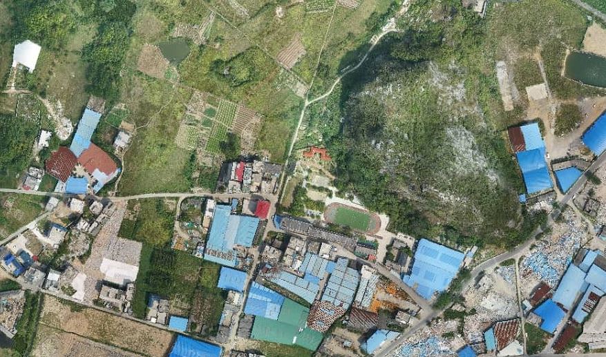
Figure 3. Digital Orthophoto Maps made with the help of P330 Pro VTOL drone.
- High accuracy Digital Surface Model (DSM): The generated elevation data provides a global view of the terrain.
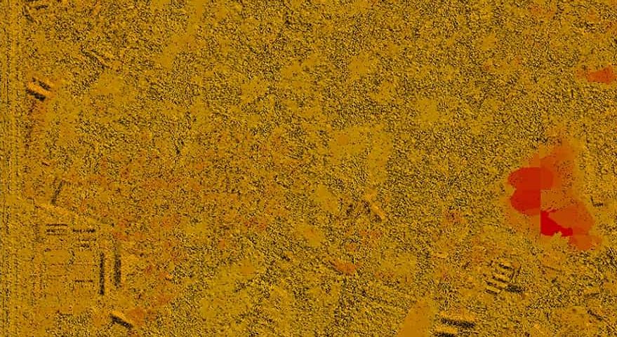
Figure 4. Digital Surface Model made with the help of P330 Pro VTOL drone.
- High accuracy Digital Line Graph (DLG): Post-processed DLGs are widely used for construction planning, resource management and environmental impact analysis.
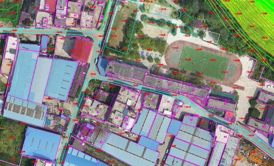
Figure 5. Digital Line Graph made with the help of P330 Pro VTOL drone.
- 3D Photogrammetric Model: 3D reality models generated with the use of an oblique camera can be applied for urban, housing, construction, and landscaping planning.
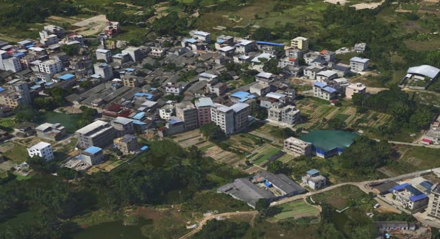
Figure 6. 3D reality model made with the help of P330 Pro VTOL drone.
- Topographic Map Contour Lines: Generation of contour lines based on Digital Surface Model (DSM) and Digital Terrain Model (DTM.)
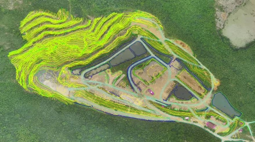
Figure 7. DSM and DTM were made with the help of a P330 Pro VTOL drone.
Accuracy and Data Results
- The flight parameters required for the project were as follows:
- Ground Sampling Distance (GSD): 3 cm/pixel
- Forward overlap: 80%
- Side overlap: 70%
- Mapping scale: 1:2000
- The final data accuracy achieved against ground control points:
- Horizontal: 6 cm
- Vertical: 10 cm
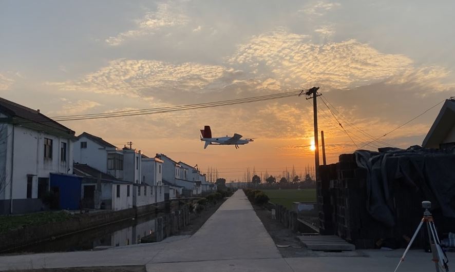
Figure 8. P330 Pro VTOL drone is landing.
Urban Planning Benefits from Drone Photogrammetry
UAV aerial mapping is a technological breakthrough for sustainable urban planning projects involving multiple dimensions: technical, economic, ecological, social and more broadly cultural. The ability of drone mapping to maintain accurate and up-to-date data allows urbanists to think and make cities differently, to create another model of urban planning and development, but also to invent other ways of living, of organizing public transportation.
The reliability of the results and the accuracy of the point cloud information confirm the compelling advantages of UAV photogrammetry for large area surveying and mapping projects. In a constantly evolving urban environment, the use of the P330 Pro VTOL drone contributes to sustainable city planning, safe operations for the field crew, reduced workload and labour costs, and an extremely fast return on investment.
Do you have questions about this case study?
Get in touch with CHC Navigation | CHCNAV, and they would be happy to answer any questions you have about pricing, suitability, availability, specs, etc.
Related articles


![3月21日-封面[1].jpg](https://cdn.geo-matching.com/voeE1ywo.jpg?w=320&s=6b3b1a0215d770f8797653e9202a8f52)


