Multibeam Echosounder Equipped USV Used In Shallow Inland Water Bathymetric Survey
For many years the GeoSwath system from Kongsberg GeoAcoustics has been providing an efficient simultaneous swath bathymetry and side scan seabed mapping solution with accuracies that exceed the IHO Standards for hydrographic surveys.
GeoSwath systems have been fitted to a number of small craft and have been utilised to conduct bathymetric surveys of lakes, ponds, dams and rivers. This article describes two of the vessels which have been employed to undertake this area of work.
Unmanned Surface Vessels
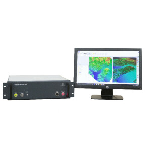
The use of Unmanned Surface Vessels (USVs) allows surveying in locations and situations in which deployment of conventional platforms is not practicable or safe to do. Kongsberg Maritime has been supplying USVs integrated with a GeoSwath system for the last couple of years. The GeoSwath USV comprises a remotely controlled hydrographic survey boat which is fully integrated with a GeoSwath system, GPS position & heading sensor, a motion reference unit (MRU) and a sound velocity sensor.
The USV is radio-controlled up to a range of 1.5 km from the operator. The sonar is operated using software installed on a laptop connected via a radio modem with a data rate exceeding 100 Mbps. The laptop computer runs the GS4 software package and is used for mission planning and execution as well as data acquisition and processing of the final bathymetry maps and Sidescan mosaics. The data is saved on the USV hard drive to ensure uninterrupted data files and also broadcast to the shore side laptop for visualisation and quality control.
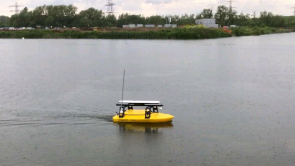
The following is a case study of a survey conducted on a shallow lake using one such system which was based upon a Seafloor Systems EchoBoat fitted with a SeaPath 134 GPS/MRU. The EchoBoat is constructed from UV resistant HDPE and measures 1.68m by 0.81m and is capable of a maximum speed of 10 knots. System power is provided by 2 independent supplies, one for the vessel and one for the GeoSwath system and ancillary equipment which gives the USV up to 10 hours of operation, depending upon battery configuration.
The USV was used to survey an old gravel pit south of Reading which was being redeveloped into an ornamental lake as part of new housing development and the developers required a hydrographic survey of the lake. The lake was approximately 150m at its widest point and approximately 300m long. A base station was set up on the side of the lake and used to control the USV as it conducted the survey.
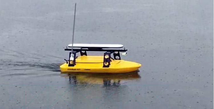
Figure 1: The USV in action on the lake
The entire survey took less than an hour to complete which was considerably less time than the alternative method of a boat and pole and gave 100% bathymetric coverage. Once the survey had been completed the data was processed using the GeoSwath4 software to generate both bathymetry and Sidescan sonar data.
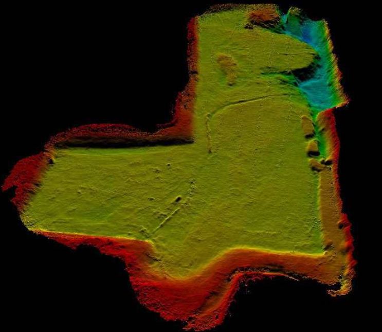
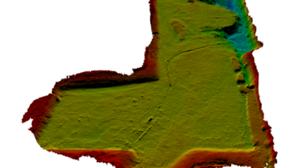
Figure 2: Bathymetry of the lake. The majority of the lake is a flat bottom at 2m depth.
The majority of the lake is about 2m deep with a deeper 4m channel in the North-East corner. Due to the extremely wide swath width of 20m (10x water depth), the entire survey was completed in just a few survey lines being run. As well as the bathymetric data recorded, the GeoSwath system also recorded co-registered geo-referenced Sidescan data.
Do you have questions about this case study?
Get in touch with Kongsberg Discovery, and they would be happy to answer any questions you have about pricing, suitability, availability, specs, etc.


![3月21日-封面[1].jpg](https://cdn.geo-matching.com/voeE1ywo.jpg?w=320&s=6b3b1a0215d770f8797653e9202a8f52)


