
CHCNAV Apache 4 USV Used For Hydrographic Survey Project
Rivers nourish the land, maintain ecological balance, and promote agricultural development, but if changes in the flow of major rivers are not known, floods or droughts may occur. Velocity and flow monitoring have always been a headache for hydrographic measurement from large rivers to small streams. Early representative equipment such as mechanical current meters, printed current meters, electromagnetic current meters, etc., can only measure single-point flow velocity and cannot accurately measure the cross-section flow. The emergence of the Acoustic Doppler Velocity Profiler (ADCP), which can measure the velocity of each layer of the entire section, more intuitively and accurately displays the flow of rivers, so hydrological users favour it.
At present, the methods that traditional hydrological users carry ADCP for cross-section flow measurement mainly include ropeway towing, being mounted on an uncrewed boat, towing by a trimaran, etc.
Therefore, the pain points can be listed as follows:
1. The equipment installation to tow in a ropeway is costly, and it’s complicated to maintain.
2. The artificial boat is inflexible when carries ADCP for flow measurement. The route along the section is often not straight, which leads to poor data results and danger for people in turbulent currents.
3. Loss of tracking data at the bottom of ADCP leads to missing flow measurement data; in addition, the environment can easily affect the compass's accuracy.

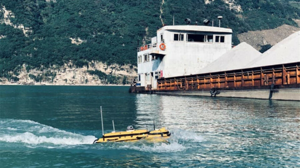
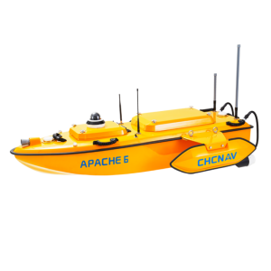
Figure 1. Apache 4 USV is completing the hydrological survey
SOLUTION
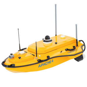
APACHE 4, an autonomous hydrographic survey USV, can help avoid the high maintenance cost of towing ropeway system; it is compact, easy to launch and handle at the mission site, works effectively in a narrow environment. Moreover, it can be conveniently transported by car.
The APACHE 4 integrates a Singlebeam Echosounder and ADCP to make up for the loss of ADCP's bottom and compass tracking data, vulnerable to environmental conditions. In addition, it supports a wide variety of ADCP systems available on the market. It offers an unmanned operation solution with a shallow draft, high navigational accuracy, and stable hovering for hydrologists when measuring the current section's water flow velocity and discharge.
The APACHE 4 USV brings together the best of high-accuracy positioning and automated navigation control technology, built around the operator's habits when conducting ADCP hydrographic cross-section flow measurements. Even when obstructed environments might degrade GNSS positioning, the internal GNSS+IMU module continues to provide a reliable position and heading for the ADCP and autopilot controller. As a result, the APACHE 4 is a perfect solution for obtaining high-quality flow and velocity measurements in water where manned boat access is impractical.
KEY FEATURES OF APACHE 4 USV TO COMPLETE THE PROJECT SUCCESSFULLY
◼ It makes the route along cross-section straighter and the flow measurement data more accurate due to automatic adaptive water flow straight-line and stable hovering technologies
◼ It provides uninterrupted positioning and heading data for ADCP and makes up for the loss of ADCP's bottom and compass tracking data due to environmental interference
◼ With its built-in Singlebeam Echosounder and ADCP, the bottom topography can be obtained during flow measurement.
PROJECT IMPLEMENTATION STEPS
1. INSTALLATION
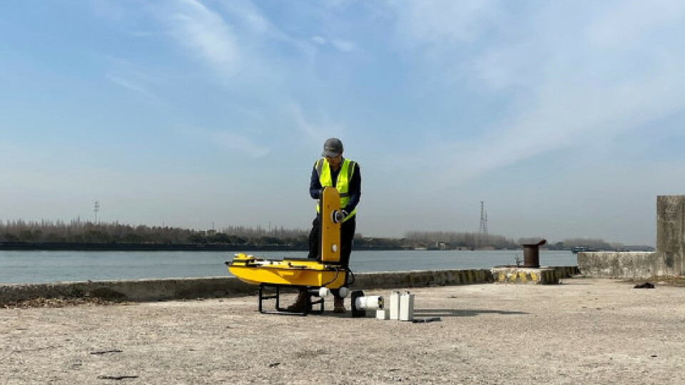
The 17cm diameter ADCP installation hole is reserved at the centre of gravity of the USV’s hull that is compatible with the market's most common variety of ADCPs. In this project, APACHE 4 is equipped with CHCNAV D230 Singlebeam Echosounder and Teledyne RD Instrument RiverPro ADCP. Therefore, users can quickly install and remove them on site.

Figure 2. The ADCP installation into the APACHE 4
2. MISSION PLANNING
A round-trip line was planned along the cross-section of the river in the AutoPlanner software in advance, which would be the round-trip route followed autonomously by the APACHE 4 USV to collect the depth and flow data.
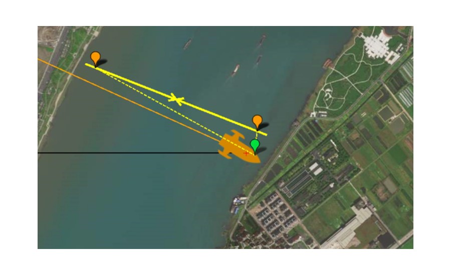
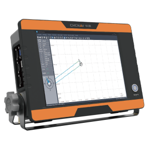
Figure 3. A round trip route planned for the survey with the APACHE 4
3. AUTONOMOUS HYDROLOGICAL OPERATION
In this project, APACHE 4 transmits ADCP data to the software of the ground station onshore through the 4G network.
After configuring the ADCP data, NMEA GPGGA positioning, and GPHDT orientation data access and setting of the distance to shore in the WinRiver II software, APACHE 4 entered the fixed-point hovering mode the shore, and it is released after the ADCP collected the shore data.
Then APACHE 4 was equipped with D230 and RiverPro ADCP to navigate the river cross-section line planned automatically, and the software recorded the cross-sectional flow profile data.

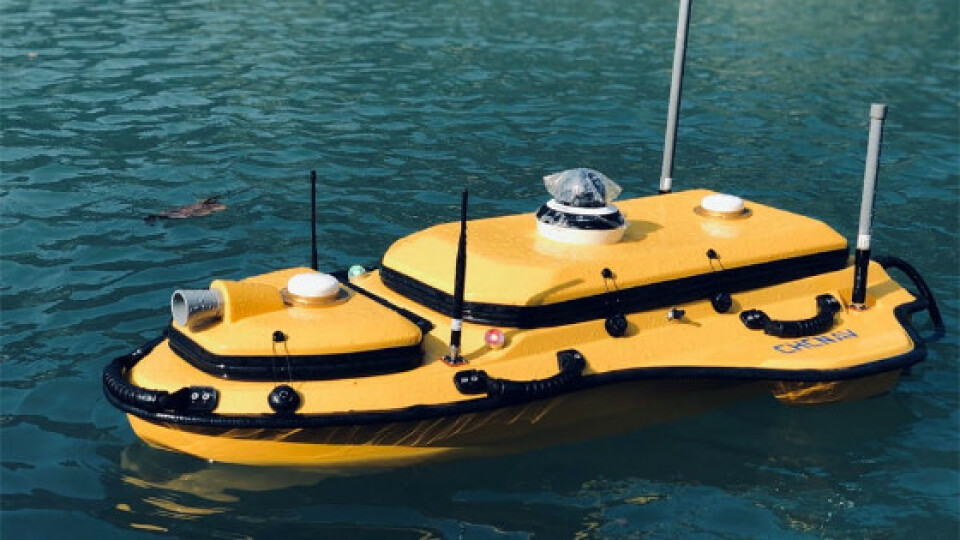
Figure 4. APACHE 4 collects the data for a survey
4. DATA COLLECTION
In this project, the APACHE 4 USV was equipped with RiverPro ADCP, completed two round-trips of cross-sectional flow measurement in just 20 minutes, shortening the time of one-time round-trip measurement by 2 hours, reducing human resources to two people.

Figure 5. Data obtained after the first round-trip measurement

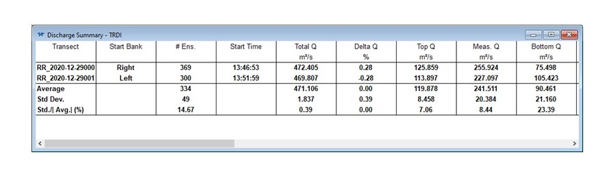
Figure 6. Data obtained after the second round-trip measurement
5. SUMMARY
The comparison error of the total flow of the two measurement rounds is only 0.39%, which is far better than the 5% required by the flow measurement accuracy specification of this project.
Users have highly praised the high efficiency and high accuracy of APACHE 4.
CONCLUSION
Water operations are one of the most dangerous industries today, where human factors cause approximately 70% of water-related accidents. The integrated applications of USV have started to modify the working status of the relevant staff and ships. The staff is already partially transferred from the boats to the land when boats are equipped with smart sensors to navigate autonomously. As a result, the operating costs are reduced, and the efficiency and measurement accuracy are greatly improved.
The APACHE 4, Autonomous Flow Measurement USV, solves the problems related to the low navigation and measurement accuracy, short data transmission distance, low work efficiency, shore flow distance estimation that are so common in hydrological surveys. It meets the measurement specification requirements and innovates the way we do the hydrological survey.
Do you have questions about this case study?
Get in touch with CHC Navigation | CHCNAV, and they would be happy to answer any questions you have about pricing, suitability, availability, specs, etc.


![3月21日-封面[1].jpg](https://cdn.geo-matching.com/voeE1ywo.jpg?w=320&s=6b3b1a0215d770f8797653e9202a8f52)


