![2024_04_SPH_IS_WEBINAR_Bathymetry_with_drones-exploring_Echo_Sounder_technology_1920x1080 (2).jpg](https://cdn.geo-matching.com/Zprly5KR.jpg?w=300&s=cb1b833565a5ed18cf560127f414333c)
![2024_05_SPH_web_geo-matching_image_1.jpg](https://cdn.geo-matching.com/Vo1zlyeR.jpg)
Showing 1-9 of 19 results
![2024_04_SPH_IS_WEBINAR_Bathymetry_with_drones-exploring_Echo_Sounder_technology_1920x1080 (2).jpg](https://cdn.geo-matching.com/Zprly5KR.jpg?w=300&s=cb1b833565a5ed18cf560127f414333c)
![Vertical_scan_church.png](https://cdn.geo-matching.com/7o2ArEPp.png?w=300&s=42a640ad1fc479cca91efca84ab28b95)
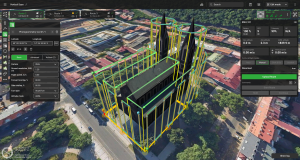
UgCS 5.0 for flight planning
![magnimbus_data.png](https://cdn.geo-matching.com/7o2Arzlp.png?w=300&s=b2f8f06abf5d92acc62c934e91fc383f)
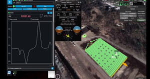
MagNIMBUS atomic total-field magnetometer real-time data
![https://i.ytimg.com/vi/om9uaHyxDoM/hqdefault.jpg](https://i.ytimg.com/vi/om9uaHyxDoM/hqdefault.jpg)
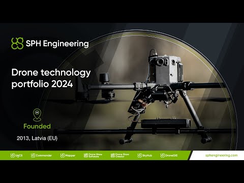
SPH Engineering technology portfolio
![MagDrone R4 2.JPG](https://cdn.geo-matching.com/yRQQ7Z9R.jpg?w=300&s=99d0e6842a5823f2058f679cbdc264df)
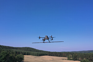
MagDrone R4 installation on DJI M300 RTK drone
![2023_10_SPH_ONLINE_DISCUSSION_Drone_technologies_1920x1080 (3) (1).jpg](https://cdn.geo-matching.com/9p60vZ7R.jpg?w=300&s=a91e57ea5286a1d3117c5638a5796cbf)
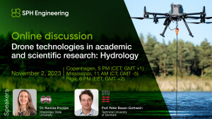
Drone technologies in academic and scientific research: Hydrology
![2023_12_SPH_IS_Bathymetry_YT (1).jpg](https://cdn.geo-matching.com/qoDdM3jo.jpg?w=300&s=775722137ebae95a269b15651c8b0d25)
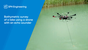
Bathymetric survey of a lake using drone with Echo Sounder
![YT_takeoffandlanding.png](https://cdn.geo-matching.com/1pPOK9mn.png?w=300&s=f5bce21af70600bf87425f41ef5ab9ed)
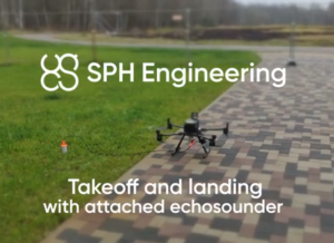
Manual take-off and landing with drone-mounted Echo Sounder
![hqdefault (949).jpg](https://cdn.geo-matching.com/3n8lWbn5.jpg?w=300&s=544991fb47fdc327dd3713a0e61beeae)