![DSC00979.JPG](https://cdn.geo-matching.com/PR0D9KgR.jpg?w=300&s=2d72a0ae16b417107ea7c5bc623afc5e)
![x1.jpg](https://cdn.geo-matching.com/Poxk3WpD.jpg)
Showing 1-9 of 27 results
![DSC00979.JPG](https://cdn.geo-matching.com/PR0D9KgR.jpg?w=300&s=2d72a0ae16b417107ea7c5bc623afc5e)
![maxresdefault (2).jpg](https://cdn.geo-matching.com/Vo1z345R.jpg?w=300&s=465667eb6918b163edfb3bc148943a7a)
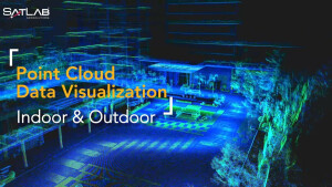
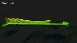
Point Cloud Data Visualization | Cygnus SLAM scanner
![BANNER.png](https://cdn.geo-matching.com/jpGJW7xn.png?w=300&s=0d6043cd9a9790bf60cdc8ebe642e480)
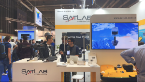
SATLAB at INTERGEO 2023
![mq3(1).jpg](https://cdn.geo-matching.com/wRWmmwyp.jpg?w=300&s=938903bd2f85662fae59a961dab40296)
Point Cloud of Saloma Link Bridge in Kuala Lumpur by Lixel X1
![J4VMHv0T0-E-HD.jpg](https://cdn.geo-matching.com/yodJJ0Nn.jpg?w=300&s=028092cafd37d13ab7b1717bf15d23c7)
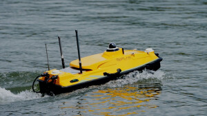
Introducing HydroBoat 1200 - Multi-Purpose USV Platform for Hydrographic Surveys and Monitoring
![hqdefault (1671).jpg](https://cdn.geo-matching.com/WRZDjJpL.jpg?w=300&s=5c13bd46c781c54602832017d49e2999)
Introducing SATLAB SLT12 Android Total Station with Real-time Visual Guidance for Unmatched Accuracy
![hqdefault (1638).jpg](https://cdn.geo-matching.com/xRKZdMo2.jpg?w=300&s=2768c0a187b390e9c6d3ef06195c8733)
[New Release] Introducing SatLab SL7 GNSS RTK - Unlock the Power of Visual Stakeout
![hqdefault (1655).jpg](https://cdn.geo-matching.com/PoEOdzn9.jpg?w=300&s=502dad6bb689660def2f07ef90cc3453)
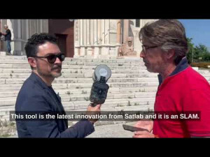
Scanning with SatLab Lixel X1 SLAM Scanner - Cathedral of Ancona
![hqdefault (1654).jpg](https://cdn.geo-matching.com/LnLM0gpj.jpg?w=300&s=bba0a8a1c76e29d37bbb9295eea06683)