![banner.jpg](https://cdn.geo-matching.com/DR366Jmo.jpg?w=480&s=0af1e6ce210884a995e100d0e27ceeb5)
![v500-2.jpg](https://cdn.geo-matching.com/4p7WOdpy.jpg)
Showing 1-9 of 26 results
![banner.jpg](https://cdn.geo-matching.com/DR366Jmo.jpg?w=480&s=0af1e6ce210884a995e100d0e27ceeb5)
![3.png](https://cdn.geo-matching.com/kpl1AkQo.png?w=480&s=c3709a2c44133954d13b22617775b36d)
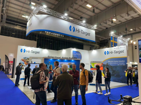
Back and Better: Hi-Target’s Momentum Soars at Intergeo in Berlin
![HD-MAX.png](https://cdn.geo-matching.com/kpl11rdo.png?w=480&s=d12c994b63192f0295c37af62ab054a7)
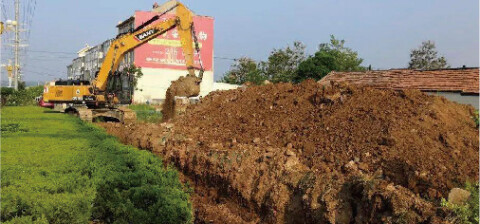
Hi-Target Introduced the Upgraded Dual Frequency Echo Sounder
![Hydrographic Survey USV Helps with Volume Acquisition in Lake Regions _ Hi-Target.png](https://cdn.geo-matching.com/0nvKl6Zp.png?w=480&s=f2ffaa9ba848c960a13504b257d26ce6)
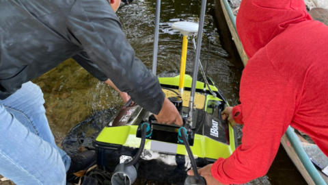
Hydrographic Survey USV Helps with Volume Acquisition in Lake Regions | Hi-Target
![survey-software-pic1.png](https://cdn.geo-matching.com/WRZ00M2p.png?w=480&s=5909a0e2adbe4938e45bcbaad1777e0f)
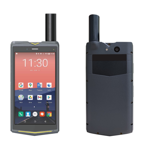
Qmini A10(CM) Works with Third-Party Field Survey Software | Hi-Target
![vrtk1.jpg](https://cdn.geo-matching.com/9pN33xWo.jpg?w=480&s=4d0c8e6beec4438e7afe38a6daa7c85f)
Fast! Steady! Accurate! vRTK is speeding up road construction with Live-view Stakeout | Hi-Target
![vRTK.jpg](https://cdn.geo-matching.com/Enk557Eo.jpg?w=480&s=a2039438c06ba478f9541734b9d180df)
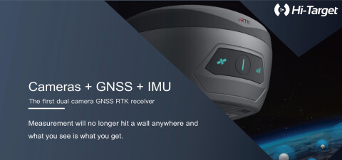
Land Survey – New Pocket-Sized vRTK is the Perfect Combination of GNSS, Advanced IMU, and Dual Cameras | Hi-Target
![04-1-1.png](https://cdn.geo-matching.com/vRMv63nY.png?w=480&s=b5925118d204621306ffd1fcccbc4e39)
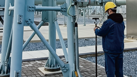
Application of GNSS High-Precision Positioning Terminal in Safety Protection of Substation Personnel | Hi-Target
![01-1-0.png](https://cdn.geo-matching.com/9pNOAOoZ.png?w=480&s=60602e952808aeea8f792a1d6b578d2e)