


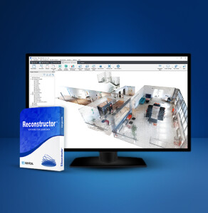
GEXCEL Adds Improved Geo-referencing, Change Detection and Cloud Sharing Features to Reconstructor Software
The recently released versions of GEXCEL HERON processing software(s) make HERON 3D mapping projects more accurate, effective and usable thanks to important improvements in the usage of ground control points, in the change detection workflow, and for the cloud-sharing process.
Brescia, Italy, January 12, 2023
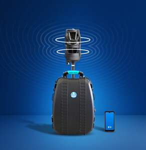
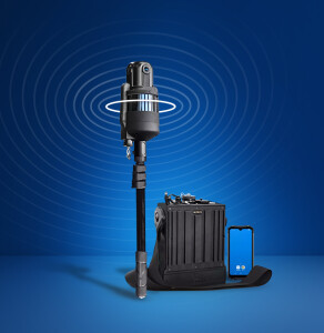
GEXCEL has been developing and offering innovative software and solutions to make the work in surveying, Lidar data processing, monitoring and 3D control more competitive and effective. The latest improvements (Constraint Tool and Change Detection maps) and the Cloud Sharing Options with 3DUserNetVISION provide better accuracy and usability.
Constraint Tool
HERON gives you several ways to constrain and geo-reference HERON trajectories improving the quality of the final trajectory.
1. Ground Control Points (GCPs):
- Measuring GCPs directly in the field by using HERON and a calibrated pole or
- Identifying CGPs on the HERON point cloud.
GCPs local coordinates are automatically paired with the related global coordinates.
2. Point Clouds and Scans:
Static scans or portions of 3D point clouds previously acquired also with different sensors (UAV, mobile scanners, mapping systems, photogrammetry) can be used as constraints as well.
Change Detection Maps
1. Use point clouds or BIM models as a reference map.
2. Let HERON self-locate with respect to the reference.
3. Produce a survey aligned with the reference map.
4. Detect changes that occurred in the time.
5. Automatically get the change detection map for further editing.
Cloud Sharing
Mobile mapping is dramatically speeding up the process of capturing 3D and image data. This should be matched by the speed of project delivery and online procedures.
To increase Site to Sight of data efficiency, GEXCEL customers can now link up with 3DUserNet to get a special free annual subscription to the VISION platform with a direct workflow from Reconstructor to 3DUserNetVISION. This will enable users to deliver more efficiently for their customers – with the opportunity to upgrade to a full subscription at a substantial discount at any time.
About GEXCEL
Gexcel is an Italian company that has been operating worldwide since 2007 with the mission to transform the know-how of its far-sighted founders into advanced and innovative technologies for 3D geospatial applications. In addition to developing and designing software and systems to capture reality in 3D, we provide sales, support, training and service directly from our Italian and Vietnamese offices or from our international network of resellers.
Do you have questions about this news item?
Get in touch with GEXCEL, and they would be happy to answer any questions you have about pricing, suitability, availability, specs, etc.


![YRBKMWXn[1].png](https://cdn.geo-matching.com/En53gY1o.png?w=320&s=7a38f8b5a386c40e410a744082db4a37)

