
3D Point Cloud Data to 3D Mesh Conversion
Point clouds are a treasure trove of useful measurement data. Unfortunately, that means the files can be very large and slow to work with—causing trouble if you need a lightweight file for visualization, scan-to-CAD, and scan-to-BIM workflows.
One answer is to turn the raw point clouds to a 3D mesh. Where a point cloud stores the location for millions and millions of points, a mesh converts those points into triangles. Although these triangles still store the location, RGB, and intensity values of the original points, they are much smaller, lighter, and faster to work with. Below, we'll do a very high-level overview of two methods you can use to turn your point cloud into a mesh!
1. A multi-step method for 3D point cloud data to 3D mesh conversion
The main benefit of this approach is that it’s flexible. You can use any number of point cloud tools, including any that your company already pays for, or even dig into an open-source tool that fit your needs. If your main use for meshes is simple visualization, and you're not going to be making too many of them, this method might be your best approach.
Step by step process:
- Export your point cloud as a LAS or PLY file
- Load the file in a point cloud processing software tool. You can use paid software or any industry-standard point cloud tools you are already using. You can also use open-source tools.
- Reduce the number of points using a subsample or decimate tool
- Load this processed point cloud into a meshing tool. Here, you can choose between paid software options or any open-source tool.
- Configure the output to the resolution you need
- Finalize the data using any necessary clean-up tools within the software
- Export the mesh
2. An Automatic Method for 3D point cloud data to 3D mesh conversion
There is another workflow that enables you to create a mesh very quickly, and with much less time in front of the computer.
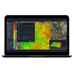
We have achieved excellent results using point cloud processing software, which generates meshes automatically from any point cloud and includes tools to get you started on the next step of a scan-to-CAD or scan-to-BIM workflow.
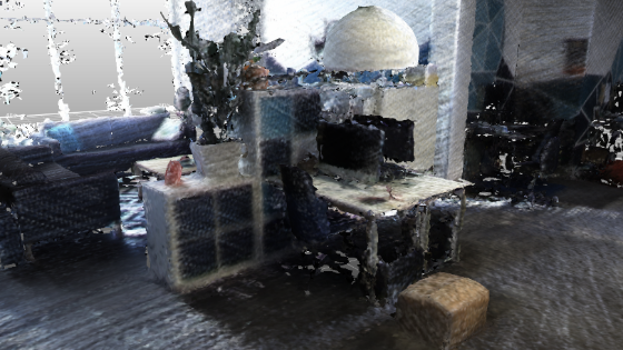
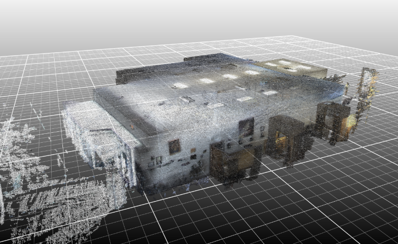
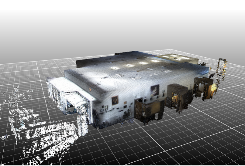
Recently, to test the software, we captured a scan of our office (see above) and exported it as an 880 MB LAS point cloud, (see below). Next, we processed the point cloud using point cloud processing software and produced a 590 MB textured mesh file. The whole process took less than 40 minutes, with only a fraction of that requiring any human oversight.
STEPS:
- Capture the environment
- Output the scan as a LAS or PLY point cloud file
- Load the scan into your point cloud processing software
- Choose your settings for mesh generation. You may need to experiment to find the right balance of detail and size for your particular application. Highly detailed industrial piping will require different settings than a simpler office environment.
- Export your IFC mesh file
NEXT STEPS:
As an added benefit, point cloud processing softwre includes a number of other workflows that help you take the next workflow step. Once you have created your mesh, you can...
- Classify and segment objects
Many software packages will automatically classify surface areas such as walls, ceilings, and floors—with the option for you to further refine these segmentations afterwards.
Automatically generate CAD or BIM - Once the software has segmented the mesh, it can automatically best-fit vectors to the data. Again, once this is complete, you will step in to review and fix small errors.
Conclusion
Whether you prefer the hands-on approach of manual conversion or the efficiency of automatic software tools, transforming point cloud data to 3D mesh can significantly enhance your data visualization and processing. The method you choose should align with your project scale, resources, and specific needs. It's good to keep in mind that the ultimate goal is to make your data more accessible, manageable, and insightful, empowering better decision-making in your projects. Happy scanning, happy meshing!
Related articles


