
WorldView-3
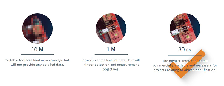
The Power of 30 cm
The power of 30cm Very High Resolution (VHR) satellite imagery lies in its ability to detect small objects. It allows you to achieve a level accuracy that’s necessary in order for your project to succeed. Through the use of Maxar's WorldView-3 satellite and our ground control station near Munich, Germany, we are able to proficiently ollect and deliver 30 cm and other VHR imagery to you.
European Space Imaging
Munich, DE
Description
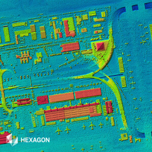
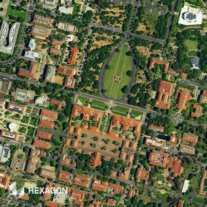
WorldView-3 was launched on August 13 2014, and truly set a new standard for commercial satellites in-orbit. With 29 spectral sensors on-board, the data from WorldView-3 allows you to differentiate between objects with far greater accuracy. Additionally, WorldView-3 was the first satellite capable of delivering true 31 cm resolution and it collects the industry’s best very high resolution imagery quickly and reliably.
Specifications
-
General
-
Year of introduction
2014
Deliverable raster products
Raw Imagery, Orthorectified imagery
Options for delivery
FTP
Satellites or constellations of delivered products
WorldView-3
Deliverable vector products [2D and 3D]
aircraft or satellite
Continents
-
Image corrections
-
Proces of geometric correction
Ortho-Rectification, Atmospheric Compensation
Image sharpening methods
Pan-Sharpening
Sensor corrected
Y
-
Imagery Specifications
-
Spectral band types
Red, Green, Blue, Red edge, Near-infrared, SWIR
Spectral bands [specify wavelengths]
8 Multispectral Bands ranging from 400 - 1010 nm, 12 SWIR Bands ranging from 1195 - 2365 nm, 12 CAVIS Bands ranging from 405 - 2245 nm
Dynamic range of RGB image [bit depth]
16
Data formats of imagery
GeoTIFF, JPEG, NITF, RAW
-
Revisit time and delivery
-
Revisit time for defined data products
Less than 1 day
Delivery time [Time between data capture and delivery; in hours]
1
-
Resolution and Accuracy
-
Resolution of RGB imagery [best GSD in centimeters]
100
Geolocation accuracy [RMSE at nadir in centimeters]
200
Geolocation accuracy [CE90 at nadir in centimeters]
300
