
Webinar – Integrating photo, scanner and video data in one software solution: is it possible?
Thu, Jun 27, 2024 at 2:00 PM (CEST)
1 hour
How much could your team’s productivity and labour costs improve with a simplified alignment process? How would better accuracy in 3D model alignments save on error and rework costs? What cost savings and project efficiency gains could you achieve with a tool that integrates various data sources and formats, and provides automated reporting?
3Dsurvey truly lives up to its claim of being made by surveyors, for surveyors. The software is specifically crafted by individuals who have faced the same field conditions and understand the precise needs of modern digital surveyors. With this in mind, version 3.0 was developed. In this webinar, find out how it can help with your survey work!
Webinar topics
X-ray reduces floor plan creation time by up to 30% by eliminating the need for multiple software tools.
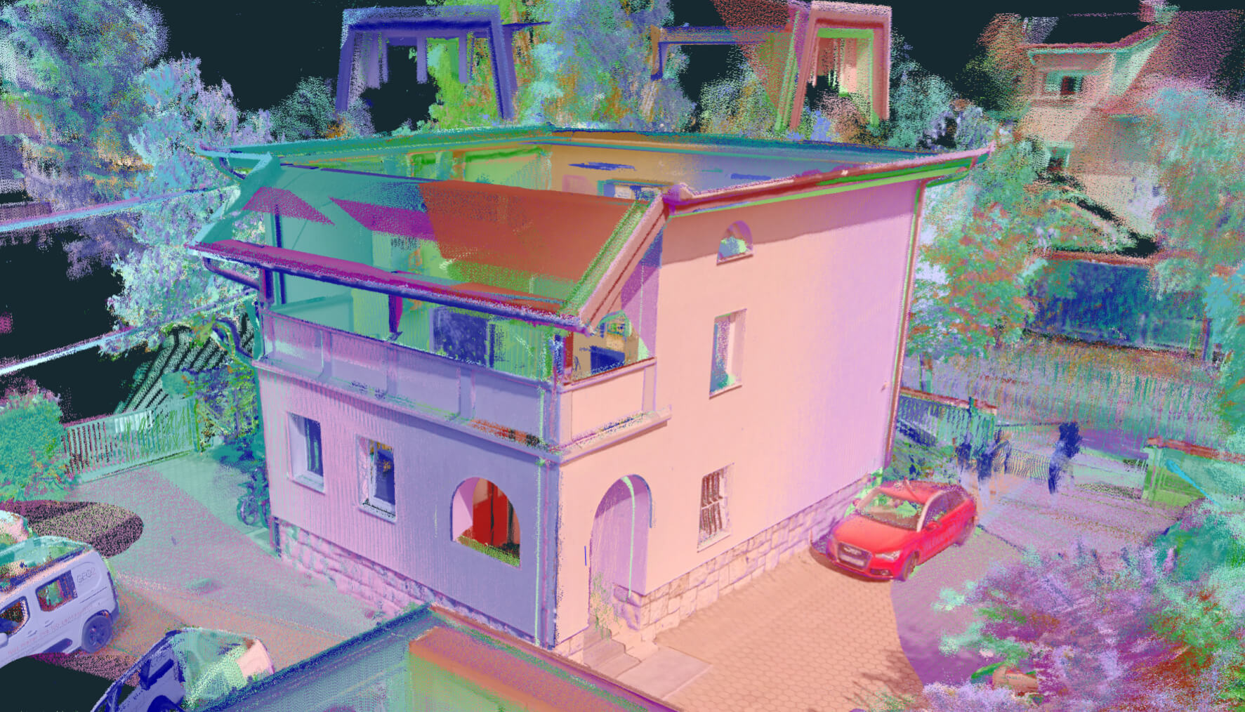
Advanced visualisation of Lidar data for better contrast. Enabling advanced inspection.
Save up to 25% of project time by integrating multiple data sets within a single platform, reducing data transfer errors by 20%.
Get the app that geotags video with precise location and gives video the power of location documentation. Essential for underground construction projects.
Get powerful software that now has robust global coordinate system support with built in country presets.
With automatic machine deactivation, treat your license like a floating license and always get your projects done no matter where you are or what machine you are working on.
Increase client satisfaction by 25% by providing tailored deliverables, reducing the data processing time by 20%.
Related products


