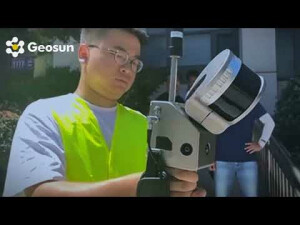
GS 100G Handheld SLAM LiDAR Revolutionizing Forestry Scanning
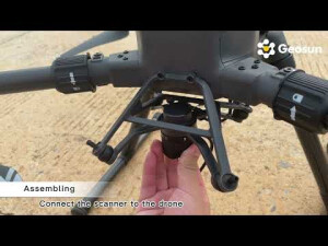
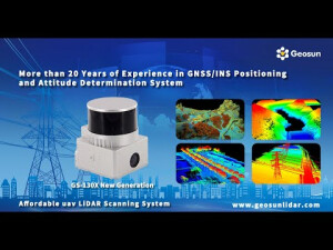
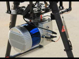
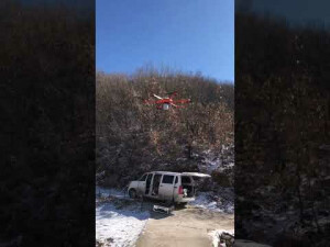
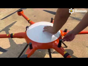
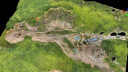
Welcome to the future of forestry management! Introducing the GS-100G Handheld SLAM LiDAR, your ultimate companion for comprehensive forest scanning. Say goodbye to traditional methods and embrace efficiency like never before. 🌲 Efficient Forestry Scanning: With the GS-100G, scanning vast forest areas becomes a breeze. Its SLAM technology ensures precise data capture, allowing you to map out terrain, measure tree heights, and assess vegetation density effortlessly. 🌳 Enhanced Accuracy: Achieve unparalleled accuracy with the GS-100G's advanced LiDAR technology. Whether you're conducting forest inventories, monitoring ecosystem changes, or planning logging operations, trust in the precision of our handheld device to deliver reliable results. 🍃 Seamless Integration: Compatible with leading forestry software platforms, the GS-100G seamlessly integrates into your workflow. Analyze data, generate detailed reports, and make informed decisions with ease, thanks to our user-friendly interface. 🔍 Optimize Your Operations: Gain insights into forest health, identify potential risks, and optimize resource allocation like never before. The GS-100G empowers forestry professionals to make proactive decisions, leading to improved sustainability and profitability. Unlock the full potential of your forestry endeavors with the GS-100G Handheld SLAM LiDAR. Experience efficiency, accuracy, and innovation like never before. Invest in your future today! If you are interested in UAV/drone LiDAR mapping or mobile LiDAR technology, you have come to the right place! Geosun is one of the leading companies in UAV/drone LiDAR mapping solutions and mobile LiDAR scanning systems. Providing the most cost-effective UAV/drone LiDAR mapping products with free 3d point cloud annotation and 3d point cloud generation software, we are here to help you understand and succeed with your UAV/drone LiDAR, and mobile LiDAR needs! Follow Us On Social Media: ➡ LinkedIn:

/ 70859796 ➡ Instagram:

/ geosunnav ➡ Facebook:

/ geosunnav-110288717349485 ➡Twitter:

/ geosunnav Learn More: ➡ Visit Our Website: https://en.geosuntech.com/ ➡ Contact Us: [email protected] Don't forget to like, share, and subscribe for more exciting content! Leave us a comment below to let us know what you want to learn next. #DroneMapping #DroneSurvey #SurveyDrone #MappingDrone #3DMapping #DroneLiDAR #LiDAR #AerialDrone #aerialmapping #Forestrysurveying