


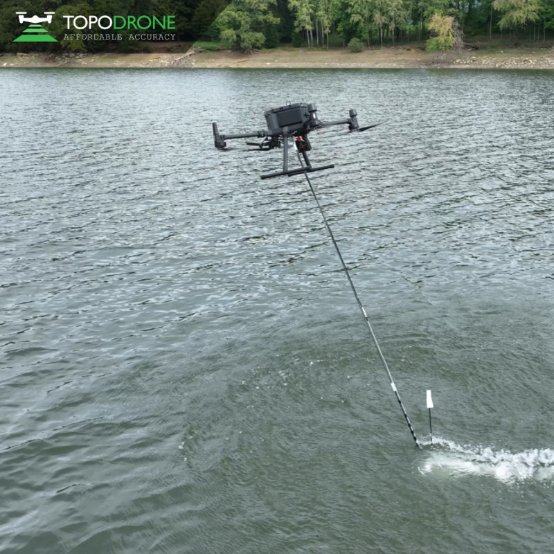
TOPODRONE AQUAMAPPER
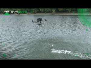
Aquamapper Is the New Drone-Based Solution in the Bathymetric Survey and Marine Construction
It is a unique multitasking platform specially designed for a wide range of applications in the maritime branch and other water sources. This product provides a great combination of high speed efficiency and accuracy, successfully challenging conventional methods such as boats and providing obvious profit as a cost-effective and easy-for-use solution.
TOPODRONE
Montreux, CH
Description
- High survey speed up to 14 km/h;
- Centimeter level accuracy;
- Cheap and effective solution for marine survey;
- Easy planning and autonomic mission;
- Quick deploy, ready for use in 10 minutes;
- Ability to work in hard access and shallow water areas;
- Ability to use different sensors for any survey mission;
- Ability to combine data with LiDAR data;
- PPK ready solution;
- Compatible with DJI Matrice 300 RTK.
Applications
- Open sea bathymetric survey up to 100m depth;
- Periodic maintenance survey of storage pools;
- Quantity survey and calculation of sediments;
- Bathymetric survey in shallow water and hard access areas.
In the box
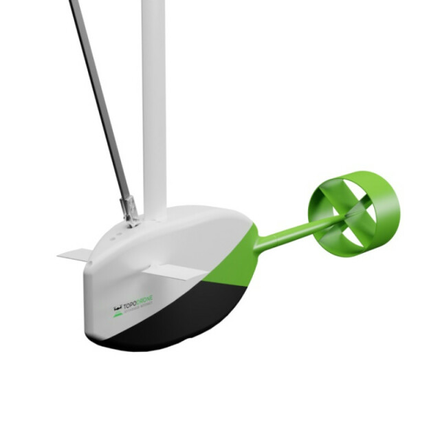
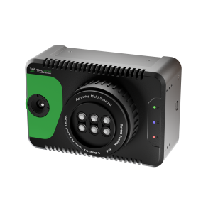
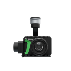
- 1 * TOPODRONE Aquamapper sensor
- 1 * GNSS antenna
- 1 * UgCS SkyHub
- 1 * Mounting to the drone
- 1 * Cable set
- 1 * Transportation case
Do you have questions about this product?
- Questions about price, availability, and/or retailers
- Questions about technical specifications and usage
- Questions about suitability for your project or application
Specifications
-
Operation Characteristics
-
Camera included
Documents
Brochure
TOPODRONE Aquamapper EN.pdf
Videos
