UAV BIRDIE GEO
Your tailor-made UAV
FlyTech UAV Ltd.
Krakow, PL
Description
BIRDIE UAV is the complete mapping solution, efficient and precise missions. absolute accuracy up to 3 cm and with maximum ground resolution up to 1cm.
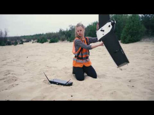
Simple hand launch and precise landing of BIRDIE make it a perfect match even for beginners. Managing your flight will be extremely easy thanks to the intuitive all-in-one flight controller.
4G LTE connectivity and ADS-B receivers ensure the highest level of safety and prepare the platform to conduct BVLOS flights.
Meet the tailor-made UAV BIRDIE, the drone adjusted to your needs.
Specifications
-
Environment
-
Min. operation temperature [°C]
-10
Max. operation temperature [°C]
50
Max. wind speed [m/sec]
15
-
Imaging/scanning devices
-
Onboard imaging/scanning devices
RGB Camera
Type of Camera
Sony A6000 with Voigtlander 21 mm lens
Additional Sensors and additional information
Thermal camera, NIR, NDVI; GSM/3G/LTE connectivity
Exchangeable
Y
Sensor tilting to allow oblique views
N
-
Platform
-
Platform
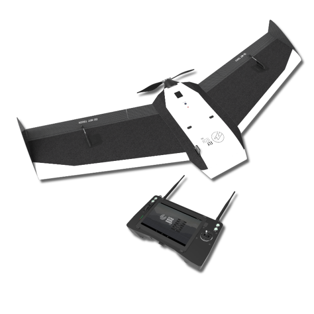
Aircraft
Brand
BIRDIE
Max. payload [kg]
0.6
Max. stay in the air [min]
60
Max. speed [km/h]
90
Max. height above sea level [m]
2500
Propulsion
Electric
-
Accessories
-
Transportation accessories
flight case, ground control station (flight controller) with tablet and app to plan and manage a flight, cables, chargers, battery
Included batteries and charger
Intelligent Li-Ion battery, charger
More included products and spare parts
control panel with comfortable suspenders, chargers, cables, battery,
-
Operation Characteristics and Safety
-
Min. ø of launch/landing site [m]
10
Launching method
by hand
Automatic launch and landing
Y
Training provided
Y
Collision avoidance systems (CAS)
N
Autonomous emergency landing
Y
-
Dimensions
-
ø / wingspan [cm]
140
Height [cm]
56
Weight of battery [kg]
0.6
Weight [kg]
2.3
Number of rotors
1
-
Base Station
-
Ground computer included
Y
Type of Ground computer
comfortable flight controller with built-in tablet
Real time image and video download link
N
-
Navigation Sensors
-
Type of GNSS receiver and captured signals
single-frequency code-phase (GPS, GLONASS, GALILEO, SBAS) (optional)
Type of IMU
Integrated with autopilot
Other sensors and additional information
Pitot tube
Correction services [PPK, RTK]
PPK
-
General
-
Year of last update
2018
Typical applications
Photogrammetry, 2D & 3D mapping, Agriculture, SAR
-
Included software and automatically generated
-
Type of software included
Flight planning, Photogrammetric software
Flight planning software
FlyTech Mission Manager Lite
Photogrammetric software
3D Survey | Agisoft Photoscan | Pix4D
Additional information on software or automatically generated products
Wide possibilities of system’s customization (in terms of drone, equipment, software), warranty, technical support and local service
Automatically Generated Products
Videos


